Strasburg in Shenandoah County, Virginia — The American South (Mid-Atlantic)
Lunette
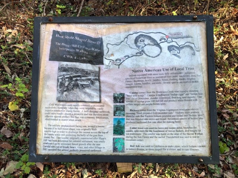
How Strata Shaped Strategy: The Hupp's Hill Civil War/Karst Interpretive Walking Trail
Civil War troops could rapidly construct sophisticated earthworks, especially when they were targeted by vastly superior numbers of enemy forces. A well-designated earthwork could more readily absorb a projectile and was therefore more effective against artillery fire than was a masonry fortification which tended to shatter when struck.
The artillery emplacement facing you, termed a lunette because if its half-moon shape, was originally built muzzle-high in order to discharge the cannon across the top of the lunette while still protecting the belly of the gun from enemy fire. This lunette, originally constructed after hupp's Hill had been deforested for colonial settlement, was totally swallowed up by secretary forest growth after the war. Careful removal of brush, briars, vines, and other foliage in 2002 revealed this almost perfectly preserved earthwork.
Catalpa comes from the Muskogee Creek word katalpa, meaning "head with wings." Catalpa is nicknamed "Indian cigar" and "Indian bead tree" for its pendulous, slender, cylindrical, foot-long seed capsule. Two species of catalpa grow 100 feet fall and produce white flowers with yellow stripes and purple-brown spots.
Hickory comes from the Virginia Algonquian word pawcohiccor, meaning "food prepared from pounded nuts." Hickory trees produce plentiful nuts that Eastern Indians pounded and boiled into "hickory milk" that was blended into stews and bread. Seventeen species of hickory also produced hardwood that was ideal for making bows.
Cedar wood was used for bows and teepee poles, branches for combs, split roots for the foundation of woven baskets, and boughs for cot mattresses. The conifer was burnt on the altar of the Sacred Woman during the Sun Dance and the sacred Thunderbird was said to nest in mountain cedars.
Red Ash was used in California to make pipes, which Indians smoked to induce dreams, to show respect for a visitor, and to cure illnesses.
Erected by Cedar Creek Battlefield Foundation. (Marker Number CWK 4.)
Topics and series. This historical marker is listed in these topic lists: Anthropology & Archaeology • Horticulture & Forestry
Location. 39° 0.044′ N, 78° 21.056′ W. Marker is in Strasburg, Virginia, in Shenandoah County. Marker can be reached from Old Valley Pike (U.S. 11) 0.2 miles west of Signal Knob Drive, on the right when traveling west. Touch for map. Marker is at or near this postal address: 33229 Old Valley Pike, Strasburg VA 22657, United States of America. Touch for directions.
Other nearby markers. At least 8 other markers are within walking distance of this marker. Winter Quarters (a few steps from this marker); Hupp Cave (within shouting distance of this marker); Keyhole Cave (within shouting distance of this marker); A Natural Bombproof (about 300 feet away, measured in a direct line); Strasburg (about 300 feet away); Field Fortifications (about 400 feet away); The Shenandoah Valley / Battle of Cedar Creek, October 19, 1864 (about 400 feet away); Trail Head (about 400 feet away). Touch for a list and map of all markers in Strasburg.
Credits. This page was last revised on November 10, 2020. It was originally submitted on November 7, 2020, by Devry Becker Jones of Washington, District of Columbia. This page has been viewed 176 times since then and 42 times this year. Photos: 1, 2. submitted on November 7, 2020, by Devry Becker Jones of Washington, District of Columbia.

