Near Richmond in Chesterfield County, Virginia — The American South (Mid-Atlantic)
Drewry’s Bluff
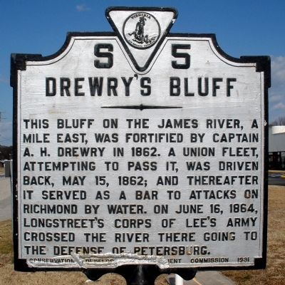
Photographed by Bernard Fisher, February 9, 2009
1. Drewry's Bluff Marker
Erected 1931 by Conservation and Development Commission. (Marker Number S-5.)
Topics and series. This historical marker is listed in these topic lists: Forts and Castles • Natural Features • War, US Civil. In addition, it is included in the Virginia Department of Historic Resources (DHR) series list. A significant historical date for this entry is May 15, 1862.
Location. 37° 25.62′ N, 77° 26.337′ W. Marker is near Richmond, Virginia, in Chesterfield County. It is at the intersection of U.S. 1 and Gwynn Avenue, on the right when traveling north on U.S. 1. Touch for map. Marker is at or near this postal address: 7051 Route 1, Richmond VA 23237, United States of America. Touch for directions.

Regionally, this marker is in the Piedmont and in Central Virginia. It is also in the American
this page online
Other nearby markers. At least 8 other markers are within walking distance of this marker: A different marker also named Drewry’s Bluff (a few steps from this marker); World War II Memorial (approx. 0.4 miles away); OH-58D Kiowa (approx. half a mile away); A-10 Thunderbolt II (approx. half a mile away); F-4 Phantom II (approx. half a mile away); Standard U.S. Navy Stockless Anchor (approx. 0.7 miles away); Twin 40 mm Bofors Anti-Aircraft Gun (approx. 0.7 miles away); Moore's Brick Cottage (approx. ¾ mile away). Touch for a list and map of all markers in Richmond.
Also see . . .
1. CWSAC Battle Summary. Drewry's Bluff (Submitted on February 10, 2009, by Bernard Fisher of Richmond, Virginia.)
2. Civil War Richmond.
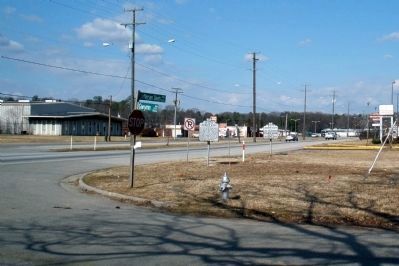
Photographed by Bernard Fisher, February 9, 2009
2. Drewry's Bluff Marker on Jeff Davis Highway
3. Richmond National Battlefield Park. Drewry's Bluff (Submitted on February 10, 2009, by Bernard Fisher of Richmond, Virginia.)
Credits. This page was last revised on May 1, 2025. It was originally submitted on February 10, 2009, by Bernard Fisher of Richmond, Virginia. This page has been viewed 1,335 times since then and 25 times this year. Photos: 1, 2. submitted on February 10, 2009, by Bernard Fisher of Richmond, Virginia. • Craig Swain was the editor who published this page.
