Alpine in Brewster County, Texas — The American South (West South Central)
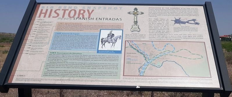
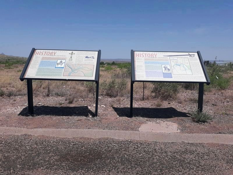
Early Spanish Entradas
Big Bend Snapshot History
1475 CE*
1492 - Columbus lands on San Salvador Island in the Caribbean West Indies
1497 - John Cabot, first known English party to land in North America, northeast Canada
1521 - Hernán Cortés conquers the Aztec Empire
1528 - Panfilo de Narváez Expedition to Florida meets disaster
1535 - Cabeza de Vaca and 3 more de Narváez expedition survivors enter Big Bend
1540 - Francisco Pizarro conquers Incas in the Andes Mountains of Peru
1541 - Francisco Vázquez de Coronado leads an expedition into Arizona, New Mexico, Kansas and the Texas High Plains region
1563 - Slave raids in La Junta cause Indigenous rebellion
1565 - Ponce de León establishes colony at St. Augustine Florida
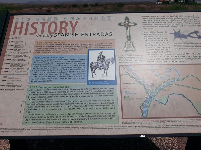
1581 Agustín Rodriguez
Franciscan Friar Agustín Rodríguez along with two fellow friars, accompanied by one officer and nine soldiers, mounted an expedition to La Junta de los Ríos, junction of the Rio Conchos and Rio Grande, to convert the native Jumano Indians. The soldiers proceeded onward to New Mexico in search of riches while the Franciscan brothers remained to convert the Jumanos. The brothers were never heard from again.
1582 Antonio de Espejo
Antonio de Espejo, governor of Querétaro province, petitioned the Spanish Viceroy for permission to find the missing Rodríguez Franciscans and to found a colony in New Mexico. Espejo followed the Rio Conchos to La Junta where he heard reports that the brothers had died at the hands of angry Indians. The expedition then marched up the Rio Grande and into New Mexico looking for gold and land to claim. In doing so, Espejo led the first organized Spanish entrada to pass through the Big Bend region. However, due to his abusive treatment of Rio Grande Pueblo Indians, he was soon forced to retreat east down the Rio Pecos and back through La Junta into Mexico.
1588 - British Navy defeats the Spanish Armada near Calais, France
1598 - Juan de Oñate establishes El Paso del Norte en route to New Mexico
1607 - Jamestown Colony established on Chesapeake Bay, Virginia
1620 - Mayflower lands at Plymouth Rock, Massachusetts
1683 Domínguez de Mendoza
After the Camino Real between Chihuahua City, Mexico, and Santa Fe, New Mexico, replaced the Rio Conchos route in 1598, La Junta was largely ignored. In 1683, Jumano Chief Juan Sabeata went to El Paso and requested that the governor send soldiers to protect them from increasingly frequent attacks by invading Apaches. Captain Juan Domínguez de Mendoza, was appointed to lead an expedition to La Junta, the first in 95 years.
Mendoza followed the Rio Grande from El Paso to La Junta where he joined two friars who had followed the Rio Conchos trail from Chihuahua City. The combined party then journeyed north through Paisano Pass into the Davis Mountains and on to Fort Stockton and beyond. Mendoza provided the first detailed reports on the region and located several major springs, critical for survival in an arid land.
Mendoza returned to Mexico and urged the Spanish Viceroy to grant La Junta a new mission, but a French expedition led by René-Robert Cavelier, Sieur de La Salle, had recently shipwrecked on the upper Texas coast. This persuaded the Spanish to make a strategic withdrawal from La Junta, which ended the early phase of Spanish activity in the Big Bend region.
1700 CE*
*CE: Common Era
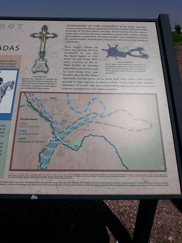
Intoxicated by the conquest of the Aztec and Inca empires, Spaniards were lured by tales of fabulous riches in the uncharted territories of the New World. Entradas, formal entries into the distant lands, were carefully planned expeditions usually with civilian, military and religious components. The early entradas were launched to search for mineral wealth, acquire land, and subdue and convert the natives to Catholicism.
Alvar Núñez Cabeza de Vaca was among the first Europeans to see the Big Bend region in 1535 when he and three other men, survivors of the ill- fated Pánfilo de Narváez expedition passed through La Junta de los Ríos, near modern day Presidio, Texas. Spaniards did not return to La Junta until 1563, when slave traders arrived to take captives to work in silver mines. Slave raids peaked between 1575 and 1585, but continued for many years and provoked intense hostility from the native peoples.
Captions
Don Antonio de Espejo, ca. 1582
Drawing by José Cisneros, Cirene Cisneros
Colonial Altar Cross
Spaniards were committed to converting the inhabitants of the New World to Catholicism. The goals of the Church and Spanish Crown were so entwined, the cross became a symbol of religious power combined with colonial conquest.
Spanish Colonial Spur
The first Spanish conquistadores had a technological and psychological advantage over the Indians who had never seen horses or men in armor. Mounted soldiers were mistaken at first for superhuman centaur-like deities with exotic powers and weapons.
José Cisneros drawing copyright Irene Cisneros, courtesy Adair Margo, President, The Tom Lea Institute. Entrada map adapted from an original drawing by Matt Walter. Artifacts, courtesy of The Museum of the Big Bend, Sul Ross State University, Alpine, Texas, Elizabeth Jackson, Director. Text sources: The Big Bend: A History of the Last Texas Frontier, Ron C. Tyler, Texas A&M Press; The Handbook of Texas Online, Texas Historical Association; Texas Beyond History, The Texas Archeological Research Laboratory, Texas University at Austin. Projects made possible through funding and support of Brewster County Commissioners Mike Pallanez, Luc Novovitch, Hugh Garrett and Ruben Ortega, County Judge Eleazar Cano; The Brewster County Historical Commission, J. Travis Roberts, Jr., Chairman; The Brewster County Tourism Council; and The Texas Department of Transportation. Exhibit Text, Project Management and Editorial Review by Mike Davidson; Research, Compilation and Artifact Photography by Jim Bones/Photographs; Graphic Design by Chris Ruggia/Vast Graphics.
Topics. This historical marker is listed in these topic lists: Colonial Era • Native Americans • Settlements & Settlers. A significant historical year for this entry is 1581.
Location. 30° 22.168′ N, 103° 37.654′ W. Marker is in Alpine, Texas, in Brewster County. Marker is at the intersection of U.S. 67/90 and Paso del Norte Road on U.S. 67/90. Touch for map. Marker is in this post office area: Alpine TX 79830, United States of America. Touch for directions.
Other nearby markers. At least 8 other markers are within 3 miles of this marker, measured as the crow flies. The Late Spanish Entradas (here, next to this marker); Lawrence Sullivan Ross (approx. 1½ miles away); Burgess' Water Hole (approx. 1.9 miles away); Nolte-Rooney House (approx. 2 miles away); Gage-Van Sickle (approx. 2.1 miles away); J. C. Bird (approx. 2.1 miles away); City Building (approx. 2.1 miles away); First Baptist Church of Alpine (approx. 2.1 miles away). Touch for a list and map of all markers in Alpine.
Credits. This page was last revised on November 26, 2020. It was originally submitted on November 25, 2020, by Craig Doda of Napoleon, Ohio. This page has been viewed 499 times since then and 63 times this year. Photos: 1, 2, 3, 4. submitted on November 25, 2020, by Craig Doda of Napoleon, Ohio. • J. Makali Bruton was the editor who published this page.


