Chesapeake Beach in Calvert County, Maryland — The American Northeast (Mid-Atlantic)
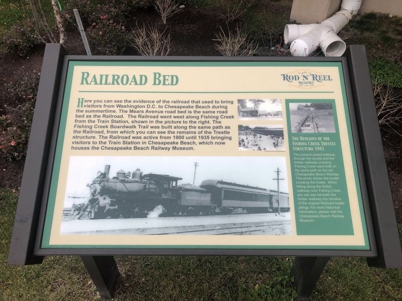
Railroad Bed
Here you can see the evidence of the railroad that used to bring visitors from Washington D.C. to Chesapeake Beach during the summertime. The Mears Avenue road bed is the same road bed as the Railroad. The Railroad went west along Fishing Creek from the Train Station, shown in the picture to the right. The Fishing Creek Boardwalk Trail was built along the same path as the Railroad, from which you can see the remains of the Trestle structure. The Railroad was active from 1900 until 1935 bringing visitors to the Train Station in Chesapeake Beach, which now houses the Chesapeake Beach Railway Museum.
[Sidebar:]
The Remains of the Fishing Creek Trestle Structure 1941
The present paved walkway through the woods and the timber walkway crossing Fishing Creek were built on the same path as the old Chesapeake Railway. This photo shows the trestle crossing the Creek. When hiking along the timber walkway, you can see beneath the timber walkway as the remains of the original Railroad trestle pilings. For more historical information, please visit the Chesapeake Beach Railway Museum.
Erected by Rod 'N' Reel Resort.
Topics. This historical marker is listed in these topic lists: Parks & Recreational Areas • Railroads & Streetcars • Roads & Vehicles • Waterways & Vessels. A significant historical year for this entry is 1900.
Location. 38° 41.403′ N, 76° 32.107′ W. Marker is in Chesapeake Beach, Maryland, in Calvert County. Marker is on Mears Avenue just east of Bayside Road (Maryland Route 261), on the right when traveling west. Touch for map. Marker is at or near this postal address: 4155 Mears Ave, Chesapeake Beach MD 20732, United States of America. Touch for directions.
Other nearby markers. At least 8 other markers are within walking distance of this marker. Chesapeake Beach Railway (within shouting distance of this marker); a different marker also named The Chesapeake Beach Railway (within shouting distance of this marker); Bald Eagle (about 300 feet away, measured in a direct line); a different marker also named Chesapeake Beach Railway (about 400 feet away); Railroad Artifacts At The Museum (about 400 feet away); Chesapeake Beach Railway Station (about 400 feet away); Abner's Crab House (approx. 0.2 miles away); Fishing Creek Aquatic Life (approx. 0.2 miles away). Touch for a list and map of all markers in Chesapeake Beach.
Credits. This page was last revised on September 14, 2021. It was originally submitted on December 18, 2020, by Devry Becker Jones of Washington, District of Columbia. This page has been viewed 147 times since then and 11 times this year. Photos: 1, 2. submitted on December 18, 2020, by Devry Becker Jones of Washington, District of Columbia.

