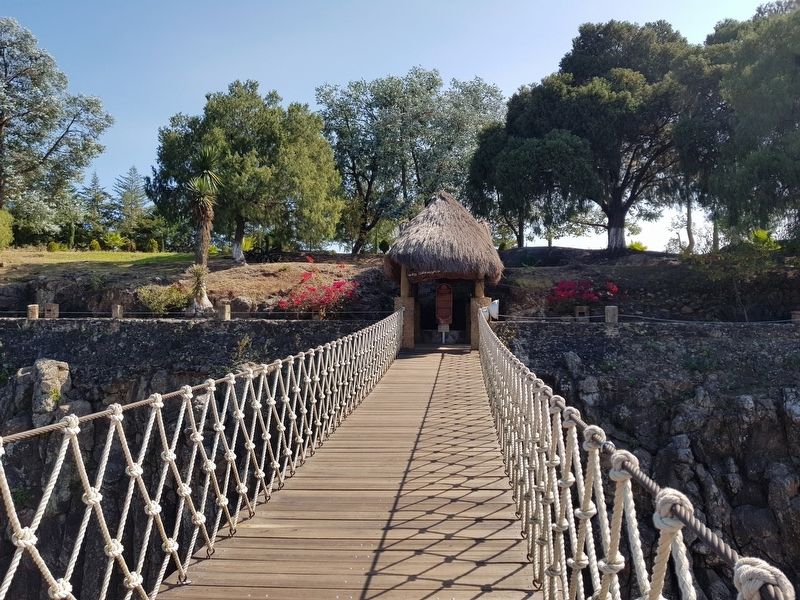
El Huariche in Huasca de Ocampo, Hidalgo, Mexico — The Central Highlands (North America)
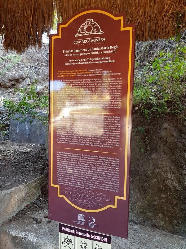
Basaltic Prisms of Santa María Regla
Comarca Minera
— Geoparque Hidalgo —
Prismas basálticos de Santa María Regla
(sitio de interés geológico, histórico y paisajístico)
Santa María Regla Tlitepetlaketsalistinij
(Ixtokil yejyektlalkuatitlamitl uan ueuejkayomatilistli)
Municipio / Municipality / Chinantlatilantli: Huasca de Ocampo
Coordenadas / Coordinates / Tlalpan ixnextilistli:20°14'04.2"N 98°33'43.8"W
Altitud / Elevation/ Uekapanka: 2040 m sobre el nivel del mar (above sea level) (m ueyatl iixmantipa.)
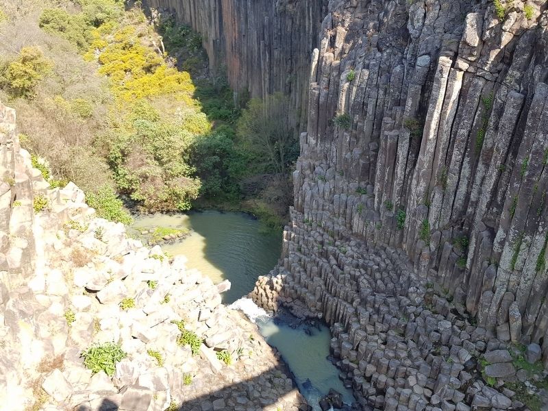
Uno de los escenarios más admirados de Hidalgo es el geositio Prismas Basálticos. Por su singularidad geológica y paisajística, este lugar ha atraído durante los últimos doscientos años a gran cantidad de exploradores, científicos y artistas. El sabio prusiano Alexander von Humboldt (1769-1859), considerado como el estudioso de la naturaleza y las sociedades americanas más importante de su época, visitó este lugar en 1803. En el libro «Vistas de las Cordilleras y monumentos de los pueblos indígenas de América» (1810), uno de los más notables de su extensa bibliografia, Humboldt le dedicó el capitulo titulado «Rocas basálticas y Cascada de Regla». Además de realizar descripciones geológicas, acompanadas de ilustraciones, comparó estos prismas con los de la célebre Calzada de los Gigantes de Irlanda. ¿Pero cómo se formaron los prismas? Si bien Humboldt y los otros científicos de su epoca no se ponían de acuerdo, hoy sabemos que son el resultado de una colada de lava que fluía a más de 1000 °C, debido a una erupción que tuvo lugar hace 2.5 millones de años. En contacto con el agua que proveían los cauces que la colada interceptó, la lava se enfrió formando las fracturas verticales de su característico patrón poligonal.
One of the most spectacular natural sceneries of the Hidalgo state are the Prismas Basálticos geosite. Because of their geological singularity and scenic value XXX columnar jointed basalts attracted explorers, scientists and artists over the last two centuries. Worthy of mention was the Prussian naturalist Alexander von Humboldt (1769-1859), whose studies about nature and peoples of the Americas are considered the most valuable of his time. He visited this very place on 1803, and included detailed geological descriptions in a chapter of the book Views of the Cordilleras and Monuments of the Indigenous Peoples of the Americas (1810). In this book, the basalt columns of Santa María Regla were compared to others as the world-renowned of the Giant's Causeway, Ireland. The question that naturally arises here is how the basaltic columns formed. Even if Humboldt and his contemporaries failed to agree on a solution, it is known today that these geological structures are the result of a lava flow with a temperature above 1000 °C, product of a volcanic eruption ca. 2.5 million years ago. The contact with water when the lava flow intercepted streams produced vertical cooling cracks - or joints - that regularly arranged gave the characteristic polygonal pattern.
Se achi tlaltlachiualispa moneltlachilia tlen Hidalgo molokajtia Tlitepetlaketsalistinij. Panpa gan ya kiixnextia yejyektlalkuatitlamitl, ni achitlalpan tlenijuelok majtlakpouali xiuitl panotok kintilantolomiyaki tlatejtemolianij, ixtlamatinij uan yejyektlachiualismej. Prusiano ixtlamatketl Alexander von Humboldt (1769-1859), ajki moixmati kemej momachtijketl ika kuatitlamitl kuan maseualaltepenechikolismej tlen monelpatiita kemej ya itstoya, kipaxaloko nikaj ipan 1803. Amochtipa “tepetinij uan tlaketsalalaxtipan Tetinij tlachialistinij” (1810) se tlen nelixtlamatketl panpa patlauak iamochxakaktlakuilol, Humboldt kisenkauili se tlaxejxeloli tlen kitokajtij “Tliltetl tetik uan uekapantik tlaauetsili tlen Regla”. Kisenkajki nojkia tlaltlatenpoualistli, kanpa kipiuili tlaixkopintinij, kiuikalui ni tliltepetlaketsalistinij tlen ueyi
tepetlamitl ojtli tlen
uejueyij Irlanda Tlitepetlaketsalistinij. San kej timoyolnojnotsaj įKenijkatsaj mosenkajkej ni Tlitepetlaketsalistinij? Tlaj kena kuali Humboldt uan sekinok ixtlamatini kemaj ya itstoya axkana san sejko kitlaliyajyaj inixtlamatilis, namaj tikixmatij ni Tlitepetlaketsalistinij mosenkajkej panpa sajsalik tsajtsastik yayauik tliltetl tlen 1000° C, moxoyauayajya ijkinoj toponki, kichiuaya 2.5 millones xiuitl. Tlen tlil kisejselo uan moasik ika atlajatl tlen teixko
temoyajya iuaya mopanti ijkinoj tlåtetl sejki uan kisenkajki siltik Tlitepetlaketsalistinij tlen ineluayo kemantika miyak o chikuasej ixayak kipankixtiya.
Topics. This historical marker is listed in these topic lists: Colonial Era • Environment • Parks & Recreational Areas. A significant historical year for this entry is 2040.
Location. 20° 14.026′ N, 98° 33.764′ W. Marker is in El Huariche, Hidalgo, in Huasca de Ocampo. Marker can be reached from Camino a Prismas Basálticas, on the left when traveling east. Touch for map. Marker is in this post office area: El Huariche HGO 43516, Mexico. Touch for directions.
Other nearby markers. At least 8 other markers are within 13 kilometers of this marker, measured as the crow flies. The Beauty of Geometric Lava (about 120 meters away, measured in a direct line); Basaltic Prisms (about 120 meters away); a different marker also named Basaltic Prisms (about 150 meters away); The San Antonio Dam (approx. 0.3 kilometers away); The Church of San Juan Bautista (approx. 3.7 kilometers away); Consuelo Velásquez Sosa (approx. 3.7 kilometers away); Coronel José María Pérez (approx. 11.5 kilometers away); Benito Juárez (approx. 11.6 kilometers away). Touch for a list and map of all markers in El Huariche.
Credits. This page was last revised on December 22, 2020. It was originally submitted on December 22, 2020, by J. Makali Bruton of Accra, Ghana. This page has been viewed 296 times since then and 11 times this year. Photos: 1, 2, 3. submitted on December 22, 2020, by J. Makali Bruton of Accra, Ghana.


