River Trades & Traditions / River Lore & Legend

River Trades & Traditions
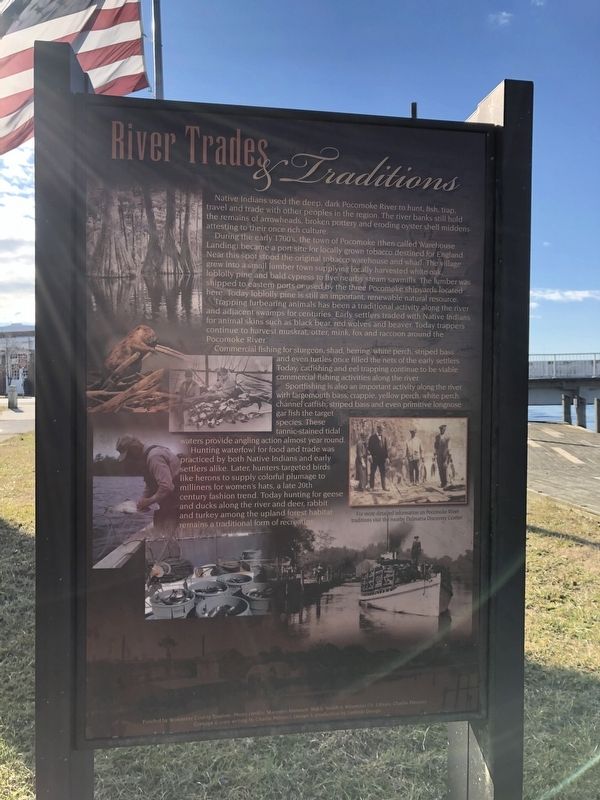
Native Indians used the deep, dark Pocomoke River to hunt, fish, trap, travel and trade with other peoples in the region. The river banks still hold the remains of arrowheads, broken pottery and eroding oyster shell middens attesting to their once rich culture.
During the early 1700's, the town of Pocomoke (then called Warehouse Landing) became a port site for locally grown tobacco destined for England. Near this spot stood the original tobacco warehouse and wharf. The village grew into a small lumber town supplying locally harvested white oak, loblolly pine and bald cypress to five nearby steam sawmills. The lumber was shipped to eastern ports or used by the three Pocomoke shipyards located here. Today loblolly pine is still important, renewable natural resource.
Trapping furbearing animals has been a traditional activity along the river and adjacent swamps for centuries. Early settlers traded with Native Indians for animal skins such as black bear, red wolves and beaver. Today trappers continue to harvest muskrat, otter, mink, fox and raccoon around the Pocomoke River.
Commercial fishing for sturgeon, shad, herring, white perch, striped bass and even turtles once filled the nets of the early settlers. Today, catfishing and eel trapping continue to be viable commercial fishing
activities along the river.Sportfishing is also an important activity along the river with largemouth bass, crappie, yellow perch, white perch, channel catfished, striped bass and even primitive longnose gar fish the target species. These tannic-stained tidal waters provide angling action almost year round.
Hunting waterfowl for food and trade was practiced by both Native Indians and early settlers alike. Later, hunters targeted birds like herons to supply colorful plumage to milliners for women's hats, a late 20th century fashioned trend. Today hunting for geese and ducks along the river and deer, rabbit and turkey among the upland forest habitat and remains a traditional form or recreation.
River Lore & Legend
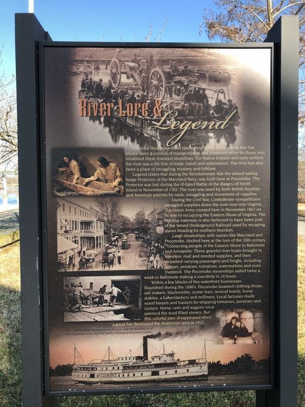
The tidal Pocomoke River connecting to the Chesapeake Bay has always been a conduit of transportation and communication for those who inhabited these forested shorelines. For Native Indians and early settlers the river was a life line of trade, travel and subsistence. The river has also been a place of smuggling, mystery and folklore.
Legend states that during the Revolutionary War the armed sailing barge Protector, of the Maryland Navy, was built here at Pocomoke. The Protector, of the Marland Navy, was built here at Pocomoke. The Island in November in 1782. The river was used by both British loyalists and American patriots for raids,

During the Civil War, Confederate sympathizers smuggled supplies down the river over into Virginia. The Union ARmy crossed here in November 1861 on its way to occupying the Eastern Shore of Virginia. The twisting waterway is also believed to have been part of the famed Underground Railroad used by escaping slaves heading for northern freedom.
Large steamships, with names like Maryland and Pocomoke, docked here at the turn of the 20th century — connecting people of the Eastern Shore to Baltimore and Annapolis. These graceful river boats brought in travelers, mail and needed supplies, and then departed carrying passengers and freight, including lumber, potatoes, tomatoes, watermelons and even livestock. The Pocomoke steamships sailed twice a week to Baltimore making a roundtrip in 24 hours.
Within a few blocks of this waterfront businesses flourished during the 1880's. Pocomoke boasted clothing shops, sail makers, blacksmiths, oyster bars, several hotels, horse stables, a haberdashery and millinery. Local factories made wood barrels and baskets for shipping tomatoes, potatoes and oysters. Horse carts and wagons once jammed the mud filled streets. But this colorful past disappeared when a great fire destroyed the downtown area in 1922.
Erected by Worcester County Tourism.
Topics. This

Location. 38° 4.606′ N, 75° 34.23′ W. Marker is in Pocomoke City, Maryland, in Worcester County. Marker can be reached from Market Street (Business U.S. 13) 0.1 miles west of Front Street, on the right when traveling west. Touch for map. Marker is at or near this postal address: 2 Riverside Dr, Pocomoke City MD 21851, United States of America. Touch for directions.
Other nearby markers. At least 8 other markers are within 2 miles of this marker, measured as the crow flies. Olive Marie Lippoldt (within shouting distance of this marker); The Shapes of Ships (about 400 feet away, measured in a direct line); Sturgis One Room School (about 500 feet away); Mar-Va Theater (about 500 feet away); In Memory of the Deceased Who Served to Protect Our Country (about 700 feet away); Costen House (approx. ¼ mile away); Pocomoke City Historic Railroad Station (approx. 0.6 miles away); Court House Hill (approx. 1.9 miles away). Touch for a list and map of all markers in Pocomoke City.
Credits. This page was last revised on January 19, 2021. It was originally submitted on January 19, 2021, by Devry Becker Jones of Washington, District of Columbia. This page has been viewed 328 times since then and 55 times this year. Photos: 1, 2, 3. submitted on January 19, 2021, by Devry Becker Jones of Washington, District of Columbia.