Chincoteague Timeline
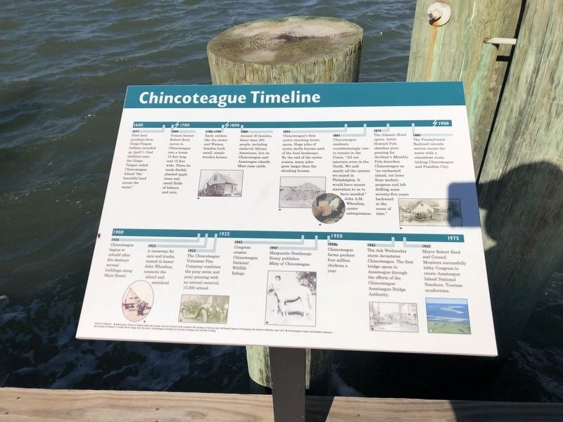
1671
First land purchase from Gingo-Teague Indians recorded on April 1. Oral tradition says the Gingo-Teague called Chincoteague Island "the beautiful land across the water."
1680
Tenant farmer Robert Scott moves to Chincoteague into a house 15 feet long and 12 feet wide. There he tends freshly planted apple trees and small fields of tobacco and corn.
1780 - 1790
Early settlers like Jester and Watson families built small, simple wooden houses.
1800
Around 30 families, fewer than 200 people, including enslaved African Americans, live on Chincoteague and Assateague islands. Most raise cattle.
1855
Chincoteague's first oyster shucking house opens. Huge piles of oyster shells become part of the local landscape. By the end of the oyster season, many piles grew larger than the shucking houses.
1861
Chincoteague residents overwhelmingly vote to remain in the Union. "All our interests were in the North. We sold nearly all the oysters we raised in Philadelphia. It would have meant starvation to us to have seceded." John A.M. Whealton, oyster entrepreneur.
1876
The Atlantic Hotel opens. Artist Howard Pyle
this page online
1885
The Pennsylvania Railroad extends service across the water with a steamboat route, linking Chincoteague and Franklin City.
1920
Chincoteague begins to rebuild after fire destroys several buildings along Main Street.
1922
A causeway for cars and trucks named to honor John Whealton, connects the island and mainland.
1925
The Chincoteague Volunteer Fire Company combines the pony smim and pony penning with an annual carnival, 15,000 attend.
1943
Congress creates the Chincoteague National Wildlife Refuge.
1947
Marguerite Breithaupt Henry publishes Misty of Chincoteague.
1950s
Chincoteague farms produce four million chickens a year.
1962
The Ash Wednesday storm devastates Chincoteague. The first bridge opens to Assateague through the efforts of the Chincoteague Assateague Bridge Authority.
1965
Mayor Robert Reed and Council Members successfully lobby Congress to create Assateague Island National Seashore.
Topics. This historical marker is listed in these topic lists: Agriculture • Colonial Era • Indigenous Peoples and Communities • Settlements & Settlers. A significant historical date for this entry is April 1, 1671.
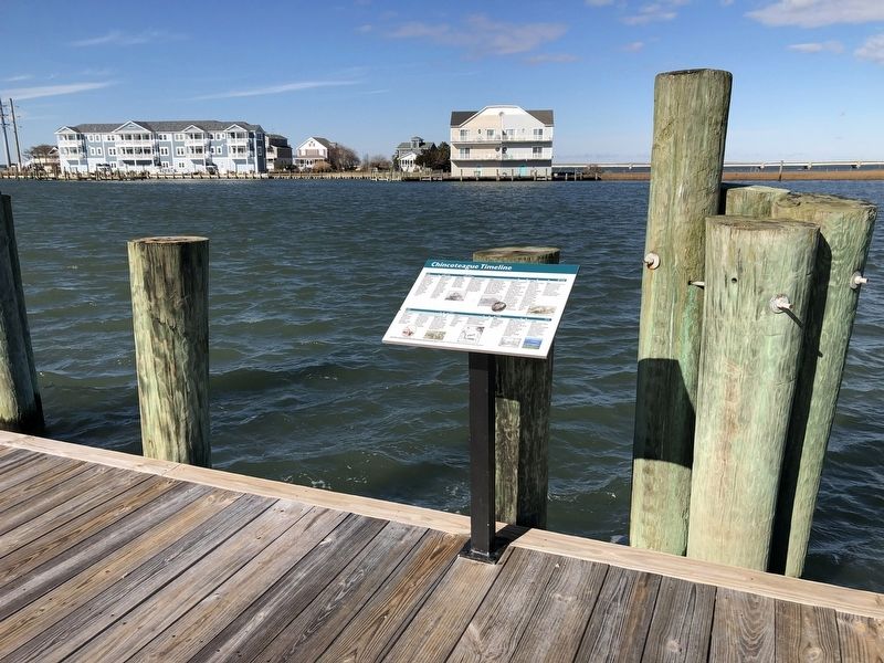
Location. 37° 56.099′ N, 75° 22.602′ W. Marker is in Chincoteague, Virginia, in Accomack County. It is on Main Street just west of Post Office Street, on the right when traveling west. Touch for map. Marker is at or near this postal address: 4105 Main St, Chincoteague Island VA 23336, United States of America. Touch for directions.

Regionally, this marker is on Virginia’s Eastern Shore. It is also in the American South, specifically in the Upper South, on the Delmarva Peninsula, in the Tidewater, and on the Eastern Seaboard. Globally, it is in the North Atlantic Region, North America, the Western Hemisphere, the Western World, and the Anglosphere. Historically, it finds itself in what was once the territory of the Mississippian Culture, one of the original Thirteen Colonies, one of the Confederate States of America, and the Antebellum South.
Other nearby markers. At least 8 other markers are within walking distance of this marker: Bounty from the Sea (a few steps from this marker); Fish So Fine (a few steps from this marker); Dollars from Decoys (a few steps from this marker); Chincoteague's Front Door (within shouting distance of this marker); Boats and Bridges (about 300 feet away, measured in a direct line); Misty of Chincoteague (about 300 feet away); You Had to Keep On (about 300 feet away); So Terribly Helpless (about 300 feet away). Touch for a list and map of all markers in Chincoteague.
Credits. This page was last revised on January 19, 2021. It was originally submitted on January 19, 2021, by Devry Becker Jones of Washington, District of Columbia. This page has been viewed 2,125 times since then and 145 times this year. Photos: 1, 2. submitted on January 19, 2021, by Devry Becker Jones of Washington, District of Columbia.
