Near Fallon in Churchill County, Nevada — The American Mountains (Southwest)
Grimes Point Archaeological Area
One of the Most Significant Archaeological Sites in the Great Basin
[side 1]
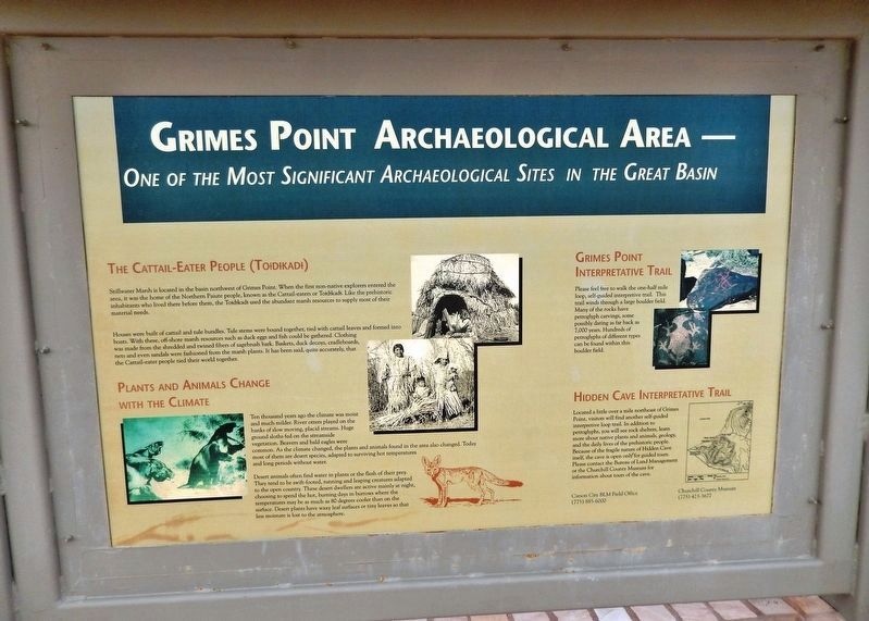
The Cattail-Eater People (Toidikadi)
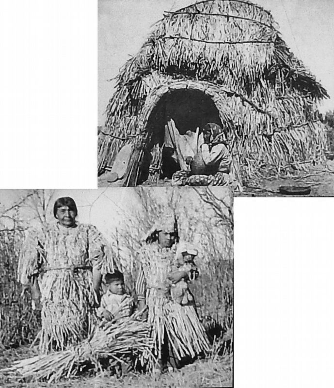
Stillwater Marsh is located in the basin northwest of Grimes Point. When the first non-native explorers entered the area, it was the home of the Northern Paiute people, known as the Cattail-eaters or Toidikadi. Like the prehistoric inhabitants who lived there before them, the Toidikadi used the abundant marsh resources to supply most of their material needs.
Houses were built of cattail and tule bundles. Tule stems were bound together, tied with cattail leaves and formed into boats. With these, off-shore marsh resources such as duck eggs and fish could be gathered. Clothing was made from the shredded and twined fibers of sagebrush bark. Baskets, duck decoys, cradleboards, nets and even sandals were fashioned from the marsh plants. It has been said, quite accurately, that the Cattail-eater people tied their world together.
Plants and Animals Change with the Climate
Ten thousand years ago the climate was moist and much milder. River otters played on the banks of slow moving, placid streams. Huge ground sloths fed on the streamside vegetation. Beavers and bald eagles were common. As the climate changed, the plants and animals found in the area also changed. Today most of them are desert species, adapted to surviving hot temperatures and long periods without water.
Desert animals often find water in plants or the flesh of their prey. They tend to be swift-footed, running and leaping creatures adapted to the open country. These desert dwellers are active mainly at night, choosing to spend the hot, burning days in burrows where the temperatures may be as much as 80 degrees cooler than on the surface. Desert plants have waxy leaf surfaces or tiny leaves so that less moisture is lost to the atmosphere.
Grimes Point Interpretive Trail
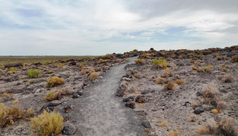
Please feel free to walk the one-half mile loop, self-guided interpretive trail. This trail winds through a large boulder field. Many of the rocks have petroglyph carvings, some possibly dating as far back as 7,000 years. Hundreds of petroglyphs of different types can be found within this boulder field.
Hidden Cave Interpretive Trail
Located a little over a mile northeast of Grimes Point, visitors will find another self-guided interpretive loop trail. In addition to petroglyphs, you will see rock shelters, learn more about native plants and animals, geology, and the daily lives of the prehistoric people. Because of the fragile nature of Hidden Cave itself, the cave is open only-for guided tours. Please contact the Bureau of Land Management or the Churchill County Museum for information about tours of the cave.
[side 2]
Welcome to
Grimes Point Archaeological Area
A Focal Point of Prehistoric Use
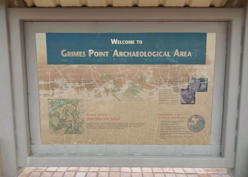
Humans first visited this area over 8,000 years ago. Lakes and marshes provided materials for making baskets and netting. Antelope and desert bighorn sheep grazed on the hillsides surrounding ancient Lake Lahontan. Sandhill cranes and ducks nested along the shoreline. Caves and rock shelters provided cover. Hidden Cave was used as a storage place for food, tools, and other important essentials. Today, all that remains of that greener, wetter and biologically rich era are remnants, fossils and artifacts.
Ancient Artists — What Were They Saying?
Nobody knows for sure. Some of the rock art boulders within this site may have been carved as long as 8,000 years ago — others less than 500 years ago. Some are abstract images with stripes, dots and zig-zags. Some are human figures, goats, snakes and horn toads. The meaning of the rock art is still debated by scholars. What stories do you see etched on the rock?
Help Preserve This Special Place
Grimes Point Archaeological Area was placed on the National Register of Historic Places in 1971. Here you have the opportunity to learn about and enjoy your cultural and natural heritage.
There are over 1,000 pieces of ancient rock art, making this one of the most important archaeological sites in the Great Basin. To help preserve this site, pleas abide by the following regulations. These regulations are enforced so that the past may be passed on to the future.
Please Follow the Rules —
Help Protect Our Resources
• All artifacts, natural features, and fossils are protected by law. Please do not collect, deface or destroy them.
• To help prevent damage to the area, no vehicles or horses are allowed within the Grimes Point Archaeological Area.
• For your safety and enjoyment as well as for the safety and enjoyment of others, no shooting or discharge of firearms is allowed.
• Please stay on the trails. Do not climb on the petroglyphs or boulders.
Topics. This historical marker is listed in these topic lists: Animals • Anthropology & Archaeology • Environment • Native Americans.
Location. 39° 24.077′ N, 118° 38.832′ W. Marker is near Fallon, Nevada, in Churchill County. Marker can be reached from the intersection of U.S. 50 at milepost 30.7, on the left when traveling east. Marker is located at the beginning of the interpretive trail at Grimes Point Archaeological site, about 10 miles east of Fallon. Touch for map. Marker is in this post office area: Fallon NV 89406, United States of America. Touch for directions.
Other nearby markers. At least 8 other markers are within 9 miles of this marker, measured as the crow flies. Grimes Point (within shouting distance of this marker); Lasting Impressions (about 400 feet away, measured in a direct line); Ensuring Success (about 500 feet away); Styles of the Past (about 600 feet away); Rock Art & Game Trails (about 700 feet away); Beachfront Property (about 700 feet away); The Brothers of E.C.V. (approx. 2.2 miles away); Oats Park School (approx. 8.2 miles away). Touch for a list and map of all markers in Fallon.
Regarding Grimes Point Archaeological Area. National Register of Historic Places #72000763.
Related markers. Click here for a list of markers that are related to this marker. Grimes Point Archaeological Area Trail
Also see . . .
1. Grimes Point/Hidden Cave Archaeological Site. During the Pleistocene Epoch, this area and most of northwestern Nevada, was covered by ancient Lake Lahontan. Over the last 10,000 years, the level of ancient Lake Lahontan fluctuated widely, at times drying up completely. When above water, the Grimes Point area would have been marshland with a wide variety of wetland plants and animals available for use by prehistoric populations. Grimes Point is a field
of basalt boulders that are covered with a glossy black patina, commonly called desert varnish. Many of the boulders are covered with pecked or carved rock art called petroglyphs. (Submitted on January 29, 2021, by Cosmos Mariner of Cape Canaveral, Florida.)
2. Grimes Point (Wikipedia). The Grimes Point site is a part of a much larger archaeological complex, which includes a wide variety of materials, caves, shelters, and other archaeological sites. The site is located on what was once a shoreline of Pleistocene Lake Lahontan. (Submitted on January 29, 2021, by Cosmos Mariner of Cape Canaveral, Florida.)
Credits. This page was last revised on January 30, 2021. It was originally submitted on January 29, 2021, by Cosmos Mariner of Cape Canaveral, Florida. This page has been viewed 379 times since then and 47 times this year. Photos: 1, 2, 3, 4, 5. submitted on January 29, 2021, by Cosmos Mariner of Cape Canaveral, Florida.
