Near Franklin in Williamson County, Tennessee — The American South (East South Central)
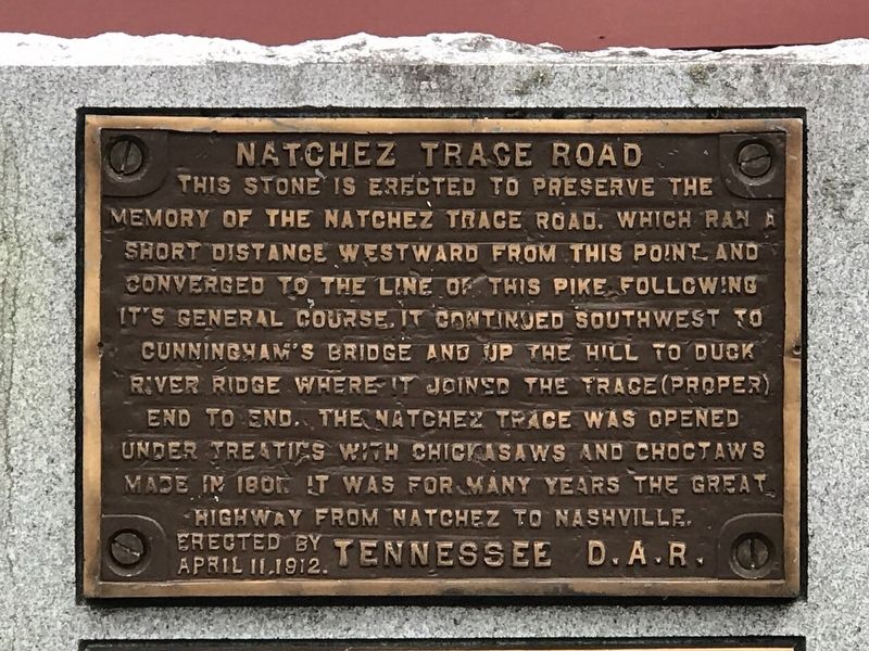
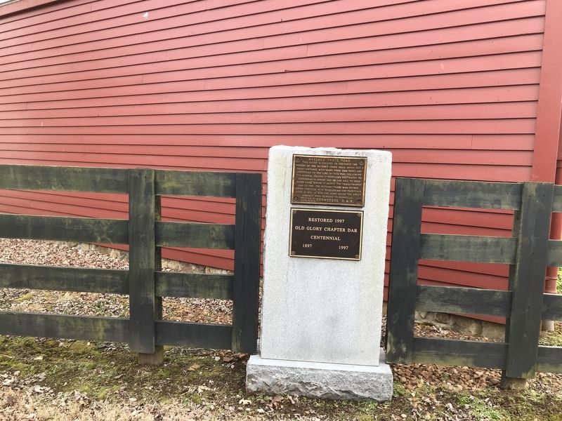
Natchez Trace Road
Erected 1912 by Tennessee Daughters of the American Revolution.
Topics and series. This historical marker is listed in these topic lists: Native Americans • Roads & Vehicles. In addition, it is included in the Daughters of the American Revolution series list. A significant historical year for this entry is 1801.
Location. 35° 58.552′ N, 86° 55.644′ W. Marker is near Franklin, Tennessee, in Williamson County. Marker is at the intersection of Old Natchez Trace and Old Hillsboro Road (Tennessee Route 46), on the right when traveling east on Old Natchez Trace. Touch for map. Marker is in this post office area: Franklin TN 37069, United States of America. Touch for directions.
Other nearby markers. At least 8 other markers are within 3 miles of this marker, measured as the crow flies. Forest Home (within shouting distance of this marker); The Old Natchez Trace / Old Town Historic Daffodil Project (approx. ¼ mile away); Montpier (approx. half a mile away); Meeting of the Waters (approx. 0.6 miles away); James McGavock Family Cemetery (approx. one mile away); Berry’s Chapel Church of Christ (approx. 2.2 miles away); Berry’s Chapel Stone Wall / Berry's Chapel Community (approx. 2.2 miles away); Leigh-Morgan Property at Grassland (approx. 2.8 miles away). Touch for a list and map of all markers in Franklin.
Credits. This page was last revised on February 7, 2021. It was originally submitted on February 6, 2021, by Duane and Tracy Marsteller of Murfreesboro, Tennessee. This page has been viewed 317 times since then and 23 times this year. Photos: 1, 2, 3. submitted on February 6, 2021, by Duane and Tracy Marsteller of Murfreesboro, Tennessee.


