A Bay Worth Preserving
Fort Monroe
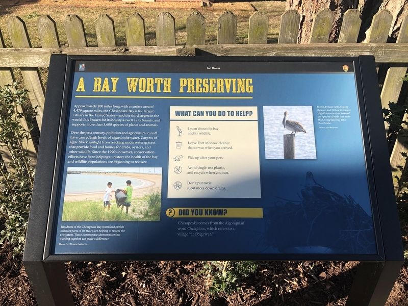
Approximately 200 miles long, with a surface area of 4,479 square miles, the Chesapeake Bay is the largest estuary in the United States—and the third largest in the world. It is known for its beauty as well as its bounty, and supports more than 3,600 species of plants and animals.
Over the past century, pollution and agricultural runoff have caused high levels of algae in the water. Carpets of algae block sunlight from reaching underwater grasses that provide food and homes for crabs, oysters, and other wildlife. Since the 1990s, however conservation efforts have been helping to restore the health of the bay, and wildlife populations are beginning to recover.
Did You Know?
Chesapeake comes from the Algonquian word Chesepiooc, which refers to a village "at a big river."
Erected by Fort Monroe Authority; National Park Service, U.S. Department of the Interior.
Topics. This historical marker is listed in these topic lists: Animals • Environment • Native Americans • Waterways & Vessels.
Location. 37° 0.137′ N, 76° 18.654′ W. Marker is in Hampton, Virginia. It is in Fort Monroe. Marker is on Ingalls Road just north of Fenwick
Other nearby markers. At least 8 other markers are within walking distance of this marker. Why Was The Fort Built Here? (here, next to this marker); How Big Is Fort Monroe? (a few steps from this marker); Who Built Fort Monroe? (a few steps from this marker); Wisser Hall: From Books To War Games (a few steps from this marker); Fort Monroe's Arc Of Freedom (a few steps from this marker); Why A Moat? (within shouting distance of this marker); Hurricane Isabel (within shouting distance of this marker); Flood of August 23, 1933 (within shouting distance of this marker). Touch for a list and map of all markers in Hampton.
Credits. This page was last revised on February 1, 2023. It was originally submitted on February 9, 2021, by Devry Becker Jones of Washington, District of Columbia. This page has been viewed 114 times since then and 8 times this year. Photos: 1, 2. submitted on February 9, 2021, by Devry Becker Jones of Washington, District of Columbia.

