Prehistoric Indian Mound

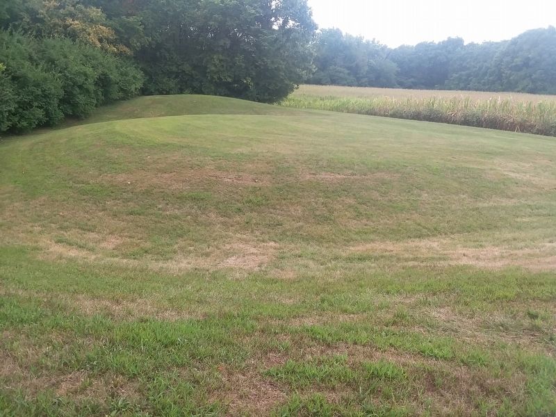
This doughnut-shaped mound with an inner ditch was probably built by the Adena people who lived here between 1000 B.C. and A.D. 100. Its exact function is not known, but it may have been ceremonial.
The Adena practiced some crude farming, raising such plants as pumpkins, squash and sunflowers, and also hunted, fished and gathered wild plant foods. Their small settlements of two to four huts were usually located near a stream or river which could afford them transportation and a source of food.
In contrast to earlier inhabitants of the area, the Adena did not move around much. This enabled them to substitute ceramic vessels for the light, tough skin and bark containers used by nomadic peoples, and pottery-making was one of their major achievements. Adena tools were made from stone, shell, bone and wood. Clothing was of animal hide sewn with sinew and also of textiles woven from plant fibers. Ornaments were made of copper, stone and shell and included bracelets, beads, finger rings and gorgets. They also made stone pipes. Most of these were tube-shaped, but a few had mouthpieces carved in the form of
this page online
The Adena culture was the first in this area to erect earth mounds over the remains of their dead. Some of these grew to a large size as more bodies and earth were added to existing mounds. Burials were often accompanied by artifacts identifying the social status and occupation of the deceased. Occasionally mounds were constructed for purposes other than burials. The large serpent-shaped mound in Adams County suggests a veneration of the snake.
Adena sites exist in Ohio, Kentucky, Indiana, West Virginia and Pennsylvania and their influence extended even further. You may be interested in
visiting some of the prehistoric Indian sites operated as state memorials
by the Ohio Historical Society.
Topics. This historical marker is listed in these topic lists: Agriculture • Anthropology & Archaeology • Indigenous Peoples and Communities.
Location. 40° 10.664′ N, 84° 15.502′ W. Marker is in Piqua, Ohio, in Miami County. It can be reached from North Hardin Road (County Route


Regionally, this marker is in the Dayton Metro, in the Miami Valley, and in the Till Plains. It is also in the American Midwest and in the Corn Belt. Globally, it is in North America, the Western Hemisphere, the Western World, and the Anglosphere. Historically, it finds itself in what was once the Haudenosaunee (Iroquois) Confederacy, the territory of the Mississippian Culture, and the Northwest Territory.
Other nearby markers. At least 8 other markers are within walking distance of this marker: Johnston Barn (about 400 feet away, measured in a direct line); The Cider House (about 600 feet away); The Courtyard (about 600 feet away); The Fruit Kiln (about 600 feet away); Site of Smokehouse (about 600 feet away); Pickawillany (approx. ¼ mile away); In Commemoration of the 94th & 110th Reg’s. O.V.I. (approx. ¼ mile away); Public History Movement (approx. ¼ mile away). Touch for a list and map of all markers
Another marker is no longer nearby. Fort Pickawillany (was approx. ¼ mile away but has been confirmed missing).
Credits. This page was last revised on February 13, 2021. It was originally submitted on February 13, 2021, by Craig Doda of Napoleon, Ohio. This page has been viewed 1,154 times since then and 73 times this year. Photos: 1, 2, 3. submitted on February 13, 2021, by Craig Doda of Napoleon, Ohio. • Devry Becker Jones was the editor who published this page.
