Near Ocala in Marion County, Florida — The American South (South Atlantic)
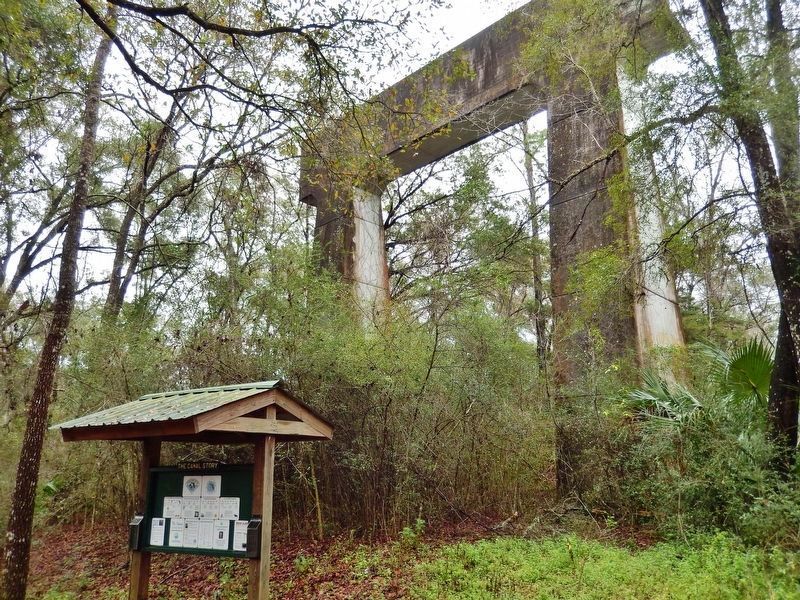
The Canal Story
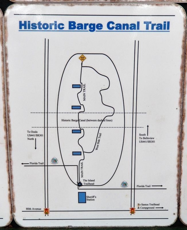
Historic Florida Barge Canal Trail
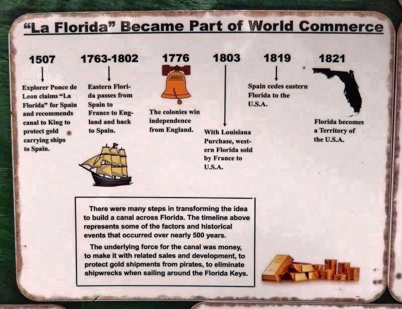
"La Florida" Became Part of World Commerce [panel 1]
1507 Explorer Ponce de Leon claims "La Florida" for Spain and recommends canal to King to protect gold carrying ships to Spain.
1763-1802 Eastern Florida passes from Spain to France to England and back to Spain.
1776 The colonies win independence from England.
1803 With Louisiana Purchase, western Florida sold by France to U.S.A.
1819 Spain cedes eastern Florida to the U.S.A.
1821 Florida becomes a Territory of the U.S.A.
There were many steps in transforming the idea to build a canal across Florida. The timeline above represents some of the factors and historical events that occurred over nearly 500 years.
The underlying force for the canal was money, to make it with related sales and development, to protect gold shipments from pirates, to eliminate shipwrecks when sailing around the Florida Keys.
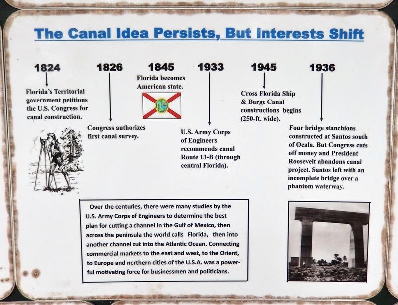
The Canal Idea Persists, But Interests Shift [panel 2]
1824 Florida's Territorial government petitions the U.S. Congress for canal construction.
1826 Congress authorizes first canal survey.
1845 Florida becomes American state.
1933 U.S. Army Corps of Engineers recommends canal Route 13-B (through central Florida).
1945 Cross Florida Ship & Barge Canal constructions begins (250-ft. wide).
1936 Four bridge stanchions constructed at Santos south of Ocala. But Congress cuts off money and President Roosevelt abandons canal project. Santos left with an incomplete bridge over a phantom waterway.
Over the centuries, there were many studies by the U.S. Army Corps of Engineers to determine the best plan for cutting a channel in the Gulf of Mexico, then across the peninsula the world calls Florida, then into another channel cut into the Atlantic Ocean. Connecting commercial markets to the east and west, to the Orient, to Europe and northern cities of the U.S.A. was a powerful motivating force for businessmen and politicians.
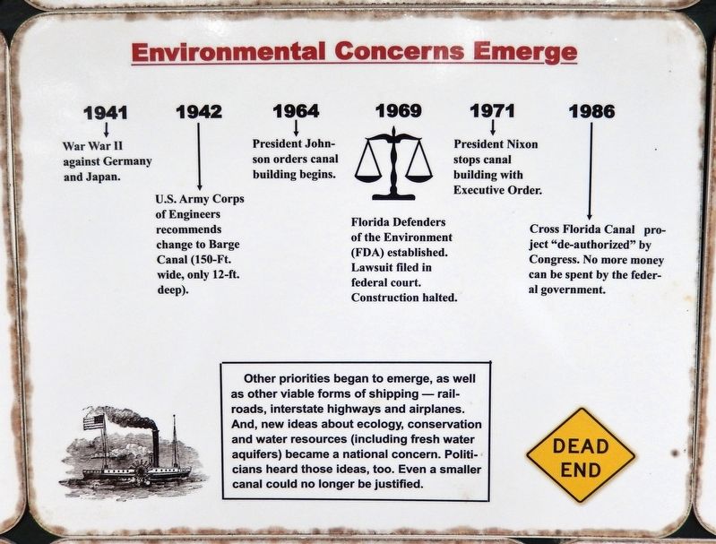
Environmental Concerns Emerge [panel 3]
1941 War War II against Germany and Japan.
1942 U.S. Army Corps of Engineers recommends change to Barge Canal (150-Ft. wide, only 12-ft. deep).
1964 President Johnson orders canal building begins.
1969 Florida Defenders of the Environment (FDA) established. Lawsuit filed in federal court. Construction halted.
1971 President Nixon stops canal building with Executive Order.
1986 Cross Florida Canal project "de-authorized" by Congress. No more money can be spent by the federal government.
Other priorities began to emerge, as well as other viable forms of shipping — railroads, interstate highways and airplanes. And, new ideas about ecology, conservation and water resources (including fresh water aquifers) became a national concern. Politicians heard those ideas, too. Even a smaller canal could no longer be justified.
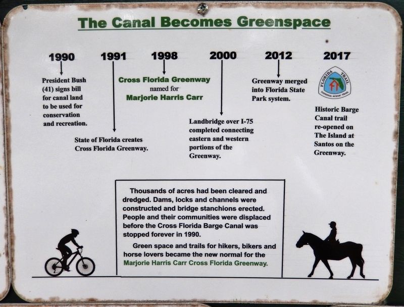
The Canal Becomes Greenspace [panel 4]
1990 President Bush (41) signs bill for canal land to be used for conservation and recreation.
1991 State of Florida creates Cross Florida Greenway.
1998 Cross Florida Greenway named for Marjorie Harris Carr.
2000 Landbridge over I-75 completed connecting eastern and western portions of the Greenway.
2012 Greenway merged into Florida State Park system.
2017 Historic Barge Canal trail re-opened on The Island at Santos on the Greenway.
Thousands of acres had been cleared and dredged. Dams, locks and channels were constructed and bridge stanchions erected. People and their communities were displaced before the Cross Florida Barge Canal was stopped forever in 1990.
Green space and trails for hikers, bikers and horse lovers became the new normal for the Marjorie Harris Carr Cross Florida Greenway.
Erected by Florida State Parks.
Topics. This historical marker is listed in these topic lists: Environment • Industry & Commerce • Parks & Recreational Areas • Waterways & Vessels.
Location. 29° 6.237′ N, 82° 5.424′ W. Marker is near Ocala, Florida, in Marion County. Marker can be reached from the intersection of Southeast 80th Street (County Road 328) and South Pine Avenue (U.S. 441), on the right when traveling east. Marker is located along the trail at "The Island" - Cross Florida Barge Canal Interpretive Park, just south of the Marion County Sheriff's Station. Touch for map. Marker is at or near this postal address: 3260 Southeast 80th Street, Ocala FL 34480, United States of America. Touch for directions.
Other nearby markers. At least 8 other markers are within walking distance of this marker. Canal Building (within shouting distance of this marker); Historical Perspective (within shouting distance of this marker); A Beautiful Place (within shouting distance of this marker); Great Depression Public Works Project (within shouting distance of this marker); Protective Perspective (within shouting distance of this marker); Opposition to the Canal (within shouting distance of this marker); Environmental Victory Nears (within shouting distance of this marker); Deliberate Strategy (within shouting distance of this marker). Touch for a list and map of all markers in Ocala.
Related markers. Click here for a list of markers that are related to this marker. Historic Florida Barge Canal Trail
Also see . . .
1. Cross Florida Barge Canal (Wikipedia). The idea of such a canal was first proposed by Philip II of Spain in 1567. It was repeatedly considered over the years but found to be economically unviable. In the 1930s, regional politicians lobbied the federal government to fund canal construction as an economic recovery program. President Franklin D. Roosevelt authorized $5 million in funding for the project in 1935. (Submitted on February 15, 2021, by Cosmos Mariner of Cape Canaveral, Florida.)
2. Marjorie Harris Carr Cross Florida Greenway. One of the nation's largest incomplete public works projects has been transformed into the diverse Cross Florida Greenway, spanning Central Florida from the Gulf of Mexico to the St. Johns River. (Submitted on February 15, 2021, by Cosmos Mariner of Cape Canaveral, Florida.)
Photographed By Cosmos Mariner, February 13, 2021
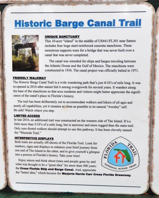
6. Marker detail: Historic Barge Canal Trail
Unique Sanctuary
This 10-acre "island" in the middle of US-441/US-301 near Santos includes four huge steel-reinforced concrete stanchions. These monstrous supports were for a bridge that was never built over a canal that was never completed. The canal was intended for ships and barges traveling between the Atlantic Ocean and the Gulf of Mexico. The stanchions were constructed in 1936. The canal project was officially halted in 1971.
Friendly Walkway
The Historic Barge Canal Trail is a wide wandering path that's just 4/10's of mile long. It was re-opened in 2016 after nature hid it among overgrowth for several years. It wanders along the base of the stanchions so that area residents and visitors might better appreciate the significance of the canal's place in Florida's history. The trail has been deliberately cut to accommodate walkers and hikers of all ages and nearly all capabilities, yet it remains as close as possible to its natural "woodsy" self. Be safe! Watch where you step.
Limited Access
In late 2016, an additional trail was constructed on the western side of The Island. It's a little more than 3/10's of a mile long, but is narrower and more rugged than the main trail. Only sure-footed walkers should attempt to use this pathway. It has been cleverly named the "Westside Trail."
Interpretive Displays
Both trails are actually off-shoots of the Florida Trail. Look for markers, signs and displays to enhance your brief journey from one end of The Island to the other, and to give yourself a glimpse into a portion of Florida's history. Take your time! Enjoy nature and think about times and people gone by and what was thought to be a "great idea" for more than 500 years: the Cross Florida Ship and Barge Canal. And, appreciate the "better idea," which became the Marjorie Harris Carr Cross Florida Greenway.

Photographed By Cosmos Mariner, February 13, 2021
7. Marker detail: Cross Florida Greenway
named in honor of
Marjorie Harris Carr
A nationally recognized environmentalist,
Marjorie Harris Carr founded
Florida Defenders of the Environment
in 1969 and led the successful effort
to stop construction of the
Cross Florida Barge Canal.
Credits. This page was last revised on February 21, 2021. It was originally submitted on February 14, 2021, by Cosmos Mariner of Cape Canaveral, Florida. This page has been viewed 369 times since then and 62 times this year. Photos: 1, 2, 3, 4, 5, 6, 7, 8, 9. submitted on February 15, 2021, by Cosmos Mariner of Cape Canaveral, Florida.

