
New Kent in New Kent County, Virginia — The American South (Mid-Atlantic)
Cedar Hill
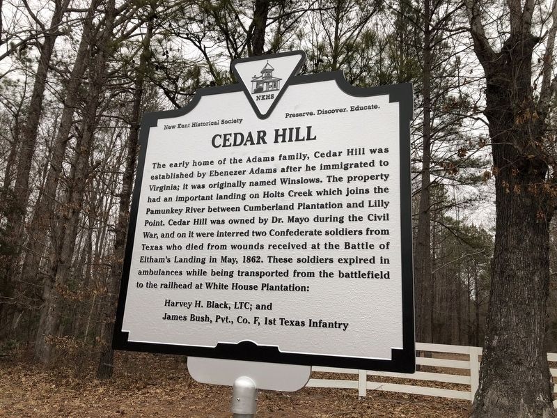
The early home of the Adams family, Cedar Hill was established by Ebenezer Adams after he immigrated to Virginia; it was originally named Winslows. The property had an important landing on Holts Creek which joins the Pamunkey River between Cumberland Plantation and Lilly Point, Cedar Hill was owned by Dr. Mayo during the Civil War, and on it were interred two Confederate soldiers from Texas who died from wounds received at the Battle of Eltham's Landing in May, 1862. These soldiers expired in ambulances while being transported from the battlefield to the railhead at White House Plantation:
Harvey H. Black, LTC; and
James bush, Pvt., Co. F, 1st Texas Infantry
Erected by New Kent Historical Society.
Topics. This historical marker is listed in these topic lists: Cemeteries & Burial Sites • War, US Civil • Waterways & Vessels. A significant historical month for this entry is May 1862.
Location. 37° 31.211′ N, 77° 0.025′ W. Marker is in New Kent, Virginia, in New Kent County. It is at the intersection of New Kent Highway (Virginia Route 249) and Mystic Oak Trail, on the right when traveling west on New Kent Highway.
this page online

Regionally, this marker is on Virginia’s Peninsula and in Coastal Virginia. It is also in the American South, specifically in the Upper South, in the Tidewater, and on the Eastern Seaboard. Globally, it is in the North Atlantic Region, North America, the Western Hemisphere, the Western World, and the Anglosphere. Historically, it finds itself in what was once the territory of the Mississippian Culture, one of the original Thirteen Colonies, one of the Confederate States of America, and the Antebellum South.
Other nearby markers. At least 8 other markers are within 2 miles of this marker, measured as the crow flies: Calvin Coolidge Green, Th.D., Ed.D., Ph.D. (1931-2011) (approx. 1.1 miles away); New Kent School (approx. 1.1 miles away); The Wilson House: Witness to Three Centuries (approx. 1.2 miles away); A Tale of Three Structures (approx. 1.2 miles away); John Parke Custis / Martha Dandridge (approx. 1.2 miles away); Martha Washington's Birthplace (approx. 1.2 miles away);
Credits. This page was last revised on March 2, 2021. It was originally submitted on March 2, 2021, by Devry Becker Jones of Washington, District of Columbia. This page has been viewed 1,155 times since then and 67 times this year. Photos: 1, 2. submitted on March 2, 2021, by Devry Becker Jones of Washington, District of Columbia.
