Ponca in Dixon County, Nebraska — The American Midwest (Upper Plains)
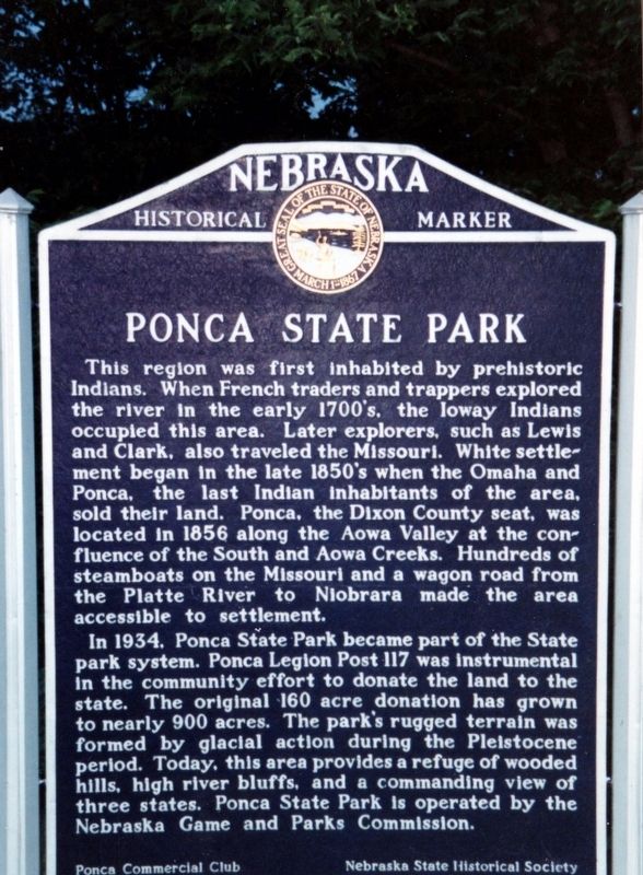
Ponca State Park
In 1934, Ponca State Park became part of the State park system. Ponca Legion Post 117 was instrumental in the community effort to donate the land to the state. The original 160 acre donation has grown to nearly 900 acres. The park's rugged terrain was formed by glacial action during the Pleistocene period. Today, this area provides a refuge of wooded hills, high river bluffs, and a commanding view of three states. Ponca State Park is operated by the Nebraska Game and Parks Commission.
Erected by Ponca Commercial Club and Nebraska State Historical Society. (Marker Number 270.)
Topics. This historical marker is listed in these topic lists: Exploration • Native Americans • Parks & Recreational Areas • Waterways & Vessels. A significant historical year for this entry is 1934.
Location. 42° 35.847′ N, 96° 42.637′ W. Marker is in Ponca, Nebraska, in Dixon County. Marker is on Highway 26 E Spur, 0.6 miles north of Highland Road. Marker is located in the park, .6 miles from the entrance. Touch for map. Marker is at or near this postal address: 88090 Spur 26 E, Ponca NE 68770, United States of America. Touch for directions.
Other nearby markers. At least 8 other markers are within 6 miles of this marker, measured as the crow flies. Ponca (approx. 2.4 miles away); Grasshopper Cross (approx. 5.6 miles away in South Dakota); The Lewis and Clark Expedition (approx. 6 miles away in South Dakota); U.S. Democracy Crosses the Mississippi River (approx. 6 miles away in South Dakota); A Land of Plenty (approx. 6 miles away in South Dakota); Entering an Uncertain Land (approx. 6 miles away in South Dakota); Return to "Elk Sign" Campsite (approx. 6 miles away in South Dakota); Lewis & Clark Campsite / Eli Wixson Farm Site (approx. 6 miles away in South Dakota).
Also see . . . Ponca State Park. (Submitted on April 11, 2021, by Tim Fillmon of Webster, Florida.)
Credits. This page was last revised on June 19, 2021. It was originally submitted on April 11, 2021, by Tim Fillmon of Webster, Florida. This page has been viewed 166 times since then and 17 times this year. Photo 1. submitted on April 11, 2021, by Tim Fillmon of Webster, Florida.
Editor’s want-list for this marker. A wide view photo of the marker and the surrounding area in context. • A clear, close-up photo of the marker. • Can you help?
