Farmville in Cumberland County, Virginia — The American South (Mid-Atlantic)
Confederate Cemetery
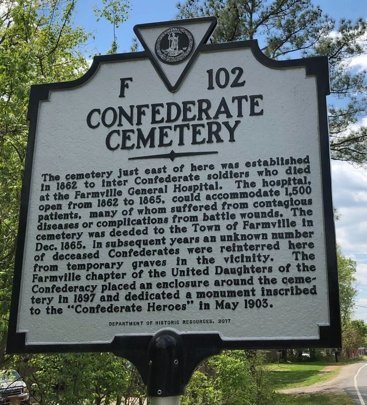
Erected 2017 by Department of Historic Resources. (Marker Number F-102.)
Topics and series. This historical marker is listed in these topic lists: Cemeteries & Burial Sites • Science & Medicine • War, US Civil. In addition, it is included in the Virginia Department of Historic Resources (DHR) series list. A significant historical month for this entry is May 1903.
Location. 37° 18.665′ N, 78° 23.204′ W. Marker is in Farmville, Virginia, in Cumberland County. It is at
this page online

Regionally, this marker is in the Piedmont and in Central Virginia. It is also in the American South and specifically in the Upper South. Globally, it is in North America, the Western Hemisphere, the Western World, and the Anglosphere. Historically, it finds itself in what was once the territory of the Mississippian Culture, one of the original Thirteen Colonies, one of the Confederate States of America, and the Antebellum South.
Other nearby markers. At least 8 other markers are within walking distance of this marker: Confederate Memorial (about 700 feet away, measured in a direct line); Confederate Veterans Monument (about 700 feet away); Lest We Forget (approx. 0.2 miles away); Bizarre (approx. 0.2 miles away); Cumberland County / Prince Edward County (approx. ¼ mile away); Farmville (approx. 0.4 miles away); a different marker also named Farmville (approx.


Photographed by Evan Dwyer, December 13, 2025
3. Confederate Cemetery
The cemetery itself is in the neighborhood northeast of this marker. This view shows the cemetery; there are no individual marked graves, but there are three memorials to Confederates within its confines.
Credits. This page was last revised on January 12, 2026. It was originally submitted on April 25, 2021, by Devry Becker Jones of Washington, District of Columbia. This page has been viewed 1,393 times since then and 186 times this year. Photos: 1, 2. submitted on April 25, 2021, by Devry Becker Jones of Washington, District of Columbia. 3. submitted on December 30, 2025, by Evan Dwyer of Richmond, Virginia.
