Near Delta in York County, Pennsylvania — The American Northeast (Mid-Atlantic)
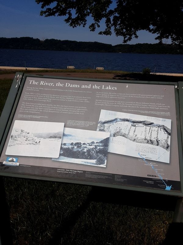
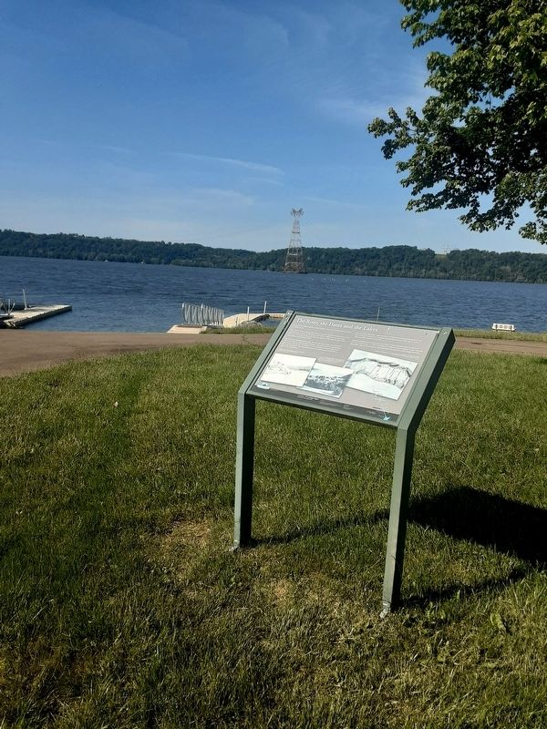
The River, the Dams and the Lakes
From 1895 to 1931, as demand for electricity increased, four hydroelectric dams were constructed on the river: at York Haven, Safe Harbor, Holtwood, and Conowingo. Each one of these dams creates huge reservoirs behind it: Lake Frederic, Lake Clarke, Lake Aldred, and Conowingo Pond.
The dams have provided many benefits, but they also have created some problems. They furnish the area with electricity, drinking water, and recreational opportunities. At the same time, they have caused harm to natural habitats, disrupted the river's flow, and contributed to the virtual disappearance of certain species of fish from parts of the Susquehanna.
In recent years, the utility companies have worked with governmental agencies and citizen groups to improve the constancy of the Susquehanna's flow and to restore migratory fish to upstream locations.
Another environmental success story occurred on Mount Johnson Island, which can be seen across the river. In 1935, the National Audubon Society obtained a lease from the Philadelphia Electric Company and made the island the world's first Bald Eagle sanctuary.
[captions:]
A summer day of recreation along the Susquehanna River at Indian Steps and falls on Porters Battery.
Courtesy York County Heritage Trust
A view of the Susquehanna River looking south from Long Level in York County, before the construction of Safe Harbor Dam and the creation of Lake Clarke. Note the exposed bedrock of the riverbed.
Courtesy Barry C. Kent from his book Susquehanna's Indians
A section of the map of the Susquehanna River, sketched by B. Henry Latrobe, in 1801, for then Governor of Pennsylvania, Thomas McKean.
Courtesy York County Heritage Trust
Lancaster - York Heritage Region
Susquehanna River Water Trail
This project was completed with generous financial contributions from the following project partners:
-National Park Service Chesapeake Bay Gateway & Water Trail Network
-Pennsylvania Department of Conservation and Natural Resources Bureau of Recreation and Conservation Growing Greener & Heritage Park Programs
-Lancaster County Planning Commission
-East Donegal Township
-Marietta Borough
-PPL Holtwood LLC
-Exelon
-Safe Harbor Water Power Corporation
-York Haven Power Company
-The John Wright Company
Topics. This historical marker is listed in these topic lists: Environment • Industry & Commerce • Parks & Recreational Areas • Waterways & Vessels. A significant historical year for this entry is 1895.
Location. 39° 46.072′ N, 76° 16.425′ W. Marker is near Delta, Pennsylvania, in York County. Marker is on Dorsey Park Trail, on the left when traveling east. Approach this park, which is on riverside just upstream of power plant, on Lay Road. Touch for map. Marker is at or near this postal address: 66 Dorsey Park Trail, Delta PA 17314, United States of America. Touch for directions.
Other nearby markers. At least 8 other markers are within 4 miles of this marker, measured as the crow flies. Parks are for People (approx. 2.7 miles away); The Canal Boats (approx. 2.9 miles away); The Canal Community (approx. 2.9 miles away); The Locks (approx. 2.9 miles away); The Susquehanna & Tidewater Canal (approx. 2.9 miles away); The Slate Splitters (approx. 3˝ miles away); Welsh Slate Quarrymens' Cottages at Coulsontown (approx. 3˝ miles away); The World Famous Peach Bottom Slate (approx. 3˝ miles away). Touch for a list and map of all markers in Delta.
Credits. This page was last revised on May 25, 2021. It was originally submitted on May 21, 2021, by Carl Gordon Moore Jr. of North East, Maryland. This page has been viewed 152 times since then and 18 times this year. Photos: 1, 2, 3. submitted on May 21, 2021, by Carl Gordon Moore Jr. of North East, Maryland. • Bill Pfingsten was the editor who published this page.


