Near Charles Town in Jefferson County, West Virginia — The American South (Appalachia)
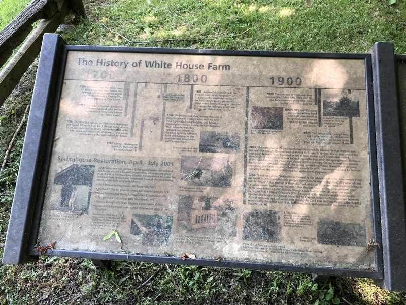
The History of White House Farm
1730 John and Isaac Van Meter, sons of Dutch immigrant Jobst Jansen Van Masteren, obtained grants for 40,000 acres in then Berkeley County, VA. from Virginia Lt. Gov. Gooch.
1731 Jost Hite, a German immigrant, purchased this land from Van Meters and it came to be known as "Hite's Grant".
1740 Dr. John McCormick, an Irish-Scots immigrant, purchased 395 acres from Jost Hite and constructed a two-room home for his family, which consisted of his wife Anne, and their eight children. These room now make up the right side of the house.
1752 George Washington surveyed the farm for Dr. McCormick. (1)
1768 Dr. McCormick died, leaving the farm to his youngest son Andrew who, with his wife Nancy, provided food, lodging, and horses to Washington's troops during the Revolutionary War. After the war, they operated an ordinary on the farm, offering travelers food and lodging on the road between Winchester and Harpers Ferry.
1807 Andrew McCormick sold the farm to John Locke, but preserved 1/4 acre in the southwest corner for the McCormick family graveyard. John Locke's brother George continued to manage the ordinary, which was known as the White House Tavern.
1863 The springhouse (2) and farmhouse (3) owned by Eleanor Locke Morrow and her husband and Joseph Morrow were sketched by James E. Taylor. The spring, one of the source of Bullskin Run, provided water to both Union and Confederate troops. Morrow's blacksmith shop was located across the lane from the springhouse. Remains of the foundation of the stone wall shown next to the shop (3) can be seen just outside the rail fence. Although access to the spring remains on White House Farm property, the spring itself was deeded to Jefferson County in 1975. Not recommended for human consumption, the water is still used for agricultural purposes.
1863 "I had reached the "White House," owned by Mr. Morrow two miles from Summit Point; had halted to let the men dismount and get water from the large spring about fifty yards off; and was the only mounted man left on the road. I had ridden up the yard fence, and was talking to the ladies, when I heard a voice exclaim, "Here they are, boys, by God, we've got them now!" At the same instant a bullet whistled through a lilac bush between the ladies and myself." So begins Major Harry Gilmore's (CSA) account of the fatal encounter between his Confederate troops and Union forces led by Captain Somers which occurred between this springhouse and the farmhouse during the Civil War (in Four Years in the Saddle, recorded by Burternut and Blue, Baltimore, MD) and depicted in the James E. Taylor Sketchbook.

Photographed By Devry Becker Jones (CC0), May 21, 2021
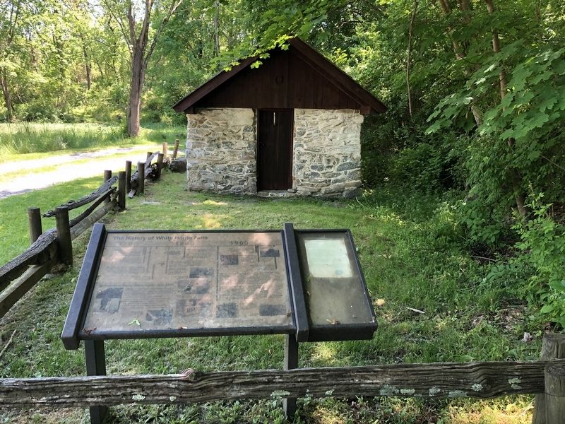
2. The History of White House Farm Marker
The springhouse is visible in the background.
1929 The concrete springhouse floor was inscribed "May 30th, 192, l.n" (5). The farm's owners at the time were Luther and Lillian Naylor.
1930's-50's (6) The farm supported a dairy herd and milk was stored in their springhouse to await pickup by the wagons and trucks.
1979 The farmhouse, springhouse, and 3 other structures of this now 40 acre farm were added to the National Register of Historic Places
Springhouse Restoration, April - July 2001
After many years in decline (7), the springhouse was restored, funded in part by a historic preservation development grant from the West Virginia State Historic Preservation Office and the National Park Service, and completed through the outstanding efforts of the following individuals:
• Fred Brewster, stonemason (8), Berryville, VA
• Michael F. Taylor, general contractor, Shepherdstown, WV
• Gene Bichner and David Lutman, Roof Construction (9)
• Charles Deeds, carpenter (10) , Middleway, WV
• Pamela Brooks, WV State Historic Preservation Office
• Summit Point citizens who signed 80 letters of support for the grant
Topics. This historical marker is listed in these topic lists: Agriculture • Colonial Era • War, US Civil • War, US Revolutionary. A significant historical month for this entry is July 2001.
Location. 39° 15.055′ N, 77° 56.725′ W. Marker is near Charles Town, West Virginia, in Jefferson County. Marker is on Summit Point Road (County Road 13) 0.2 miles west of McCormack Lane, on the right when traveling east. Touch for map. Marker is at or near this postal address: 3735 Summit Point Rd, Charles Town WV 25414, United States of America. Touch for directions.
Other nearby markers. At least 8 other markers are within 4 miles of this marker, measured as the crow flies. White House Farm (here, next to this marker); Washington's Land (approx. 0.8 miles away); Richwood Hall (approx. 3.2 miles away); Locust Hill (approx. 3.4 miles away); "Claymont Court" (approx. 3.7 miles away); "Blakeley" (approx. 3.7 miles away); Cedar Lawn (approx. 3.9 miles away); Cameron's Depot (approx. 3.9 miles away). Touch for a list and map of all markers in Charles Town.
Credits. This page was last revised on August 2, 2021. It was originally submitted on May 22, 2021, by Devry Becker Jones of Washington, District of Columbia. This page has been viewed 683 times since then and 95 times this year. Photos: 1, 2. submitted on May 22, 2021, by Devry Becker Jones of Washington, District of Columbia.
