Near McGuffey in Hardin County, Ohio — The American Midwest (Great Lakes)
Scioto Marsh
Photographed by William Fischer, Jr., March 7, 2010
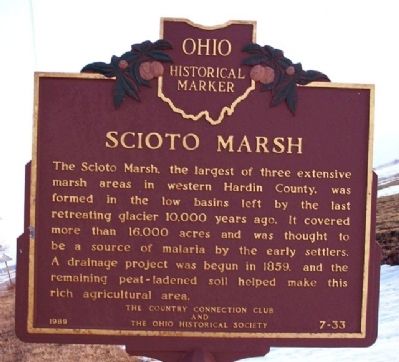
1. Scioto Marsh Marker
The Scioto Marsh, the largest of three extensive marsh areas in western Hardin County, was formed in the low basins left by the last retreating glacier 10,000 years ago. It covered more than 16,000 acres and was thought to be a source of malaria by the early settlers. A drainage project was begun in 1859, and the remaining peat-ladened soil helped make this rich agricultural area.
Erected 1989 by The Country Connection Club and The Ohio Historical Society. (Marker Number 7-33.)
Topics and series. This historical marker is listed in these topic lists: Agriculture • Natural Features • Settlements & Settlers • Waterways & Vessels. In addition, it is included in the Ohio Historical Society / The Ohio History Connection series list. A significant historical year for this entry is 1859.
Location. Marker has been reported missing. It was located near 40° 40.441′ N, 83° 47.138′ W. Marker was near McGuffey, Ohio, in Hardin County. It was at the intersection of Ohio Route 195 and County Route 110, on the right when traveling south on Ohio Route 195. The marker was about 250 feet south of the intersection. Touch for map.
this page online

Regionally, this marker was in the Till Plains. It was also in the American Midwest and in the Corn Belt. Globally, it was in North America, the Western Hemisphere, the Western World, and the Anglosphere. Historically, it found itself in what was once the Haudenosaunee (Iroquois) Confederacy, the territory of the Mississippian Culture, and the Northwest Territory.
Other nearby markers. At least 8 other markers are within 6 miles of this location, measured as the crow flies: Village of McGuffey / Great 1934 Onion Strike (approx. 1.4 miles away); Alger Marion Township Veterans Memorial (approx. 3.8 miles away); Alger-Marion Township Veterans Wall (approx. 3.8 miles away); Jacob Parrott (approx. 3.8 miles away); Raymond "Ray" Brown (1908-1965) (approx. 4.3 miles away); Veterans Memorial (approx. 5.3 miles away); Mount Zion United Methodist Church (approx. 5.3 miles away); Fort McArthur Cemetery (approx. 5.9 miles away).
Also see . . . The Scioto Marshes of Ohio. Ohio State University PDF
Photographed by William Fischer, Jr., March 7, 2010
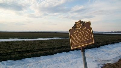
2. Scioto Marsh Marker
Looking NW.
Photographed by William Fischer, Jr., March 7, 2010
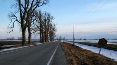
3. Scioto Marsh Marker
Looking south along Ohio Route 195.

Photographed by William Fischer, Jr., March 7, 2010
4. Scioto Marsh Marker
An unwelcome surprise, with marker visible to left of telephone pole, just above barricade. Looking south.
Photographed by William Fischer, Jr., March 7, 2010
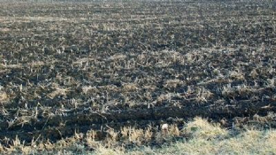
5. The Rich Scioto Marsh Soil
Credits. This page was last revised on November 6, 2023. It was originally submitted on March 24, 2010, by William Fischer, Jr. of Reynoldsburg, Ohio. This page has been viewed 2,289 times since then and 97 times this year. Last updated on May 26, 2021, by Robert Baughman of Bellefontaine, Ohio. Photos: 1, 2, 3, 4, 5. submitted on March 24, 2010, by William Fischer, Jr. of Reynoldsburg, Ohio. • Devry Becker Jones was the editor who published this page.
