Kennett in Dunklin County, Missouri — The American Midwest (Upper Plains)
Kennett
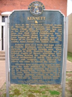
Here in the Southeast Lowland Region of Missouri on a Delaware and Shawnee Indian village site, Kennett was laid out as the seat of Dunklin County, 1846. The town was first called Chilletecaux for a Delaware Indian living here at the time. Later known as Butler, it was named for Mayor of St. Louis L.M. Kennett, 1851. The county name honors Gov. Daniel Dunklin.
Kennett grew as a trade and legal center as Dunklin developed into a noted cotton, soybean, and livestock farming area. When organized in 1845, Dunklin County was an isolated region of forest, overflowed land, and swamp bearing the marks of the New Madrid earthquakes of 1811-12. First settlers, hunters and trappers, were followed by others who came to harvest the forests.
Effective land reclamation began in 1893 when the state provided for organization of county drainage districts and levees on the St. Francis River. Dunklin County is in the Little River Drainage District, one of the largest drainage systems in the U.S., organized 1905. Drainage districts include some 300,000 of Dunklin's 347,524 acres.
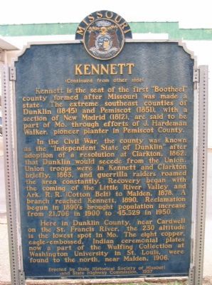
Kennett is the seat of the first "Bootheel" county formed after Missouri was made a state. The extreme southeast counties of Dunklin (1845) and Pemiscot (1851), with a section of New Madrid (1812), are said to be part of Mo. through efforts of J. Hardeman Walker, pioneer planter in Pemiscot County.
In the Civil War, the county was known as the "Independent State of Dunklin" after adoption of a resolution at Clarkton, 1862, that Dunklin would secede from the Union. Union troops were in Kennett and Clarkton briefly, 1863, and gerrilla raiders roamed the area constantly. Recovery began with the coming of the Little River Valley and Ark. R.R. (Cotton Belt) to Malden, 1878. A branch reached Kennett, 1890. Reclamation begun in 1890's brought population increase from 21,706 in 1900 to 45,329 in 1950.
Here in Dunklin County, near Cardwell on the St. Francis River, the 230 altitude is the lowest spot in Mo. The eight copper, eagle-embossed, Indian ceremonial plates now a part of the Wulfing Collection at Washington University in St. Louis were found to the north, near Malden, 1906.
Erected 1957 by State Historical Society of Missouri and State Highway Commission.
Topics and series. This historical marker is listed in these topic lists: Agriculture • Native Americans • Settlements & Settlers • War, US Civil. In addition, it is included in the Missouri, The State Historical Society of series list. A significant historical year for this entry is 1846.
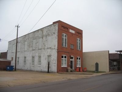
Location. 36° 14.232′ N, 90° 3.335′ W. Marker is in Kennett, Missouri, in Dunklin County. Marker is at the intersection of College Street and North Court Square, on the right on College Street. Located in front of the old City Hall building, now occupied by the Dunklin County Museum. Touch for map. Marker is in this post office area: Kennett MO 63857, United States of America. Touch for directions.
Other nearby markers. At least 2 other markers are within 14 miles of this marker, measured as the crow flies. The Village of Kennett (about 300 feet away, measured in a direct line); Hornersville (approx. 14 miles away).
More about this marker. This marker was located in front of the hospital on the east side of town, near the intersection of 1st Street and Teaco Road. It was moved in the 1990s.
Also see . . . How did the state boundary of Missouri come to include the "Bootheel"?. Local lore has many reasons for the creation of Missouri's boot heel. A popular one is that a local land owner entertained the surveyors with strong drinks. This article sets aside the myths. As with many boundary issues, it was a simple case of political influence. (Submitted on March 30, 2009, by Craig Swain of Leesburg, Virginia.)
Photographed By Craig Swain, March 15, 2009
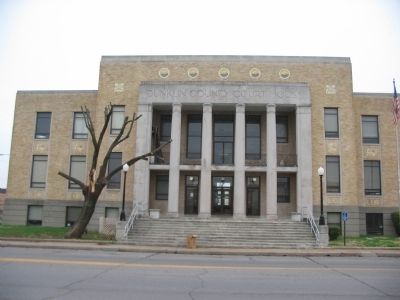
4. Dunklin County Court House
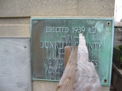
The original court house was burned during the Civil War. A replacement was built in the later part of the 19th Century. The present building was constructed with an art-deco style as part of a Works Progress Project in the 1930s.
Photographed By Craig Swain, March 17, 2009
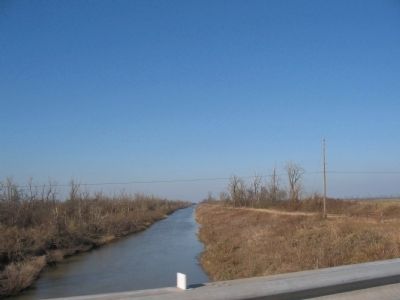
7. Drainage Ditch
Mentioned on the marker, the land around Kennett was drained in the 1890s to 1920s. Drainage ditches cross all around the county. This ditch is one of five which form a "flood way" east of town, which drained the Little River, itself a tributary of the St. Francis River.
Photographed By Craig Swain, March 15, 2009
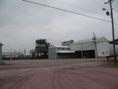
8. Cotton Gin
South of town is this cotton gin facility. In the old days, the harvested cotton arrived in trailers to have the seeds removed. In recent decades, the cotton is instead formed into modular blocks in the field for easier transporting, and processing in bulk.
Photographed By Craig Swain, March 15, 2009
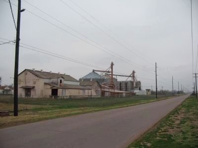
9. Cotton Compress
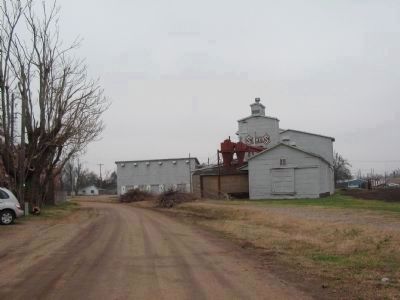
Cotton bales were required to conform to specific dimensions and densities. The compress did just that by, as the word implies, compressing the cotton. With the move to bulk processing of modular blocks from the field, this facility is not used. The railroad, mentioned on the marker, ran along in front of the compress building. In the 1980s the line was removed.
Credits. This page was last revised on December 17, 2020. It was originally submitted on March 30, 2009, by Craig Swain of Leesburg, Virginia. This page has been viewed 2,575 times since then and 103 times this year. Photos: 1, 2, 3, 4, 5, 6, 7, 8, 9, 10, 11. submitted on March 30, 2009, by Craig Swain of Leesburg, Virginia.
