Swansboro in Richmond, Virginia — The American South (Mid-Atlantic)
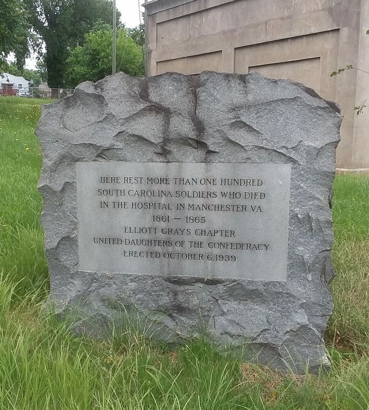
Here Rest More Than One Hundred
Photographed by Janet Jordan Perkins, May 25, 2020
1. South Carolina Hospital Burying Ground
Erected 1939 by Elliott Grays Chapter United Daughters of the Confederacy.
Topics and series. This memorial is listed in these topic lists: Cemeteries & Burial Sites • Science & Medicine • War, US Civil. In addition, it is included in the United Daughters of the Confederacy series list. A significant historical year for this entry is 1861.
Location. 37° 30.936′ N, 77° 27.293′ W. Memorial is in Richmond, Virginia. It is in Swansboro. It is at the intersection of Wise Street and West 24th Street, on the left when traveling east on Wise Street. Touch for map. Memorial is in this post office area: Richmond VA 23225, United States of America. Touch for directions.

Regionally, this memorial is in Central Virginia. It is also in the American South and specifically in the Upper South. Globally, it is in North America, the Western Hemisphere, the Western World, and the Anglosphere. Historically, it finds itself in what was once the territory of the Mississippian Culture, one of the original Thirteen
this page online
Other nearby markers. At least 8 other markers are within walking distance of this marker: The First Baptist Church of South Richmond (approx. half a mile away); Dr. Dorothy Irene Height (approx. 0.6 miles away); Dorothy Height (approx. 0.6 miles away); Headgate Cleaner and Hydro Plant (approx. 0.8 miles away); Colonel Thomas Stegge, Jr. (approx. 0.8 miles away); First Break Rapid (approx. 0.9 miles away); Belle Isle Hydro Plant (approx. 0.9 miles away); Quarrying Broad Rock Island (approx. 0.9 miles away). Touch for a list and map of all markers in Richmond.
Other markers no longer nearby. Headgate (was approx. 0.8 miles away but has been replaced with another marker now near it); Headgate Cleaner (was approx. 0.8 miles away but has been replaced with another marker now near it); Gun Emplacement (was approx. 0.8 miles away but has been permanently removed); Manchester Elliott Grays (was approx. 0.8 miles away but has been permanently removed); First Break Rapids (was approx. 0.9 miles away but has been replaced with another marker now near
Photographed by Evan Dwyer, October 13, 2025
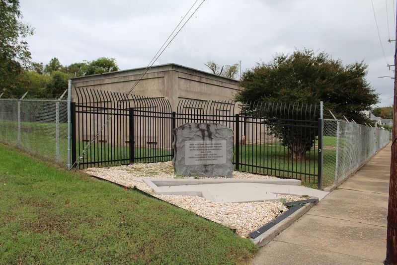
2. Here Rest More Than One Hundred Marker
More about this memorial. The marker sits at the southwest corner of the fenced in burying ground. The City of Richmond Dept. of Public Utilities relocated the graves to the rear of the site several decades ago prior to erecting the utility building.
Also see . . .
1. Confederate Soldiers Memorial. Findagrave.com (Submitted on June 20, 2021, by Janet Jordan Perkins of Richmond, Virginia.)
2. Discovery of 742 potential graves raises new questions about how to handle Confederate marker. Richmonder.org (Submitted on April 5, 2026, by Mike McKeown of Baltimore, Maryland.)
Photographed by Evan Dwyer, October 13, 2025
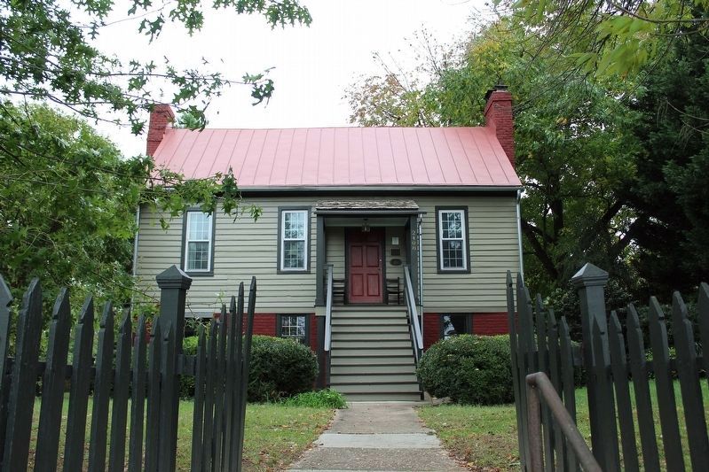
3. John A. Carroll House, CSA Hospital
This house, built in 1816 by Richard Kendall Weisiger and owned by John A. Carroll during the Civil War, was used as a Confederate Hospital in the town of Manchester. Those soldiers who succumbed while in this hospital and its surrounds are the men who are interred in the mass grave commemorated by the marker (which is on the lot immediately behind the house; the marker fronts Wise Street, the original backyard of this home, while the house fronts Bainbridge Street and no longer includes the back lot). This house is on the National Register of Historic Places as the Carroll-Weisiger House.
Credits. This page was last revised on April 6, 2026. It was originally submitted on June 20, 2021, by Janet Jordan Perkins of Richmond, Virginia. This page has been viewed 1,739 times since then and 59 times this year. Photos: 1. submitted on June 20, 2021, by Janet Jordan Perkins of Richmond, Virginia. 2, 3. submitted on October 21, 2025, by Evan Dwyer of Richmond, Virginia. • Bernard Fisher was the editor who published this page.
