North Central in San Antonio in Bexar County, Texas — The American South (West South Central)
Jefferson Davis Smith
(1862 - 1940)
Photographed by James Hulse, July 1, 2021
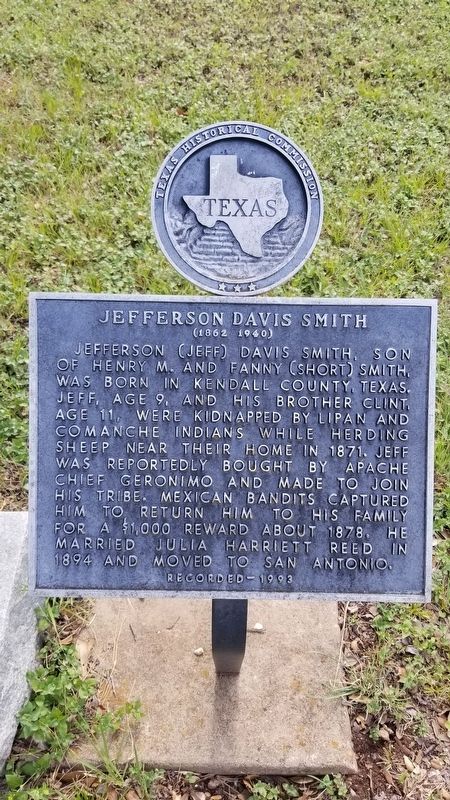
1. Jefferson Davis Smith Marker
Jefferson (Jeff) Davis Smith, son of Henry M. and Fanny (Short) Smith, was born in Kendall County, Texas. Jeff, age 9, and his brother Clint, age 11, were kidnapped by Lipan and Comanche Indians while herding sheep near their home in 1871. Jeff was reportedly bought by Apache Chief Geronimo and made to join his tribe. Mexican bandits captured him to return him to his family for a $1,000 reward about 1878. He married Julia Harriett Reed in 1894 and moved to San Antonio.
Recorded 1993
Erected 1993 by Texas Historical Commission. (Marker Number 4960.)
Topics. This historical marker is listed in these topic lists: Cemeteries & Burial Sites • Indigenous Peoples and Communities • Wars, US Indian. A significant historical year for this entry is 1871.
Location. 29° 33.353′ N, 98° 29.556′ W. Marker is in San Antonio, Texas, in Bexar County. It is in North Central. It can be reached from East North Loop Road ¼ mile west of Wurzbach Parkway. The marker is located in the central section of the Coker Cemetery and it can be accessed through the Coker United Methodist Church parking lot. Touch for map. Marker is at or near this postal address: 231 East North Loop Road, San Antonio TX 78216, United States of America. Touch for directions.

Regionally, this marker is in South Texas. It is also in the American South. Globally, it is in North America, a Gulf of Mexico state, the Western Hemisphere, the Western World, and the Anglosphere. Historically, it finds itself in what was once New Spain, the Republic of Texas, and one of the Confederate States of America.
Other nearby markers. At least 8 other markers are within 6 miles of this marker, measured as the crow flies: Hampton Coker (within shouting distance of this marker); Malinda Brown Coker (within shouting distance of this marker); John "Jack" Coker
this page online
Regarding Jefferson Davis Smith. There is a book written about their story by Clint Smith called “The Boys Captives”.
Also see . . . Smith, Clinton Lafayette and Jefferson Davis.
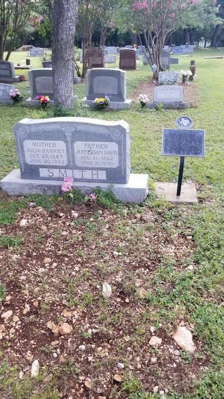
Clint and Jeff Smith were captured on February 26, 1871, by Lipans and Comanches while herding sheep near the Smith home on Cibolo Creek between San Antonio and Boerne. They were the sons of Henry Smith, a Texas lawman and rancher from Pennsylvania, and Frances Short, a native of Alabama and a member of the controversial Short clan of Fayette County, Texas. When an initial rescue effort led by the brothers' two sisters Amanda (Lane) and Caroline (Coker) failed, Capt. Henry Smith and Capt. John W. Sansom, a cousin, assembled a large body of Texas Rangers and local militia, who, along with(Submitted on July 12, 2021, by James Hulse of Medina, Texas.)a posse led by Capt. Charles Schreiner, pursued the Indians from near Kendalia to Fort Concho in West Texas. The rescue attempt was futile, however, and for the next five years, until Clint and Jeff were returned to their families, Henry Smith offered a reward of $1,000 for each of the boys. Source: The Handbook of TexasPhotographed by James Hulse, July 1, 20212. The gravestone of Jefferson Davis Smith and his wife with the marker
Photographed by James Hulse, July 1, 2021
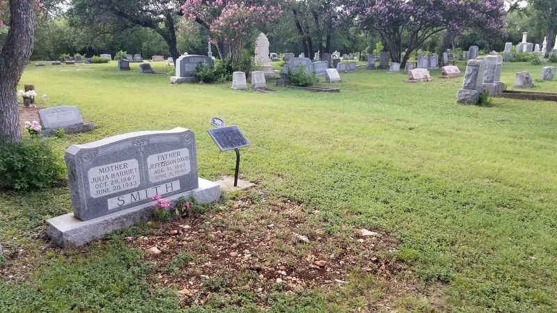
3. The view of the gravestone and marker from the cemetery
Credits. This page was last revised on February 2, 2023. It was originally submitted on July 12, 2021, by James Hulse of Medina, Texas. This page has been viewed 1,080 times since then and 109 times this year. Photos: 1, 2, 3. submitted on July 12, 2021, by James Hulse of Medina, Texas.
