Near Ocracoke in Carteret County, North Carolina — The American South (South Atlantic)
Exploring Portsmouth
Cape Lookout National Seashore
Photographed by Sean C Bath, July 13, 2021
1. Exploring Portsmouth Marker
(captions)
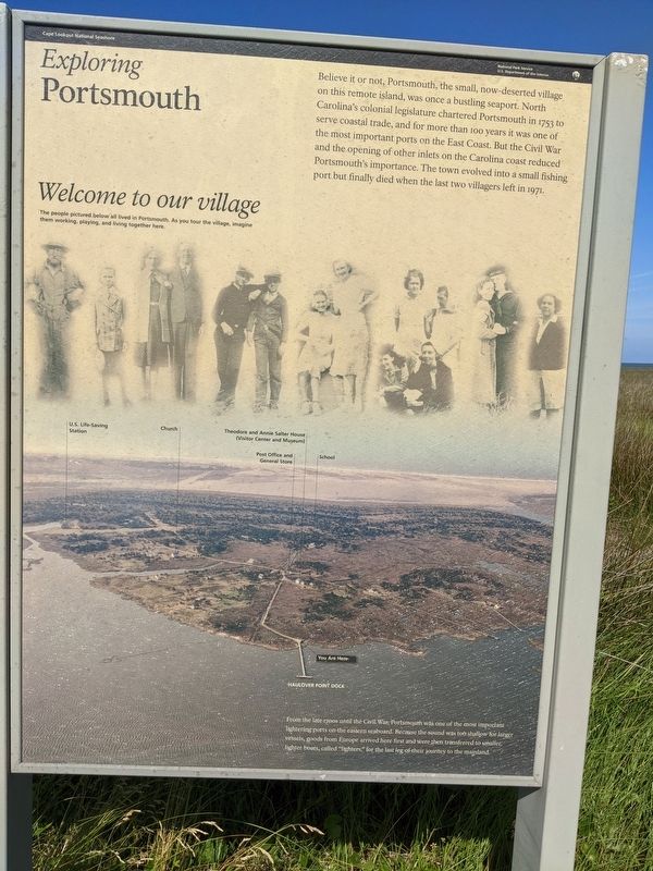
Welcome to our village The people pictured below all lived in Portsmouth. As you tour the village, imagine them working, playing, and living together here.
From the late 1700s until the Civil War, Portsmouth was one of the most important lightering ports on the eastern seaboard. Because the sound was too shallow for larger vessels, goods from Europe arrived here first and were then transferred to smaller, lighter boats, called "lighters," for the last leg of their journey to the mainland.
Erected by National Park Service, U.S. Department of the Interior.
Topics. This historical marker is listed in these
this page online
Location. 35° 4.359′ N, 76° 3.893′ W. Marker is near Ocracoke, North Carolina, in Carteret County. It can be reached from an unnamed road. Portsmouth Island is accessible only by boat. The island is managed by the National Park Service as part of Cape Lookout National Sea Shore. Touch for map. Marker is in this post office area: Ocracoke NC 27960, United States of America. Touch for directions.

Regionally, this marker is in the Coastal Plain, on the Crystal Coast, and on the Outer Banks. It is also in the American South, specifically in the Upper South, in the Tidewater, and on the Eastern Seaboard. Globally, it is in the North Atlantic Region, North America, the Western Hemisphere, the Western World, and the Anglosphere. Historically, it finds itself in what was once the territory of the Mississippian Culture, one of the original Thirteen Colonies, one of the Confederate States of America, and the Antebellum South.
Other nearby markers. At least 8 other markers are within 6 miles of this marker, measured as the crow flies: Remembering Our Ancestors (here, next to this marker); Through These Doors (approx. 0.2 miles away); Methodist Church (approx. 0.3 miles away); Springer’s Point Preserve (approx. 5 miles away); Growing More Resilient (approx. 5.1 miles away); Ocracoke’s Silent Sentinel (approx. 5.1 miles away); A Light for Ocracoke Inlet (approx. 5.1 miles away); Living at the Light (approx. 5.1 miles away). Touch for a list and map of all markers in Ocracoke.
More about this marker. Boats chartered from Ocracoke drop visitors off at 'Haulover Point' to the north of Portsmouth Village. The marker is to the right along the trail leading to the village.
Also see . . .
1. Portsmouth Village. Cape Lookout National Seashore. National Park Service (Submitted on July 14, 2021.)
2. Visiting Portsmouth Village. Cape Lookout National Seashore. National Park Service. (Submitted on July 14, 2021.)
3. Portsmouth, North Carolina. Wikipedia (Submitted on July 14, 2021.)
Credits. This page was last revised on April 5, 2025. It was originally submitted on July 13, 2021, by Sean C Bath of Silver Spring, Maryland. This page has been viewed 343 times since then and 17 times this year. Photo 1. submitted on July 13, 2021, by Sean C Bath of Silver Spring, Maryland. • Bernard Fisher was the editor who published this page.
Editor’s want-list for this marker. Wide shot of marker and its surroundings. • Can you help?
