Near Prince George in Prince George County, Virginia — The American South (Mid-Atlantic)
Bailey's Creek
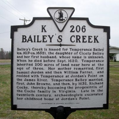
Photographed by Bernard Fisher, March 28, 2009
1. Bailey's Creek Marker
Erected 1999 by Department of Historic Resources. (Marker Number K-206.)
Topics and series. This historical marker is listed in these topic lists: Colonial Era • Settlements & Settlers • Waterways & Vessels • Women. In addition, it is included in the Virginia Department of Historic Resources (DHR) series list. A significant historical year for this entry is 1620.
Location. 37° 14.476′ N, 77° 14.844′ W. Marker is near Prince George, Virginia, in Prince George County. It is at the intersection of
this page online

Regionally, this marker is in Coastal Virginia. It is also in the American South, specifically in the Upper South, in the Tidewater, and on the Eastern Seaboard. Globally, it is in the North Atlantic Region, North America, the Western Hemisphere, the Western World, and the Anglosphere. Historically, it finds itself in what was once the territory of the Mississippian Culture, one of the original Thirteen Colonies, one of the Confederate States of America, and the Antebellum South.
Other nearby markers. At least 8 other markers are within 3 miles of this marker, measured as the crow flies: Jordan's Point (here, next to this marker); The Beefsteak Raid (here, next to this marker); World War II Memorial (approx. 2½ miles away); Prince George Court House (approx. 2.6 miles away); a different marker also named Prince George Court House (approx. 2.6 miles away); The Clerk's Office (approx. 2.6 miles away); In Memoriam (approx.
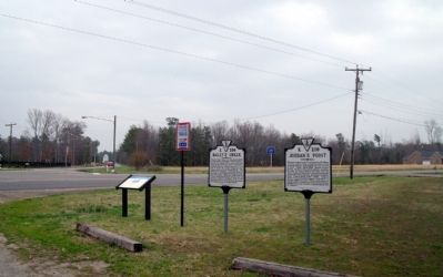
Photographed by Bernard Fisher, March 28, 2009
2. Ruffin Road & Old Stage Road, Prince George County, Va.
Credits. This page was last revised on February 3, 2020. It was originally submitted on April 7, 2009, by Bernard Fisher of Richmond, Virginia. This page has been viewed 3,267 times since then and 260 times this year. Photos: 1, 2. submitted on April 7, 2009, by Bernard Fisher of Richmond, Virginia.
