LeBreton Flats in Ottawa, Ontario — Central Canada (North America)
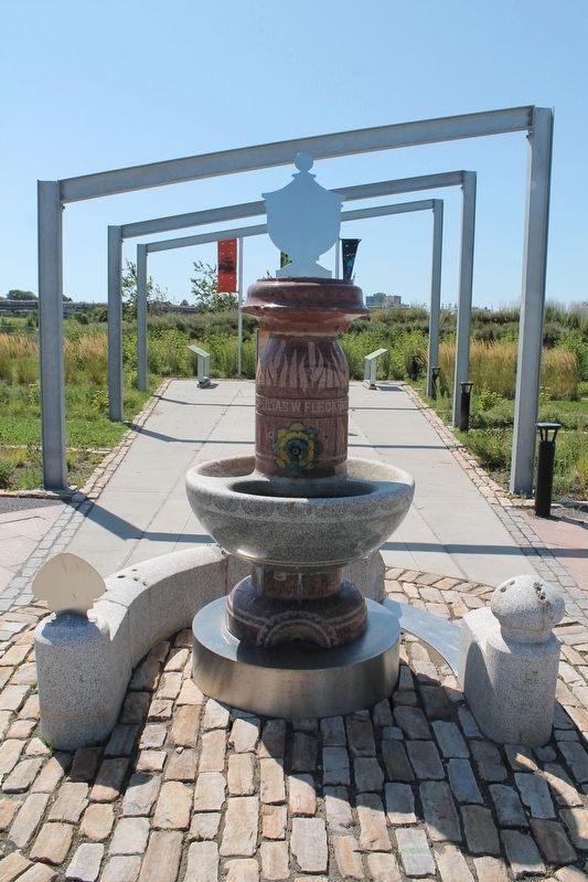
The Fleck Fountain
⎯⎯⎯
La Fontaine Fleck
A Byway to the Past

Photographed by Robert Rusaw, August 20, 2019
1. The Fleck Fountain Marker

In 1894, it became a centrepiece for a small park built in the east end of the Flats. The park was a beautification project financed in part by Mrs. Fleck's son-in-law, Thomas Ahearn. How the fountain came to be buried in a different part of the Flats remains unknown.
This drinking fountain is a relic from a time when LeBreton Flats was a busy working-class neighbourhood in a young capital city. Living conditions - both in the Flats and in Ottawa itself - would improve greatly over the next few decades thanks to innovations linked to this community.
En
this page online
Cette fontaine est une relique d'une époque où les plaines LeBreton étaient un quartier ouvrier animé au sein d'une jeune capitale. Les conditions de vie, dans les plaines et à Ottawa, s'améliorent considérablement au cours des décennies grâce aux innovations liées à cette communauté.
Topics. This historical marker is listed in these topic lists: Man-Made Features • Parks & Recreational Areas. A significant historical year for this entry is 2013.
Location. 45° 24.962′ N, 75° 42.887′ W. Marker is in Ottawa, Ontario. It is in LeBreton Flats. It is at the intersection of Sir John A. MacDonald Parkway and Booth Street on Sir John A. MacDonald Parkway. Touch for map. Marker is in this post office area: Ottawa ON K1R, Canada. Touch for directions.

Regionally, this marker is in Eastern Ontario. It is also in Central Canada. Globally, it is
Photographed by Robert Rusaw, August 20, 2019
2. The Fleck Fountain Marker
Other nearby markers. At least 8 other markers are within walking distance of this marker: The Capital's Forest Heritage / Le patrimoine forestier de la capitale (approx. half a kilometer away); Christ Church Cathedral / La cathédrale Christ Church (approx. 0.6 kilometers away); Royal Canadian Naval Monument / Monument De La Marine Royale Canadienne (approx. 0.6 kilometers away); L’aménagement de la région de la capitale / Building a Capital Region (approx. 0.8 kilometers away in Québec); Veterans Charter / La Charte des Anciens Combattants (approx. 0.8 kilometers away); Canada's Discovery Route / La voie de la découverte du Canada (approx. 0.9 kilometers away in Québec); Le Boulevard de la Confédération / Confederation Boulevard (approx. 0.9 kilometers away in Québec); La Place du Portage / Place du Portage (approx. 0.9 kilometers away in Québec). Touch for a list and map of all markers in Ottawa.
Credits. This page was last revised on January 24, 2022. It was originally submitted on August 1, 2021, by Robert Rusaw of Massena, New York. This page has been viewed 544 times since then and 27 times this year. Photos: 1, 2. submitted on August 1, 2021, by Robert Rusaw of Massena, New York. • Andrew Ruppenstein was the editor who published this page.
