Point Pleasant in Mason County, West Virginia — The American South (Appalachia)
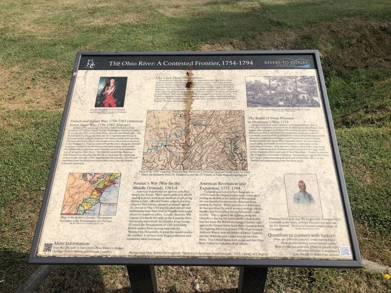
The Ohio River: A Contested Frontier, 1754-1794
Rivers to Ridges Heritage Trail

Photographed By Devry Becker Jones (CC0), July 31, 2021
1. The Ohio River: A Contested Frontier, 1754-1794 Marker
One Land, Many Competitors:
Bountiful and beautiful described the land around the Ohio River. Many American Indian tribes lived here and desired to protect their ways of using the land. While relying on the hunting prowess of Indians to create a lucrative international animal skin economy, the French and British claimed the land as their own. The land was difficult to possess to the exclusion of others. Indian tribes each had different allegiances and different views on the limits of European encroachment. With few settlers, the French struggled to populate an army. the British struggled to finance an ever growing army as settlers demand military protection while moving further and further west. Yet within 50 years, a conflict already 150 years old would end.
French and Indian War, 1754-1763 (America)
Seven Years War, 1756-1763 (Europe)
In May 1754, encouraged by Ohio Valley Indians and the governor of Virginia, Major George Washington marched soldiers to occupy the forks of the Ohio River (present day Pittsburgh). The French built Ft. Duquesne first, but the Virginians and Iroquois defeated French soldiers at Jumonville Glen; a battle with less than 100 men which launched a war fought across the world as far away as the Philippines. Virginia soldiers built 40+ forts along the frontier to protect settlers from the French and their Indian allies while, to protect settlers from the French and their Indian allies while the British allied Cherokee and Catawba carried on an offensive war all along the Ohio River. The British enticed the Shawnee and Delaware to abandon the French in exchange for restricting settlers to the east side of the Appalachian Mountains. The French capitulated and the British occupied their forts, but the frontier remained contested.
The Battle of Point Pleasant in Dunmore's War, 1774
Illegal settlement and retaliatory raids escalated into war in 1774, after Virginians murdered the family of peaceful Mingo Chief Logan, who avenged his family with a series of raids. Virginia's Royal Governor Lord Dunmore raised two armies to respond. Cornstalk, now the Principal Shawnee Chief along with about 1200 Shawnees, Delawares, Mingoes, and Ottawas attacked General Andrew Lewis and about 800 Virginians before the two armies could unite. Cornstalk moved to surprise Lewis early on the morning of October 10th, but two soldier warned the main body. Lewis counterattacked and heavy losses ensued in the fight north of the Kanawha River and east of the Ohio River. Unable to destroy the Virginians, Cornstalk withdrew. Eventually he signed the Treaty of Camp Charlotte ceding all land east of the Ohio River to the British and maintaining peace

Photographed By Devry Becker Jones (CC0), July 31, 2021
2. The Ohio River: A Contested Frontier, 1754-1794 Marker
Pontiac's War (War for the Middle Ground), 1763-4
American Indians did not agree to cede their land to the British. More significantly, new British trading policies, such as the abolition of gift giving during a trade, offended Indian cultural practices. Ottawa Chief Pontiac initiated an assault against Ft. Detroit in May 1763 and his ideas spread until settlements from New York to Virginia were under attack by numerous tribes. Locally, Shawnee War Captain Cornstalk led raids up the Kanawha River and nearby watersheds. In October, King George III issued the Proclamation of 1763 forbidding British settlers from moving west passed the Appalachian Mountains, hoping this would resolve the conflict. It did not both illegal settlement and retaliatory raids continued.
American Revolution and Expansion, 1777-1794
Cornstalk journeyed to Fort Randolph in 1777 to warn the Virginians that some tribes were joining the British in the American Revolution. He was detained to prevent the Shawnee from joining the British. While protected as a detainee, he was murdered by newly arrived soldiers, whose families had been killed during Cornstalk's raids in 1763. This re-ignited the fighting along the Ohio River during the American Revolution and beyond when the British encouraged Indian raids against the United States from their Canadian forts. The fighting did not end until 1794 when General Anthony Wayne won the battle of Fallen Timbers and the Shawnee ceded land west of the Ohio River. The United States now possessed the Ohio River Valley to exclusion of all others.
Erected by Rivers to Ridges Heritage Trail.
Topics. This historical marker is listed in these topic lists: Native Americans • War, French and Indian • War, US Revolutionary • Wars, US Indian. A significant historical month for this entry is May 1754.
Location. 38° 50.236′ N, 82° 7.35′ W. Marker is in Point Pleasant, West Virginia, in Mason County. Marker is on Lighthouse Lane just west of Krodel Park Road, on the right when traveling west. Touch for map. Marker is at or near this postal address: 419 Krodel Park Rd, Point Pleasant WV 25550, United States of America. Touch for directions.
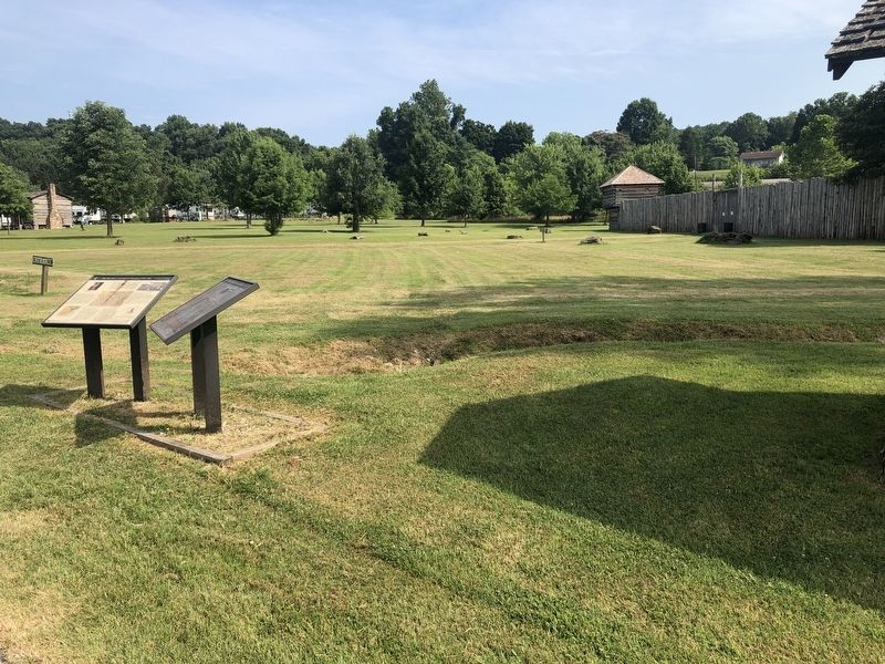
Other nearby markers. At least 8 other markers are within walking distance of this marker. Fort Randolph: Safety and Control (here, next to this marker); Andrew & Charles Lewis March (about 700 feet away, measured in a direct line); Boone’s Trading Post (approx. 0.4 miles away); Point Pleasant - Henderson Bridge (approx. 0.9 miles away); Korean and Vietnam Wars Memorial (approx. 0.9 miles away); 502 Viand Street (approx. 0.9 miles away); Gold Star Mothers (approx. 0.9 miles away); Historic Point Pleasant (approx. 0.9 miles away). Touch for a list and map of all markers in Point Pleasant.
Credits. This page was last revised on August 3, 2021. It was originally submitted on August 3, 2021, by Devry Becker Jones of Washington, District of Columbia. This page has been viewed 401 times since then and 83 times this year. Photos: 1, 2. submitted on August 3, 2021, by Devry Becker Jones of Washington, District of Columbia.