Mukilteo in Snohomish County, Washington — The American West (Northwest)
Native Americans
Mulkilteo Walking Tour Stop 2
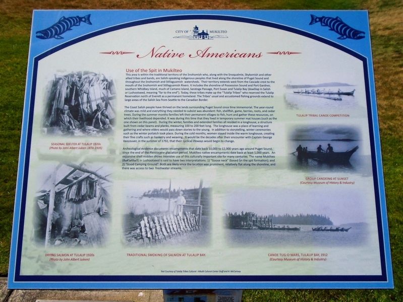
Use of the Spit in Mukilteo
This area is within the traditional territory of the Snohomish who, along with the Snoqualmie, Skykomish and other allied tribes and bands, are Salish-speaking indigenous peoples that lived along the shoreline of Puget Sound and throughout the Snohomish and Stillaguamish watersheds. Their territory extends west from the Cascade crest to the mouth of the Snohomish and Stillaguamish Rivers. It includes the shoreline of Possession Sound and Port Gardner, southern Whidbey Island, much of Camano Island, Saratoga Passage, Port Susan and Tulalip Bay (dxwlilap in Salish or Lushootseed, meaning "far to the end"). Today, these tribes make up the "Tulalip Tribes" who reserved the Tulalip Reservation north of Everett as a permanent homeland. The Tribes' usual and accustomed fishing grounds extend to large areas of the Salish Sea from Seattle to the Canadian Border.
The Coast Salish people have thrived on the lands surrounding Puget Sound since time immemorial. The year-round climate was mild and everything they needed to subsist was abundant: fish, shellfish, game, berries, roots, and cedar trees. During the summer months families left their permanent villages to fish, hunt and gather these resources, on which their livelihood depended. It was during this time that they lived in temporary summer mat houses (such as the one shown on this panel). During the winter, families and extended families all resided in a longhouse, a structure built from cedar beams and planks, measuring 100 to 200 feet long. The longhouse was a place of learning and gathering and where elders would pass down stories to the young. In addition to storytelling, winter ceremonies such as the winter potlatch took place. During the cold months, women stayed inside the warm longhouse, creating their fine crafts such as basketry and weaving. It would be the decades after their encounter with Captain George Vancouver, in the summer of 1792, that their cyclical lifeways would begin to change.
Archeological evidence documents encampments that date back 10,000 to 12,000 years ago around Puget Sound, since the end of the Pleistocene glaciation period. Mukilteo native encampments date back at least 1,000 years. An expansive shell midden shows intensive use of this culturally important site for many centuries. The name Mukilteo (Bək'wəttiwʔ) in Lushootseed is said to have two interpretations: 1) "Goose neck" (based on the spit formation); and 2) "Good Camping Ground". Both are likely since the location was prominent, relatively flat along the shoreline, and there was access to two freshwater streams.
[Photo captions, counterclockwise from top
left, read]
• SEASONAL SHELTER AT TULALIP 1920s
• DRYING SALMON AT TULALIP 1920s
• TRADITIONAL SMOKING OF SALMON AT TULALIP BAY.
• CANOE TUG-O-WARS, TULALIP BAY, 1912
• GROUP CANOEING AT SUNSET
• TULALIP TRIBAL CANOE COMPETITION
Erected by City of Mukilteo.
Topics. This historical marker is listed in these topic lists: Environment • Native Americans • Waterways & Vessels. A significant historical year for this entry is 1792.
Location. 47° 56.897′ N, 122° 18.341′ W. Marker is in Mukilteo, Washington, in Snohomish County. Marker is on Front Street, on the left when traveling west toward the traffic circle. Marker is at Mukilteo Lighthouse Park, southeast of the lighthouse. Touch for map. Marker is at or near this postal address: 609 Front Street, Mukilteo WA 98275, United States of America. Touch for directions.
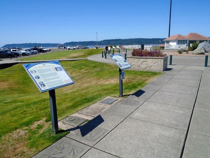
Other nearby markers. At least 8 other markers are within walking distance of this marker. Commemorating Signing Point Elliott Treaty (here, next to this marker); Point Elliott Treaty (here, next to this marker); Tradition of Carving (a few steps from this marker); Light Station and Park (a few steps from this marker); Early Explorers (within shouting distance of this marker); Geology of Mukilteo (within shouting distance of this marker); The Keeper's House (within shouting distance of this marker); Mukilteo Light Station (within shouting distance of this marker). Touch for a list and map of all markers in Mukilteo.
Also see . . .
1. Lushootseed: The Language of Puget Sound. (Submitted on August 5, 2021, by William Fischer, Jr. of Scranton, Pennsylvania.)
2. The Tulalip Tribes. (Submitted on August 5, 2021, by William Fischer, Jr. of Scranton, Pennsylvania.)
Credits. This page was last revised on August 5, 2021. It was originally submitted on August 5, 2021, by William Fischer, Jr. of Scranton, Pennsylvania. This page has been viewed 376 times since then and 51 times this year. Photos: 1, 2. submitted on August 5, 2021, by William Fischer, Jr. of Scranton, Pennsylvania.

