Genoa in Nance County, Nebraska — The American Midwest (Upper Plains)
Pawnee
Photographed by Cosmos Mariner, August 10, 2021
1. Pawnee Marker
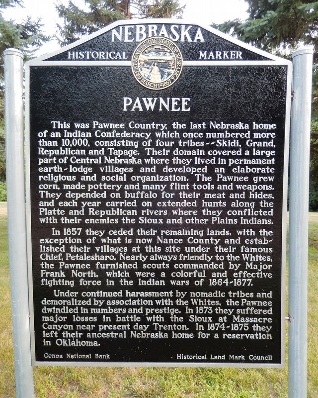
In 1857 they ceded their remaining lands, with the exception of what is now Nance County and established their villages at this site under their famous Chief, Petalesharo. Nearly always friendly to the Whites, the Pawnee furnished scouts commanded by Major Frank North, which were a colorful and effective fighting force in the Indian wars of 1864-1877.
Under continued harassment by nomadic tribes and demoralized by association with the Whites, the Pawnee dwindled in numbers and prestige. In 1873 they suffered major
this page online
Erected by Genoa National Bank; and Historical Land Mark Council. (Marker Number 18.)
Topics and series. This historical marker is listed in these topic lists: Agriculture • Animals • Indigenous Peoples and Communities • Wars, US Indian. In addition, it is included in the Nebraska State Historical Society series list. A significant historical year for this entry is 1857.
Location. 41° 26.552′ N, 97° 44.129′ W. Marker is in Genoa, Nebraska, in Nance County. It can be reached from South Park Street (State Highway 39) just south of Ewing Avenue, on the right when traveling south. Marker is located along on the south side of the park road, just inside the Genoa City Park south entrance. Touch for map. Marker is in this post office area: Genoa NE 68640, United States of America. Touch for directions.

Regionally, this marker is in Eastern Nebraska. It is also in the American Midwest, in the Corn Belt, and on the prairies. Globally, it is in North America, the
Photographed by Cosmos Mariner, August 10, 2021
2. Pawnee Marker
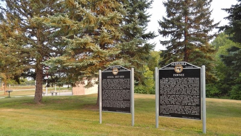
Other nearby markers. At least 6 other markers are within 11 miles of this marker, measured as the crow flies: Genoa: 1857-1859 (here, next to this marker); U. S. Indian Industrial School Building (approx. ¾ mile away); West Hill Community (approx. 7.8 miles away); Gardiner School (approx. 10.3 miles away); The Lincoln Highway - Gardiner Station Section (approx. 10.3 miles away); St. Edward (approx. 11.1 miles away).
Also see . . .
1. Pawnee Nation History. Early in the 18th century, more than 60,000 members of the Pawnee Tribe inhabited the area along the North Platt River in Nebraska. After encroachment by white settlers, the Pawnees ceded their territory to the U.S. Government in the 1800s and were removed from Nebraska to what is now Pawnee County, Oklahoma, in 1875. (Submitted on August 13, 2021, by Cosmos Mariner of Cape Canaveral, Florida.)
2. Pawnee. In the early fall of 1831 the tribe was decimated by an outbreak of smallpox. In spite of their tragic circumstances they continued to defend their land, but it was a hopeless effort. In 1854 they were placed on a reservation in what is now Nance County, Nebraska, where they lived for approximately twenty years before being moved to another reservation in Oklahoma. (Submitted on August 13, 2021, by Cosmos Mariner of Cape Canaveral, Florida.)
Credits. This page was last revised on August 13, 2021. It was originally submitted on August 13, 2021, by Cosmos Mariner of Cape Canaveral, Florida. This page has been viewed 647 times since then and 56 times this year. Photos: 1, 2. submitted on August 13, 2021, by Cosmos Mariner of Cape Canaveral, Florida.
