Castile in Wyoming County, New York — The American Northeast (Mid-Atlantic)
Gardeau Overlook
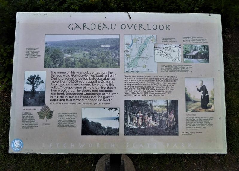
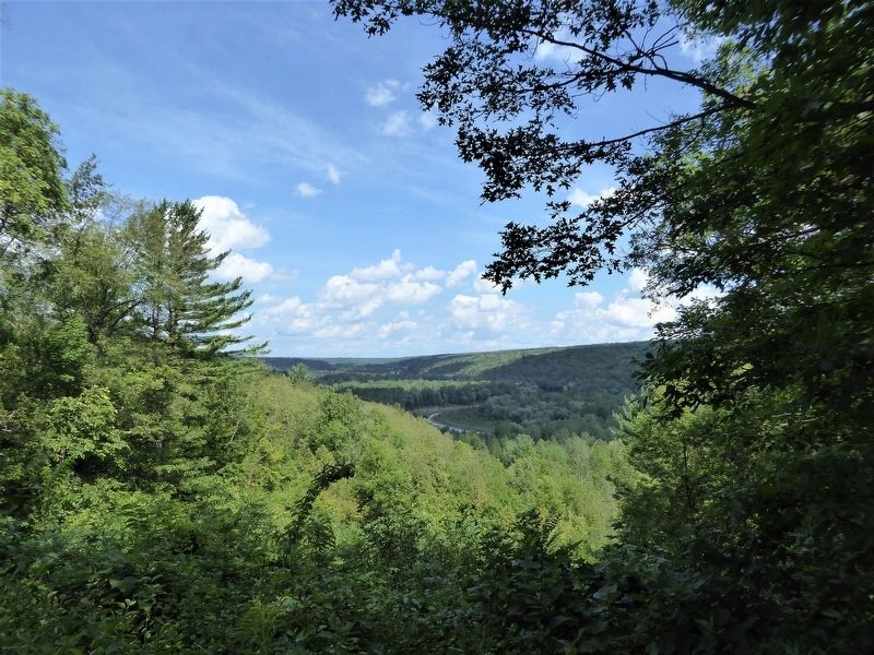
,br> The flat bottomland you see below was used by Native Americans thousands of year before the Seneca. Here, Mary Jemison, White Woman of the Genesee, lived for more than 50 years. Mary, a teenager when captured during the French and Indian War, was adopted by a Seneca family. During the Revolutionary War, she brought her family to this valley to escape the raids carried out during the Sullivan Campaign. At the Treaty of Big Tree in 1797, Mary was given 17,927 acres known as the Gardeau Reservation.
,br> (photo caption) More than 20 feet of silt cover the fields along the river today, supporting a thick growth of willows, cottonwoods. and sycamores.
,br> (photo caption) 1798 map showing the heart of the Gardeau Reservation.
,br> (photo caption) The cabin of Nancy Jemison, Mary's daughter, was salvaged by Mr. Letchworth and moved to the Council Grounds above the Glen Iris.
,br> (photo caption) Mary remained at the Gardeau Reservation until 1831. Saddened by the loss of her sons, who were killed in drunken brawls, she moved to the Buffalo Creek Reservation where she remained until her death in 1833.
,br> (photo caption) The Big Sycamore - In 2002, the park's largest free measured 18 feet 7 inches in circumference, 122 feet in height, and 69 feet in spread. It is likely that this tree never existed in Mary Jemison's time.
,br> (photo caption) Sycamore
,br> (photo caption) The Gardeau Valley, once home to many farming families, was acquired as park land where water could be stored behind the future dam at Mount Morris. When the dam is full, the valley fills with water above the treetops.
,br> (photo caption) Mary Jemison - This image of Mary Jemison by Carlos Stebbins was created after her death and is based on another person's memories. Mr. Stebbins, Wyoming County's pre-eminent portrait artist in the late 1800s, lived in Pike, New York Courtesy of the Wyoming County Pioneer Association.
,br> (photo caption) The Taking of Mary Jemison, by Robert Griffing.
Erected by Letchworth State Park.
Topics. This historical marker is listed in these topic lists: Agriculture
• Horticulture & Forestry • Native Americans • Parks & Recreational Areas.
Location. 42° 38.418′ N, 77° 59.001′ W. Marker is in Castile, New York, in Wyoming County. Marker is on Gardeau Rd. Gardeau Rd (about 1/3 mile long and ending at the overlook) intersects to the east of Park Rd, Letchworth State Park. Touch for map. Marker is in this post office area: Castile NY 14427, United States of America. Touch for directions.
Other nearby markers. At least 8 other markers are within 3 miles of this marker, measured as the crow flies. St. Helena (approx. 1˝ miles away); Site of St Helena Camp 76, SP 37 (approx. 1.6 miles away); CCC Camp 76, SP 37 at Work (approx. 1.7 miles away); Gardeau Tract (approx. 1.9 miles away); Wolf Creek (approx. 2.3 miles away); Site of Camp 23, Sp 5 - Letchworth State Park's first camp (approx. 2.8 miles away); Whaley Tavern (approx. 2.9 miles away); The Civilian Conservation Corps (approx. 2.9 miles away). Touch for a list and map of all markers in Castile.
Credits. This page was last revised on September 4, 2021. It was originally submitted on September 2, 2021, by Bruce Kelly of Perry, New York. This page has been viewed 352 times since then and 50 times this year. Photos: 1, 2, 3. submitted on September 2, 2021, by Bruce Kelly of Perry, New York. • Bill Pfingsten was the editor who published this page.


