Near Chivington in Kiowa County, Colorado — The American Mountains (Southwest)
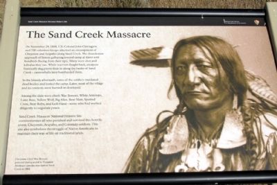
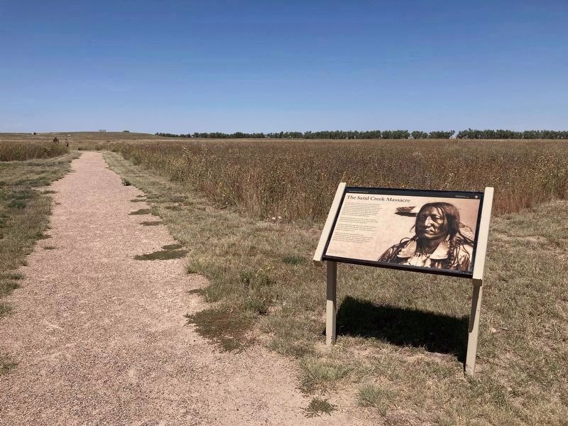
The Sand Creek Massacre
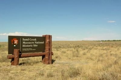
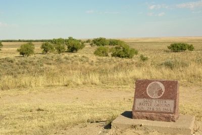
Sand Creek Massacre National Historic Site
Photographed by Duane Hall, October 8, 2010
1. The Sand Creek Massacre Marker
In the bloody aftermath, some of the soldiers mutilated dead bodies and looted the camp. Later, most of the village and its contents were burned or destroyed.
Among the slain were chiefs War Bonnet, White Antelope, Lone Bear, Yellow Wolf, Big Man, Bear Man, Spotted Crow, Bear Robe, and Left Hand - some who had worked diligently to negotiate peace.
Sand Creek Massacre National Historic Site commemorates all who perished and survived this horrific event, Cheyenne, Arapaho, and Colorado soldiers. This site also symbolizes the struggle of Native Americans to maintain their way of life on traditional lands.
(Photo Caption)
Cheyenne Chief War Bonnet, pictured during a visit to President Abraham Lincoln,
this page online
Erected by National Park Service, U.S. Department of the Interior.
Topics and series. This historical marker is listed in these topic lists: Indigenous Peoples and Communities • Wars, US Indian. In addition, it is included in the Former U.S. Presidents: #16 Abraham Lincoln series list. A significant historical month for this entry is November 1853.
Location. Marker has been permanently removed. It was located near 38° 32.691′ N, 102° 30.265′ W. Marker was near Chivington, Colorado, in Kiowa County. It could be reached from County Road W 1.3 miles east of County Road 54. Marker is located in Sand Creek Massacre National Historic Site; the above directions are to the intersection of County Road W and the driveway to the park visitor center. Touch for map. Marker was in this post office area: Eads CO 81036, United States of America.
We have been informed that this marker is no longer there and will not be replaced. This page is an archival view of what was.
Regionally, this marker was in the Eastern Plains. It was also in the American Mountain West, on the Southern Plains, and specifically on the High

Photographed by Connor Olson, August 30, 2021
2. The Sand Creek Massacre Marker
Other nearby markers. At least 8 other markers are within walking distance of this location: Conscience and Courage (a few steps from this marker); Welcome to the Sand Creek Massacre National Historic Site (a few steps from this marker); Why A 33 Star Flag (within shouting distance of this marker); Humans and the Prairie (within shouting distance of this marker); Sand Creek as Camp Site (approx. ¼ mile away); Fort Lyon Reservation (approx. ¼ mile away); Sacred Memory (approx. half a mile away); Cheyenne and Arapaho Village at Sand Creek (approx. half a mile away). Touch for a list and map of all markers in Chivington.
Other markers no longer nearby. The Attack (was approx. 0.3 miles away but has been permanently removed); Remains (was approx. half a mile away but has been permanently removed); Returned to Sand Creek (was approx. half a mile away but has been permanently removed); Healing (was approx. half
Photographed by Duane Hall, October 8, 2010
3. Entrance to Sand Creek Massacre NHS
More about this marker. Reported removed by Park Guide
The marker was at the Monument Hill trailhead
Also see . . .
1. Sand Creek Massacre National Historic Site. Official National Park Service website. (Submitted on March 24, 2014.)
2. Sand Creek Massacre - Wikipedia entry. (Submitted on March 24, 2014.)
Photographed by Duane Hall, October 8, 2010
4. Site of Sand Creek Massacre
Credits. This page was last revised on July 11, 2025. It was originally submitted on March 24, 2014, by Duane Hall of Abilene, Texas. This page has been viewed 2,164 times since then and 108 times this year. Last updated on September 3, 2021, by Connor Olson of Menomonee Falls, Wisconsin. Photos: 1. submitted on March 24, 2014, by Duane Hall of Abilene, Texas. 2. submitted on August 30, 2021, by Connor Olson of Menomonee Falls, Wisconsin. 3, 4. submitted on February 19, 2014, by Duane Hall of Abilene, Texas. • J. Makali Bruton was the editor who published this page.
