Near Chivington in Kiowa County, Colorado — The American Mountains (Southwest)
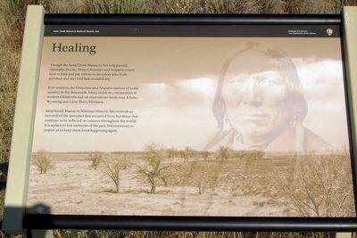
Healing
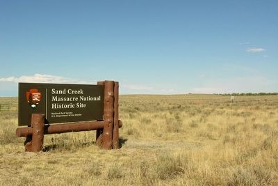
Sand Creek Massacre National Historic Site
Photographed by Duane Hall, October 8, 2010
1. Healing Marker
Ever resilient, the Cheyenne and Arapaho nations of today number in the thousands. Many reside in communities in western Oklahoma and on reservation lands near Ethete, Wyoming and Lame Deer, Montana.
Sand Creek Massacre National Historic Site reminds us not only of the atrocities that occurred here, but those that continue to be inflicted on cultures throughout the world. It is a place to rest torments of the past, but moreover, to inspire us to keep them from happening again.
Erected by National Park Service.
Topics. This historical marker is listed in these topic lists: Indigenous Peoples and Communities • Wars, US Indian.
Location. Marker has been reported permanently removed. It was located near 38° 32.98′ N, 102° 30.69′ W. Marker was near Chivington, Colorado, in Kiowa County. It could be reached from County Road W 1.3 miles east of County Road 54. Marker is located
this page online
We have been informed that this marker is no longer there and will not be replaced. This page is an archival view of what was.
Regionally, this marker was in the Eastern Plains. It was also in the American Mountain West, on the Southern Plains, and specifically on the High Plains. Globally, it was in North America, the Western Hemisphere, the Western World, and the Anglosphere. Historically, it found itself in what was once the Comanchería, the Dust Bowl, and the Republic of Texas.

Other nearby markers. At least 8 other markers are within walking distance of this location: Sacred Memory (here, next to this marker); A Chief’s Village (a few steps from this marker); Cheyenne and Arapaho Village at Sand Creek (within shouting distance of this marker); Dawn November 29, 1864 (about 400 feet away); Fort Lyon Reservation (approx. ¼ mile away); Sand Creek as Camp Site (approx. ¼ mile
Photographed by Duane Hall, October 8, 2010
2. Entrance to Sand Creek Massacre NHS
Other markers no longer nearby. Testimony (was here, next to this marker but has been permanently removed); Pleas for Peace (was within shouting distance of this marker but has been permanently removed); Why? (was within shouting distance of this marker but has been permanently removed); Returned to Sand Creek (was about 300 feet away, measured in a direct line but has been permanently removed); Remains (was about 300 feet away but has been permanently removed); The Attack (was approx. 0.2 miles away but has been permanently removed).
More about this marker. The marker is at the monument and overlook; it is a 0.6 mile walk from the visitor center parking lot to the marker.
Also see . . .
1. Sand Creek Massacre National Historic Site. Official National Park Service website. (Submitted on March 11, 2016.)
2. Sand Creek Massacre - Wikipedia entry. (Submitted on March 11, 2016.)
Photographed by Duane Hall, October 8, 2010
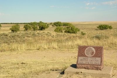
3. Site of Sand Creek Massacre
Photographed by Duane Hall, October 8, 2010
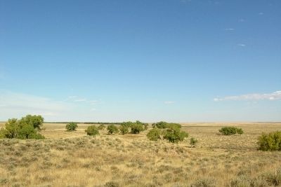
4. Site of Sand Creek Massacre
Credits. This page was last revised on July 5, 2025. It was originally submitted on March 11, 2016, by Duane Hall of Abilene, Texas. This page has been viewed 891 times since then and 39 times this year. Last updated on September 5, 2021, by Connor Olson of Menomonee Falls, Wisconsin. Photos: 1. submitted on March 11, 2016, by Duane Hall of Abilene, Texas. 2, 3. submitted on February 19, 2014, by Duane Hall of Abilene, Texas. 4. submitted on March 11, 2016, by Duane Hall of Abilene, Texas. • J. Makali Bruton was the editor who published this page.
