Near Eads in Kiowa County, Colorado — The American Mountains (Southwest)
Why?
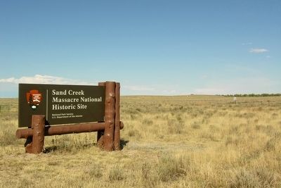
Sand Creek Massacre National Historic Site
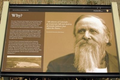
Skirmishes and raids erupted along overland routes, and at Indian camps and isolated ranches. When U.S. soldiers killed Cheyenne Chief Lean Bear, warriors clamored for revenge. The murder of rancher Nathan Hungate and his family sparked widespread fear and panic in Denver and throughout the Territory.
Governor Evans envisioned statehood for Colorado Territory and promised protection for its citizens. He directed friendly Arapaho and Cheyenne to go to the U.S. Indian Agent at Fort Lyon, "who will show them a place of safety." But for hostile Indians, he issued a call for all Colorado citizens to "pursue, kill, and destroy" them. Only then, he proclaimed, "can we secure a permanent and lasting peace."
"All citizens of Colorado...go in pursuit, kill and destroy all hostile Indians that infest the Plains..."
Territorial Governor John Evans
Erected by National Park Service.
Topics. This historical marker is listed in these topic lists: Native Americans • Wars, US Indian. A significant historical year for this entry is 1858.
Location. Marker has been reported permanently removed. It was located near 38° 32.962′ N, 102° 30.709′ W. Marker was near Eads, Colorado, in Kiowa County. Marker was on County Road W, 1.3 miles east of County Road 54. Marker is located in Sand Creek Massacre National Historic Site; the above directions are to the intersection of County Road W and the driveway to the park visitor center. Touch for map. Marker was in this post office area: Eads CO 81036, United States of America.
We have been informed that this sign or monument is no longer there and will not be replaced. This page is an archival view of what was.
Other nearby markers. At least 8 other markers are within walking distance of this location. Cheyenne and Arapaho Village at Sand Creek (here, next to this marker); A Chief’s Village (a few steps from this marker); Returned to Sand Creek (within shouting distance of this marker); Sacred Memory (within shouting distance of this marker); Dawn November 29, 1864 (about 300 feet away, measured in a direct line); Fort Lyon Reservation
(approx. ¼ mile away); Sand Creek as Camp Site (approx. ¼ mile away); Troops Approach the Village (approx. 0.4 miles away).
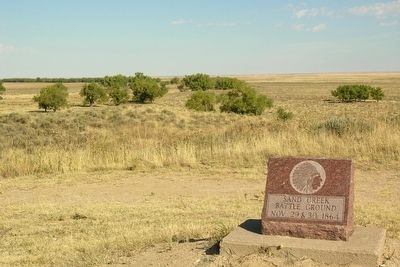
More about this marker. The marker is along the trail to the monument and overlook; it is a 0.5 mile walk from the visitor center parking lot to the marker.
Marker includes a photo of the Indian encampment at Fort Lyon and a photo of Territorial Governor John Evans.
Also see . . .
1. Sand Creek Massacre National Historic Site. Official National Park Service website. (Submitted on March 11, 2016.)
2. Sand Creek Massacre - Wikipedia entry. (Submitted on March 11, 2016.)
Credits. This page was last revised on September 10, 2021. It was originally submitted on March 11, 2016, by Duane Hall of Abilene, Texas. This page has been viewed 679 times since then and 18 times this year. Last updated on September 7, 2021, by Connor Olson of Kewaskum, Wisconsin. Photos: 1. submitted on March 11, 2016, by Duane Hall of Abilene, Texas. 2, 3. submitted on February 19, 2014, by Duane Hall of Abilene, Texas. • J. Makali Bruton was the editor who published this page.


