Fremont in Sandusky County, Ohio — The American Midwest (Great Lakes)
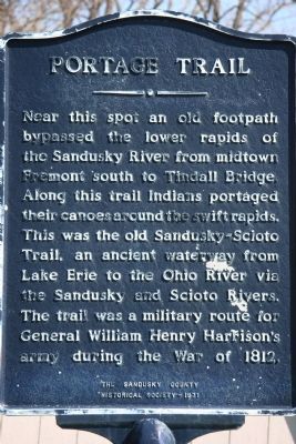
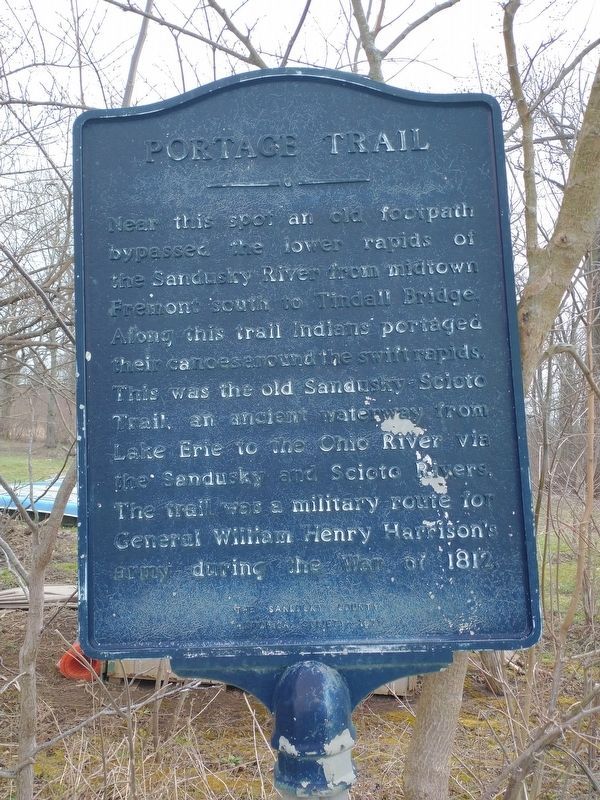
Portage Trail
Photographed by Dale K. Benington, April 8, 2009
1. Portage Trail Marker
Erected 1971 by the Sandusky County Historical Society.
Topics and series. This historical marker is listed in these topic lists: Indigenous Peoples and Communities • Roads & Vehicles • War of 1812 • Waterways & Vessels. In addition, it is included in the Former U.S. Presidents: #09 William Henry Harrison series list. A significant historical year for this entry is 1812.
Location. 41° 19.287′ N, 83° 9.243′ W. Marker is in Fremont, Ohio, in Sandusky County. It is on South River Road, on the right when traveling north. Touch for map. Marker is at or near this postal address: 2139 S River Rd, Fremont OH 43420, United States of America. Touch for directions.

Regionally, this marker is on the Lake Erie Shore and in the Toledo Metropolitan Area. It is also in the American Midwest and in the Corn Belt. Globally, it is in North America, on the Great Lakes, in the Western Hemisphere, in the Western World, and in the Anglosphere. Historically, it finds itself in what was once the Viceroyalty of New France, the Haudenosaunee (Iroquois) Confederacy, the territory of the Mississippian Culture, and the Northwest Territory.
Other nearby markers. At least 8 other markers are within 2 miles of this marker, measured as the crow flies: Ball’s Battlefield (approx. 0.7 miles away); Sisters of Mercy (approx. 1.4 miles away); Harold R. Balsizer (approx. 1.6 miles away); Robert R. Benner
this page online
Another marker is no longer nearby. Sandusky-Scioto Trail (was approx. 1½ miles away but has been confirmed missing).
More about this marker. This marker is located just south of present day Fremont (and of what was once the site of Fort Stephenson), near the west bank of the historic Sandusky River.
Related markers. Click here for a list of markers that are related to this marker.
Also see . . . Marker went missing years ago and recently found. Marker found after going missing and has now been refurbished and installed at close-by, but different, GPS coordinates at the Ghoul Runnings Kayak Adventures rental service. (Submitted on May 12, 2024, by Mark Hilton of Montgomery, Alabama.)
Photographed by Craig Doda, April 2, 2022
2. Portage Trail Marker
Photographed by Dale K. Benington, April 8, 2009
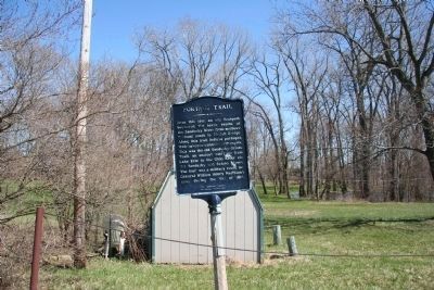
3. Portage Trail Marker
View of the "Portage Trail" marker in the foreground with the Sandusky River being just beyond the treeline in the background.
Photographed by Dale K. Benington, April 8, 2009
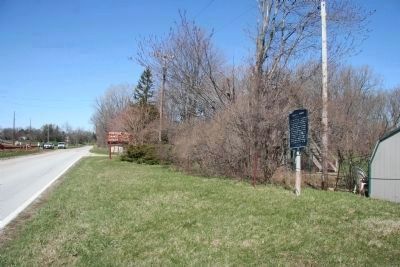
4. Portage Trail Marker
View of the "Portage Trail" marker and the adjacent roadway, which was once part of the Sandusky-Scioto Trail (and the Harrison Military Trail).
Credits. This page was last revised on May 12, 2024. It was originally submitted on April 22, 2009, by Dale K. Benington of Toledo, Ohio. This page has been viewed 2,097 times since then and 59 times this year. Photos: 1. submitted on April 22, 2009, by Dale K. Benington of Toledo, Ohio. 2. submitted on April 8, 2022, by Craig Doda of Napoleon, Ohio. 3, 4. submitted on April 22, 2009, by Dale K. Benington of Toledo, Ohio. • Christopher Busta-Peck was the editor who published this page.
Editor’s want-list for this marker. Photo of refurbished marker and update of new location. • Can you help?
