Near Chivington in Kiowa County, Colorado — The American Mountains (Southwest)
Attack and Pursuit
Sand Creek Massacre National Historic Site
Photographed by Connor Olson, August 30, 2021
1. Attack and Pursuit Marker
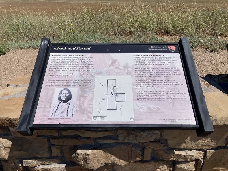
As the soldiers' gunfire increased, and artillery began firing deadly salvos toward the village, Black Kettle remained in camp. In a final show of desperate hope, the chief hoisted an American and a white flag above his lodge. As women and children gathered near Black Kettle, any attempt to avoid disaster disappeared his people scattered, leaving his camp vacant. His duties as a chief fulfilled, Black Kettle and his wife fled on foot.
"I looked toward Black Kettle's lodge and he had (US) flag on lodge pole in front of his lodge...”
George Bent (From Bent Letters, Yale University)
“When the troops began approaching, I saw Black Kettle...hoist the American flag over his lodge, as well as a white flag, fearing there might be some mistake as to who they were.
John Smith, US Interpreter (Deposition given January 27, 1865, Fort Lyon, Colorado Territory)
A Path of Death and Destruction
Most of the encampments were abandoned by the time the soldiers entered them. “The Indians attempted to escape,...and our artillery opened on them while they were running.” Major
this page online
As Chivington's men advanced, a desperate pursuit up the valley unfolded, with some Cheyenne and Arapaho seeking refuge in sand pits along the banks of Sand Creek. Soldiers crisscrossed the dry stream and fanned out across the prairie in pursuit of them.
A “killing field” formed north of the village as defenseless women and children were slaughtered. Pockets of warriors attempted to cover their retreat, but couldn't halt the soldiers' advance.
“There were still people there suffering in agony from the soldiers, from their bullets,... The Tipis were burned. Kids all were laying scattered, butchered, scalped...”
Mr. Donlin Many Bad Horses relating the story his Cheyenne Grandmother told about her great grandmother, who survived the Sand Creek Massacre (Sand Creek Massacre Project, Site Location Study, Vol. I)
Erected by National Park Service.
Topics. This memorial is listed in these topic lists: Indigenous Peoples and Communities • Wars, US Indian. A significant historical date for this entry is November 29, 1864.
Location. 38° 33.196′ N, 102° 30.974′ W.
Photographed by Connor Olson, August 30, 2021
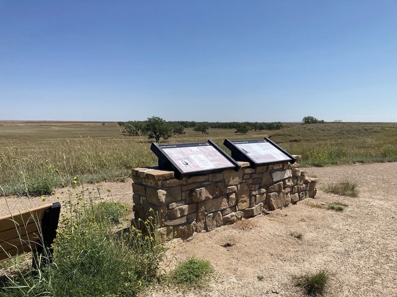
2. Attack and Pursuit Marker

Regionally, this memorial is in the Eastern Plains. It is also in the American Mountain West, on the Southern Plains, and specifically on the High Plains. Globally, it is in North America, the Western Hemisphere, the Western World, and the Anglosphere. Historically, it finds itself in what was once the Comanchería, the Dust Bowl, and the Republic of Texas.
Other nearby markers. At least 8 other markers are within walking distance of this marker: Troops Approach the Village (here, next to this marker); Conflict Within and Without (approx. 0.3 miles away); The Big Head Fight (approx. 0.3 miles away); Dawn November 29, 1864 (approx. 0.3 miles away); A Chief’s Village (approx. 0.4 miles away); Sacred Memory (approx. 0.4 miles away); Cheyenne and Arapaho Village at Sand Creek (approx. 0.4 miles away); Chaos, Disorder, and Disgust (approx. 0.6 miles away). Touch for a list and map of all markers in Chivington.
Other markers no longer nearby. Testimony (was approx. 0.4 miles away but has been permanently removed); Healing (was approx. 0.4 miles away but has been permanently removed); Pleas for Peace (was approx. 0.4 miles away but has been permanently removed); Why? (was approx. 0.4 miles away but has been permanently removed); Returned to Sand Creek (was approx. 0.4 miles away but has been permanently removed); Remains (was approx. 0.4 miles away but has been permanently removed); The Attack (was approx. 0.6 miles away but has been permanently removed).
Credits. This page was last revised on July 5, 2025. It was originally submitted on September 21, 2021, by Connor Olson of Menomonee Falls, Wisconsin. This page has been viewed 360 times since then and 56 times this year. Photos: 1, 2. submitted on September 21, 2021, by Connor Olson of Menomonee Falls, Wisconsin. • Andrew Ruppenstein was the editor who published this page.
