Taylor Ranch in Albuquerque in Bernalillo County, New Mexico — The American Mountains (Southwest)
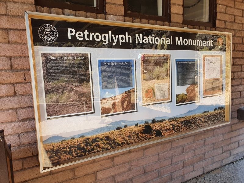
Petroglyph National Monument
Inscription.
Petroglyph National Monument
What type of rock is this?
The rock that makes up the West Mesa escarpment is vesicular basalt. The basalt flow originated from fissures marked by five volcanic spatter cones that be seen along the western horizon of Albuquerque. Located within the monument boundary, these cones are considered part of a sacred landscape by many of the Pueblo people today. The last volcanic eruption occurred approximately 150,000 years ago. Although the area is still geologically active, geologists consider these spatter cones to be dormant.
The basalt that makes up the boulders on which the petroglyphs are carved was originally a light gray color. Over time the surface of the rock was coated by a thin black or dark brown layer of oxidation scientists call desert varnish. When the surface of the boulder is pecked or abraded, the lighter gray rock underneath is exposed, making two-tone petroglyph images possible.
What are Petroglyphs?
Petroglyphs are images carved, pecked or incised directly into rock surfaces using a stone chisel and hammerstone. Petroglyphs differ from pictographs, which are paintings on rock. When the “desert varnish” on the surface of the rock was was pecked or scratched off, the lighter rock underneath was exposed, creating a two-tone petroglyph. Archeological surveys have found over 21,000 petroglyph images along the 17 miles of escarpment within the monument’s boundary.
It is estimated that 90% of the monument’s petroglyphs were created by the ancestors of today’s Pueblo people. The Rio Grande valley has been home to many of the Pueblo people since before 500 A.D., but a drought in the late 13th century caused many new settlements along the Rio Grande. It is believed that the majority of the petroglyphs were carved between 1300 and 1700 A.D. A small percentage of the petroglyphs found within the monument pre-date the Puebloan time period, perhaps reaching as far back as 3,000 years ago. Other images date from historic periods, starting in the 1700’s with petroglyphs carved by early Spanish settlers.
Pueblo: People or Place?
Perhaps no other word in the Southwest carries so much weight and meaning, used to describe buildings, people, language, culture and time. But the literal translation of “pueblo” from the Spanish language is far more simple, it means village or city.
When Spanish explorers traveled up the Rio Grande in 1540 A.D., they met Native Americans who were not nomadic, but were farmers who lived in independent communities, each with their own tribal elders, culture and language. The Spanish named these people and the above ground dwellings the people lived in Pueblos. Today there are 19 remaining
Pueblos in New Mexico.
Often times terms like Pueblo people, Puebloan and Pueblos refer to the 19 remaining groups as a whole. It is important to remember that each one of these groups is separate, with its own culture and traditions. The term pueblo can also refer to the historic physical structures that these people live in, or can refer to their government or the land set aside as an independent nation.
Why not Anasazi?
The term Anasazi has been in standard use by both scholars and the public for many years. Anasazi is a term derived from two Navajo words meaning “enemy ancestor” or “ancient enemy.” To many modern Pueblo tribes the word is culturally insensitive and inappropriate to use when referring to their ancestors. Today the Pueblo people prefer the term Ancestral Puebloan when referring to their ancestors.
Why were Petroglyphs made?
There were many reasons for creating the petroglyphs, many of which are not well understood by persons outside of Native American culture. Petroglyphs are more than just “rock art,” picture writing, or an imitation of the natural world. They should not be confused with hieroglyphics, which are symbols used to represent words, and should not be thought of as ancient Indian graffiti. Petroglyphs are powerful cultural symbols that reflect the complex societies and religions of the surrounding tribes.
Petroglyphs are central to the monument’s sacred landscape where traditional ceremonies still take place. The context of each image is extremely important and integral to its meaning. Note each petroglyph’s orientation to the horizon and surrounding images, as well as the landscape in which it sits. Today’s Pueblo people have stated the placement of each petroglyph image was not a casual or random decision.
Some petroglyphs have meanings that are known onl to the individuals who made them. Others represent tribal, clan, kiva or societal symbols. Some are religious entities and others show who came to the area and where they went. Some petroglyphs still have contemporary meaning while the meaning of others is no longer known, but are respected for belonging to those who came before.
Map of the Petroglyph National Monument panel
Rinconada Canyon
Located at the intersection of Unser Blvd. and St. Joseph Ave., this 2.5 mile undeveloped round-trip dirt path allows the viewing of hundreds of different petroglyphs along the south facing canyon wall. Pets on-leash are allowed.
Piedras Marcadas Canyon
Located at the intersection of Golf Course Road and Paradise Boulevard, this undeveloped 1.5 mile round-trip dirt path allows the viewing of numerous petroglyph concentrations. Pets on-leash are allowed.
Volcanoes Day Use Area
While there are no petroglyphs located at the Volcanoes, this unpaved trail system provides several miles of panoramic scenery. Pets on-leash are allowed.
Erected by City of Albuquerque and National Park Service.
Topics. This historical marker and monument is listed in these topic lists: Anthropology & Archaeology • Native Americans • Parks & Recreational Areas. A significant historical year for this entry is 1300.
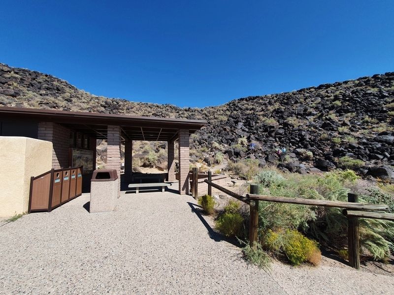
Location. 35° 9.733′ N, 106° 43.095′ W. Marker is in Albuquerque, New Mexico, in Bernalillo County. It is in Taylor Ranch. Marker is on Macaw Trail east of Atrisco Drive NW. The marker is attached to the rest area near the Macaw and Cliff Base Trails at Boca Negra Canyon. Touch for map. Marker is in this post office area: Albuquerque NM 87120, United States of America. Touch for directions.
Other nearby markers. At least 8 other markers are within walking distance of this marker. Macaw Trail (a few steps from this marker); a different marker also named Macaw Trail (within shouting distance of this marker); Formation of Boca Negra Canyon - Cliff Base Trail (within shouting distance of this marker); Petroglyph Orientation - Cliff Base Trail (within shouting distance of this marker); Reasons for Petroglyphs - Cliff Base Trail (within shouting distance of this marker); Estimating Petroglyph Age - Cliff Base Trail (within shouting distance of this marker); Formation of Basalt - Cliff Base Trail (within shouting distance of this marker); Petroglyph Meanings - Cliff Base Trail (about 300 feet away, measured in a direct line). Touch for a list and map of all markers in Albuquerque.
Credits. This page was last revised on February 2, 2023. It was originally submitted on September 29, 2021, by J. Makali Bruton of Accra, Ghana. This page has been viewed 219 times since then and 14 times this year. Photos: 1, 2. submitted on September 29, 2021, by J. Makali Bruton of Accra, Ghana.

