Croom in Prince George's County, Maryland — The American Northeast (Mid-Atlantic)
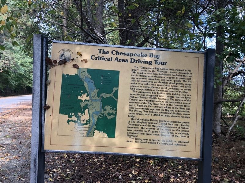
The Chesapeake Bay Critical Area Driving Tour

Photographed By Devry Becker Jones (CC0), October 16, 2021
1. The Chesapeake Bay Critical Area Driving Tour Marker
The "Chesapeake Bay Critical Area Protection Program" passed by the Maryland General Assembly in 1984 requires each local jurisdiction bordering the Bay and its tributaries to develop a program to protect natural resources, shorelines, and water quality. The Act calls for restrictions on shoreline development, designation of a buffer area around tidal waters, and development of comprehensive local guidelines to ensure long-term protection of the natural assets of the Bay.
The Chesapeake Bay Critical Area Driving Tour is a four-mile long designated drive through Patuxent River Park and Merkle Wildlife Sanctuary. The purpose of the Driving Tour is twofold: to show the outstanding natural resources of the Bay found here on the Patuxent River, and to highlight the combined efforts of the State and local governments to protect the Bay and its tributaries. The Driving Tour features educational displays, observation towers, and a 1000-foot long, elevated wooden bridge.
The Critical Area Driving Tour is a cooperative project of The Maryland-National Capital Park and Planning Commission and the Maryland Department of Natural Resources. The majority of the funds for this project were provided by Program Open Space, a nationally acclaimed land preservation program of the State of Maryland.
The driving tour is open to the public at scheduled times. See posted notices for hours and regulations.
Erected by Maryland Department of Natural Resources.
Topics. This historical marker is listed in these topic lists: Environment • Parks & Recreational Areas • Roads & Vehicles • Waterways & Vessels. A significant historical year for this entry is 1984.
Location. 38° 45.249′ N, 76° 42.586′ W. Marker is in Croom, Maryland, in Prince George's County. Marker is on Croom Airport Road, one mile east of Park Entrance Road, on the right when traveling north. Touch for map. Marker is at or near this postal address: 16091 Croom Airport Rd, Upper Marlboro MD 20772, United States of America. Touch for directions.
Other nearby markers. At least 8 other markers are within walking distance of this marker. The Cloud Club (within shouting distance of this marker); Columbia Air Center (within shouting distance of this marker); The Compass Rose (within shouting distance of this marker); John W. Greene (within shouting distance of this marker); Eastern Bluebird (about 400 feet away, measured in a direct line); Aviation History (approx. ¼ mile away); Man and the River (approx. half a mile away); Woodland Indian Villages on the Patuxent River (approx. half a mile away). Touch for a list and map of all markers in Croom.

Photographed By Devry Becker Jones (CC0), October 16, 2021
2. The Chesapeake Bay Critical Area Driving Tour Marker
Credits. This page was last revised on October 16, 2021. It was originally submitted on October 16, 2021, by Devry Becker Jones of Washington, District of Columbia. This page has been viewed 108 times since then and 11 times this year. Photos: 1, 2. submitted on October 16, 2021, by Devry Becker Jones of Washington, District of Columbia.