Croom in Prince George's County, Maryland — The American Northeast (Mid-Atlantic)
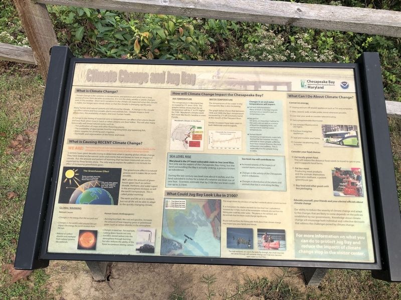
Climate Change and Jug Bay
How will Climate Change Impact the Chesapeake Bay?
Air Temperature
The temperature in Maryland has increased by 2°F since 1970. The graphic below shows that the air temperature will be 3° to 9°F higher by 2100. Maryland's climate could feel more like North Carolina or even Florida.
Water Temperature
The temperature of the water in the Chesapeake Bay is also increasing.
The graph below shows that between 1938 and 2006 the Bay's temperature increased by 3°F off Solomons Island at the mouth of the Patuxent River.
Similar increases have been seen in both Baltimore and Annapolis.
Sea Level Rise
Maryland is the 3rd most vulnerable state to Sea Level Rise.
Not only are the waters of the Chesapeake Bay rising, but the land surrounding the Bay is actually sinking, a process known as subsidence.
During the last century sea level rose about 6 inches and the land subsided 6 inches for a total of a relative sea level rise of one foot. Scientists estimate that by 2100 the sea level could rise up to 3.5 feet.
Erected by Chesapeake Bay National Estuarine Research Reserve; National Oceanic and Atmospheric Administration, U.S. Department of Commerce.
Topics. This historical marker is listed in these topic lists: Environment • Natural Features • Natural Resources • Waterways & Vessels. A significant historical year for this entry is 1970.
Location. 38° 46.391′ N, 76° 42.596′ W. Marker is in Croom, Maryland, in Prince George's County. Marker can be reached from Park Entrance Road, 1.8 miles north of Croom Airport Road, on the right when traveling east. Touch for map. Marker is at or near this postal address: 8400 McClure Rd, Upper Marlboro MD 20772, United States of America. Touch for directions.
Other nearby markers. At least 8 other markers are within walking distance of this marker. Blown to Atoms (about 300 feet away, measured in a direct line); The Blacksmith Shop (about 600 feet away); The Sears House (about 600 feet away); The Duckett Cabin (about 600 feet away); Charles Town (approx. ¾ mile away); First Americans at Mount Calvert (approx. 0.8 miles away); Mount Calvert Historical and Archaeological Park (approx. 0.8 miles away); Chesapeake Beach Railway (approx. 0.8 miles away). Touch for a list and map of all markers in Croom.
Regarding Climate Change and Jug Bay. Non-historical information on the marker has not been transcribed.
Credits. This page was last revised on October 16, 2021. It was originally submitted on October 16, 2021, by Devry Becker Jones of Washington, District of Columbia. This page has been viewed 90 times since then and 11 times this year. Photos: 1, 2. submitted on October 16, 2021, by Devry Becker Jones of Washington, District of Columbia.

