Chantilly in Fairfax County, Virginia — The American South (Mid-Atlantic)
Newton Boundary Stone
Historic Centreville & Chantilly
Willoughby Newton was an 18th century real estate developer.
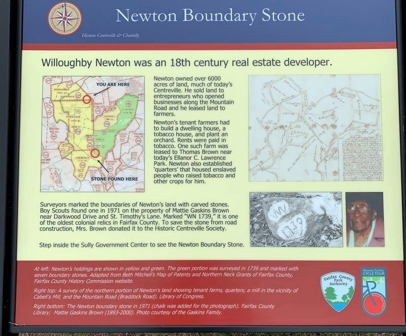
Newton owned over 6000 acres of land, much of today’s Centreville. He sold land to entrepreneurs who opened businesses along the Mountain Road and he leased land to farmers.
Newton’s tenant farmers had to build a dwelling house, a tobacco house, and plant an orchard. Rents were paid in tobacco. One such farm was leased to Thomas Brown near today’s Ellanor C. Lawrence Park. Newton also established ‘quarters’ that housed enslaved people who raised tobacco and other crops for him.
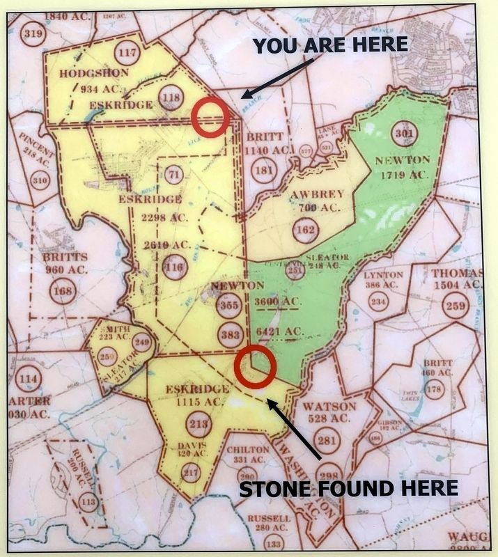
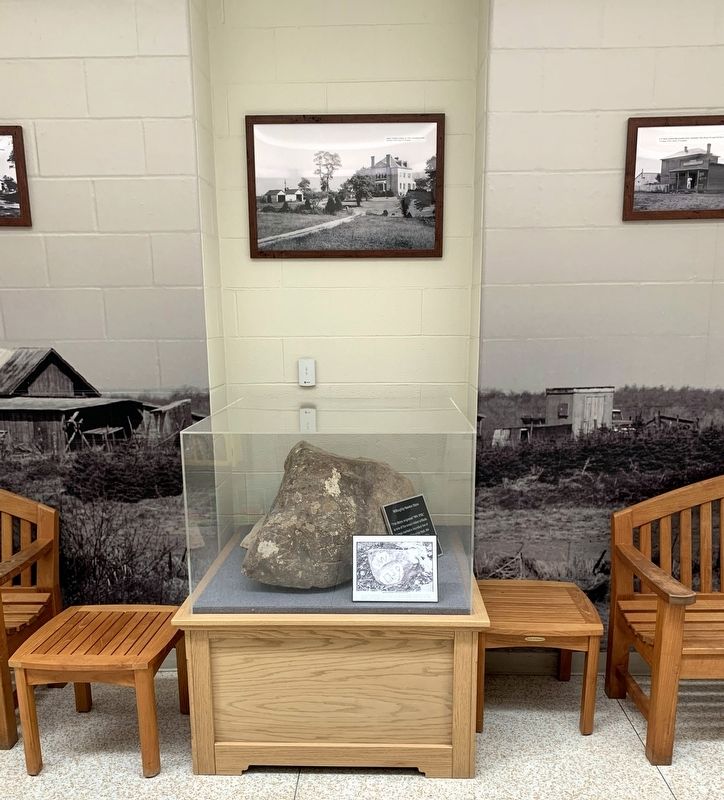
Surveyors marked the boundaries of Newton’s land with carved stones. Boy Scouts found one in 1971 on the property of Mattie Gaskins Brown near Darkwood Drive and St. Timothy’s Lane. Marked “WN 1739,” it is one of the oldest colonial relics in Fairfax County. To save the stone from road construction, Mrs. Brown donated it to the Historic Centreville Society.
Step inside the Sully Government Center to see the Newton Boundary Stone.
Erected by Fairfax County Park Authority.
Topics. This historical marker is listed in these topic lists: African Americans • Agriculture • Colonial Era • Settlements & Settlers. A significant historical year for this entry is 1739.
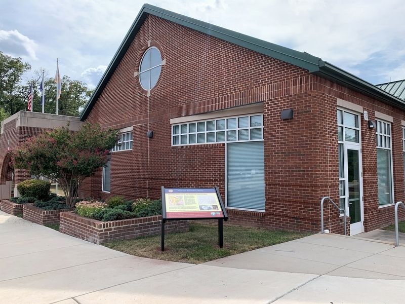
Location. 38° 52.276′ N, 77° 27.062′ W. Marker is in Chantilly, Virginia, in Fairfax County. Marker is on Stonecroft Boulevard just west of Westcroft Boulevard, on the right when traveling east. The marker stands near the front entrance of the Sully Government Center building. Touch for map. Marker is at or near this postal address: 4906 Stonecroft Blvd, Chantilly VA 20151, United States of America. Touch for directions.
Other nearby markers. At least 8 other markers are within 2 miles of this marker, measured as the crow flies. Leeton (approx. 1.1 miles away); The Walney Dairy (approx. 1.3 miles away); a different marker also named The Walney Dairy (approx. 1.3 miles away); Walney Outbuildings (approx. 1.3 miles away); Wipe Your Feet! (approx. 1.3 miles away); Walney Barnyard (approx. 1.3 miles away); Walney House (approx. 1.3 miles away); The Houses at Walney (approx. 1.3 miles away). Touch for a list and map of all markers in Chantilly.
More about this marker. The marker has two maps and two photos captioned:
At left: Newton’s holdings are shown in yellow and green. The green portion was surveyed in 1739 and marked with seven boundary stones. Adapted from Beth Mitchell’s Map of Patents and Northern Neck Grants of Fairfax County, Fairfax History Commission website.
Right top: A survey of the northern portion of Newton’s land showing tenant farms, quarters, a mill in the vicinity of Cabell’s Mill, and the Mountain Road (Braddock Road). Library of Congress.
Right bottom: The Newton Boundary stone in 1971 (chalk was added for the photograph). Fairfax County Library; Mattie Gaskins Brown (1893-2000). Photo courtesy of the Gaskins Family.
Also see . . . Library of Congress - Newton Survey Map.
Captain Willoughby Newton's including deed for 6421 acre of land in the County of Fairfax(Submitted on October 23, 2021.)
Credits. This page was last revised on October 23, 2021. It was originally submitted on October 23, 2021. This page has been viewed 209 times since then and 17 times this year. Photos: 1, 2, 3, 4. submitted on October 23, 2021. • Devry Becker Jones was the editor who published this page.


