Near Wyandotte in Ottawa County, Oklahoma — The American South (West South Central)
The Grand Lake Region: An Important Native American Heritage
Inscription.
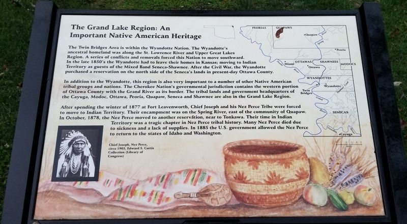
The Twin Bridges Area is within the Wyandotte Nation. The Wyandotte's ancestral homeland was along the St. Lawrence River and Upper Great Lakes Region. A series of conflicts and removals forced this Nation to move southward. In the late 1850's the Wyandotte had to leave their homes in Kansas; moving to Indian Territory as guests of the Mixed Band Seneca-Shawnee. After the Civil War, the Wyandotte purchased a reservation on the north side of the Seneca's lands in present-day Ottawa County.
In addition to the Wyandotte, this region is also very important to a number of other Native American tribal groups and nations. The Cherokee Nation's governmental jurisdiction contains the western portion of Ottawa County with the Grand River as its border. The tribal lands and government headquarters of the Cayuga, Modoc, Ottawa, Peoria, Quapaw, Seneca and Shawnee are also in the Grand Lake Region.
After spending the winter of 1877 at Fort Leavenworth, Chief Joseph and his Nez Perce Tribe were forced to move to Indian Territory. Their encampment was on the Spring River, east of the community of Quapaw. In October, 1878, the Nez Perce moved to another reservation, near to Tonkawa. Their time in Indian Territory was a tragic chapter in Nez Perce tribal history. Many Nez Perce died due to sickness and a lack of supplies. In 1885 the U.S. government allowed the Nez Perce to return to the states of Idaho and Washington.
Caption
Chief Joseph, Nez Perce, circa 1903, Edward S. Curtis Collection (Library of Congress)
Erected by Oklahoma State Parks.
Topics. This historical marker is listed in these topic lists: Native Americans • Parks & Recreational Areas • Wars, US Indian. A significant historical month for this entry is October 1878.
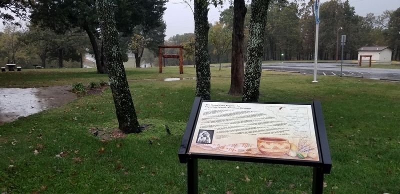
Location. 36° 48.286′ N, 94° 45.471′ W. Marker is near Wyandotte, Oklahoma, in Ottawa County. Marker is on State Highway 137, half a mile north of U.S. 60, on the right when traveling north. The marker is located east of the highway next to the park office of the Twin Bridges at Grand Lake State Park. Touch for map. Marker is at or near this postal address: 14820 OK-137, Miami OK 74354, United States of America. Touch for directions.
Other nearby markers. At least 8 other markers are within 9 miles of this marker, measured as the crow flies. Welcome to Grand Lake State Park's Twin Bridges Area (here, next to this marker); Henry C. Holderman (approx. 0.3 miles away); Wyandot Tribe (approx. 0.3 miles away); Modoc Church (approx. 6.7 miles away); James Long (approx. 6.7 miles away); Modoc Church and Cemetery (approx. 7 miles away); Gateway Sign (approx. 8.1 miles away); Miami Trust and Savings Bank Clock (approx. 8.2 miles away). Touch for a list and map of all markers in Wyandotte.
Also see . . . Chief Joseph.
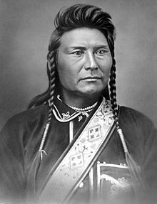
Chief Joseph led his band of Nez Perce during the most tumultuous period in their history, when they were forcibly removed by the United States federal government from their ancestral lands in the Wallowa Valley of northeastern Oregon onto a significantly reduced reservation in the Idaho Territory. A series of violent encounters with white settlers in the spring of 1877 culminated in those Nez Perce who resisted removal, including Joseph's band and an allied band of the Palouse tribe, to flee the United States in an attempt to reach political asylum alongside the Lakota people, who had sought refuge in Canada under the leadership of Sitting Bull. Source: Wikipedia(Submitted on October 29, 2021, by James Hulse of Medina, Texas.)
Credits. This page was last revised on October 30, 2021. It was originally submitted on October 29, 2021, by James Hulse of Medina, Texas. This page has been viewed 337 times since then and 47 times this year. Photos: 1, 2. submitted on October 29, 2021, by James Hulse of Medina, Texas. 3. submitted on October 30, 2021, by James Hulse of Medina, Texas.


