Near Chivington in Kiowa County, Colorado — The American Mountains (Southwest)
Why A 33 Star Flag
Sand Creek Massacre National Historic Site
Photographed by Connor Olson, August 30, 2021
1. Why A 33 Star Flag Marker
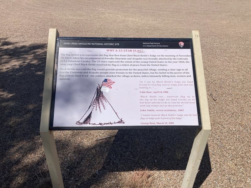
The flag before you represents the flag that flew from Chief Black Kettle's lodge on the morning of November 29, 1864, when his encampment of friendly Cheyenne and Arapaho was brutally attacked by the Colorado (U.S.) Volunteer Cavalry. The 33-stars represent the extent of the young United States in the year 1860, the same year Chief Black Kettle received his flag as a token of peace from the United States.
Black Kettle was told the flag would provide protection for the peaceful village, sending a clear sign to all that the Cheyenne and Arapaho people were friends to the United States, but his belief in the power of the flag proved short lived - the soldiers attacked the village at dawn, indiscriminately killing men, women and children.
“As I ran by Black Kettle's lodge [at Sand Creek] he had flag tied to lodge pole and was holding it..."
Little Bear, April 14, 1906
"Black Kettle ran... American flag up to the top of his lodge [at Sand Creek]...as he had been advised to do in case he should meet with any troops out on the prairies".
John Smith, sworn testimony, 1865
"I looked towards Black Kettle's lodge and he had flag on lodge pole in front of his lodge."
this page online
George Bent, March 15, 1905
Erected by National Park Service, Department of the Interior.
Topics and series. This historical marker is listed in these topic lists: Indigenous Peoples and Communities • Wars, US Indian. In addition, it is included in the Vexillology series list. A significant historical year for this entry is 1860.
Location. 38° 32.668′ N, 102° 30.222′ W. Marker is near Chivington, Colorado, in Kiowa County. It can be reached from County Road W east of Chief White Antelope Way. Touch for map. Marker is in this post office area: Eads CO 81036, United States of America. Touch for directions.

Regionally, this marker is in the Eastern Plains. It is also in the American Mountain West, on the Southern Plains, and specifically on the High Plains. Globally, it is in North America, the Western Hemisphere, the Western World, and the Anglosphere. Historically, it finds itself in what was once the Comanchería, the Dust Bowl, and the Republic of Texas.
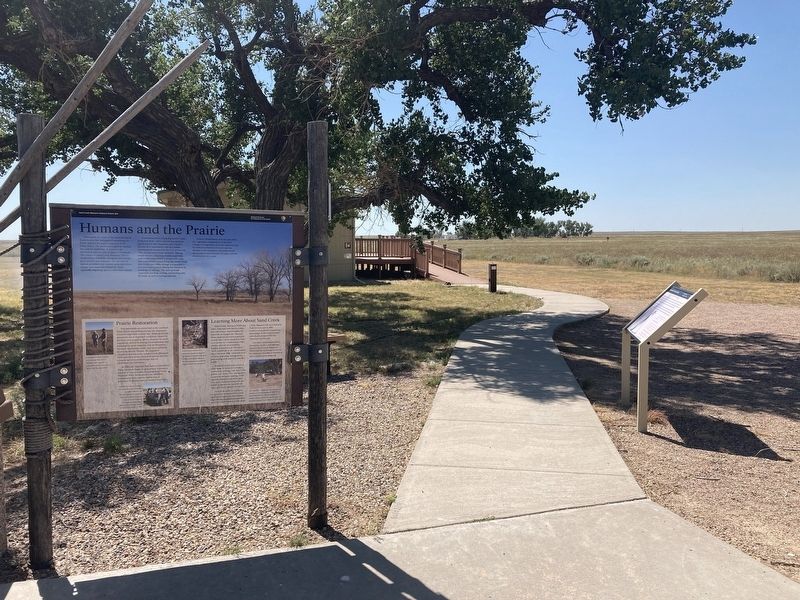
Other nearby markers. At least 8 other markers are within walking distance of this marker: Humans and the Prairie (here, next to this marker); Welcome to the Sand Creek Massacre National Historic Site
Photographed by Connor Olson, August 30, 2021
2. Marker can be seen to the right
Other markers no longer nearby. The Sand Creek Massacre (was within shouting distance of this marker but has been permanently removed); The Attack (was approx. 0.4 miles away but has been permanently removed); Remains (was approx. 0.6 miles away but has been permanently removed); Returned to Sand Creek (was approx. 0.6 miles away but has been permanently removed); Healing (was approx. 0.6 miles away but has been permanently removed); Pleas for Peace (was approx. 0.6 miles away but has been permanently removed); Why? (was approx. 0.6 miles away but has been permanently removed); Testimony (was approx. 0.6 miles away but has been permanently removed).
Credits. This page was last revised on July 5, 2025. It was originally submitted on October 30, 2021, by Connor Olson of Menomonee Falls, Wisconsin. This page has been viewed 267 times since then and 28 times this year. Photos: 1, 2. submitted on October 30, 2021, by Connor Olson of Menomonee Falls, Wisconsin. • Andrew Ruppenstein was the editor who published this page.
