Urbanna in Middlesex County, Virginia — The American South (Mid-Atlantic)
Virginia Street
Urbanna, Virginia
—
The Museum in the Streets
—
Photographed by Devry Becker Jones (CC0), November 25, 2021
1. Virginia Street Marker
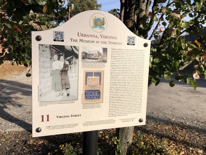
Inscription. Virginia Street is one of the oldest streets in America and the busiest in Urbanna. There are five original colonial buildings standing. Three of Urbanna's most famous residents, Dr. Arthur Lee, Dr. John Mitchell, and Andrew Jackson Montague lived in homes on the street. Lee, along with Benjamin Franklin and Silas Deane, negotiated the Treaty of Alliance in 1778 bringing France into the Revolutionary War. Mitchell is known for having drawn the "Map of the British and French Dominion" used at the Treaty of Paris at the conclusion of the Revolutionary War. Montague was governor of Virginia from 1902 to 1906 and a congressman from 1912 to 1937. Legen has it William Clark left from the Gressitt House, located on Virginia street, to meet Captain Meriwether Lewis at the start of the famed Lewis and Clark Expedition. During the 20th century, the hub of the commercial sector of town shifted away from Cross to Virginia Street. In 1911, the present Something Different building housed the L.L. Tignor Co. Department Store (Haber Dashers) in the main room and Jones & Chowning Druggists in the side room. Later, Green Front grocery occupied
Click or scan to see this page online
the main room and the Southside Sentinel weekly newspaper was printed next door. The Rappanna Theatre brought "talkies," sound motion pictures, to town in 1931. It replaced the silent film theater located in the upstairs of the Regal Building (Town Hall building) on Cross Street. The Rappanna was located on what is today the town parking lot on Virginia Street right behind this panel. The theater was torn down after a snow storm caused the roof to collapse in 1996. At one time there were four car dealerships in town. The earliest cars arrived by steamboat from Baltimore at Burton's STeamboat Wharf on Watling Street and were motored there from there to the owners or dealerships in town. Atwell Taylor owned and operated Taylor (Ford) Motor Company in the building that is today the Urbanna Harbor Gallery & Art Services. The Urbanna 5 and 10 Cents store was located in the Virginia Street Cafe building. The ABC Store was built in the mid-1930s and brought commerce to town. Residents of surrounding dry counties flocked to town to purchase intoxicants. Tides Inn in Irvington had a regular Saturday passenger cruise to Urbanna for its patrons
Photographed by Devry Becker Jones (CC0), November 25, 2021
2. Virginia Street Marker
called the "whiskey run." The town liquor store quenched the thirs of many a local drinker but fueled a passionate animosity from the ladies of the local Baptist Temperence Society.
Erected by The Museum in the Streets®. (Marker Number 11.)
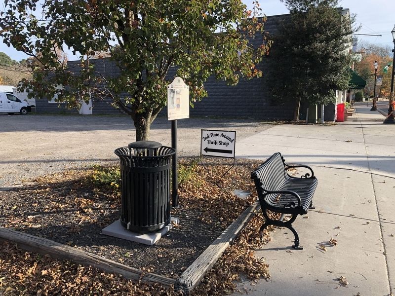
Location. 37° 38.189′ N, 76° 34.528′ W. Marker is in Urbanna, Virginia, in Middlesex County. It is on Virginia Street (Virginia Route 602) 0.1 miles east of Upton Lane, on the left when traveling east. Touch for map. Marker is at or near this postal address: 231 Virginia Street, Urbanna VA 23175, United States of America. Touch for directions.
Regionally, this marker is on the Middle Peninsula. It is also in the American South, specifically in the Upper South, in the Tidewater, in the Chesapeake Bay Region, and on the Eastern Seaboard. Globally, it is in the North Atlantic Region, North America, the Western Hemisphere, the Western World, and the Anglosphere. Historically, it finds itself in what was once the territory of the Mississippian Culture, one of the original Thirteen Colonies, one of the Confederate States of America, and the Antebellum South.
Credits. This page was last revised on January 11, 2024. It was originally submitted on November 25, 2021, by Devry Becker Jones of Washington, District of Columbia. This page has been viewed 528 times since then and 58 times this year. Photos:1, 2. submitted on November 25, 2021, by Devry Becker Jones of Washington, District of Columbia.