Near Vicksburg in Warren County, Mississippi — The American South (East South Central)
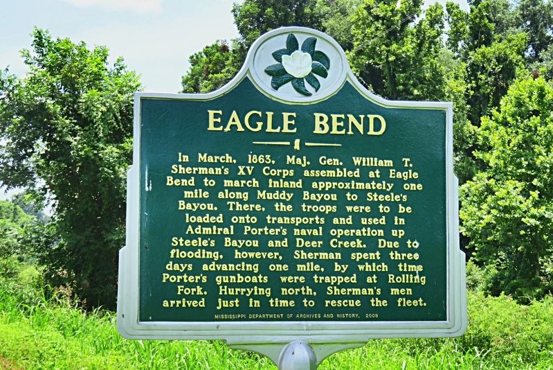
Eagle Bend
Erected 2009 by Mississippi Department of Archives and History. (Marker Number 1166.)
Topics. This historical marker is listed in these topic lists: War, US Civil • Waterways & Vessels. A significant historical month for this entry is March 1863.
Location. 32° 30.798′ N, 90° 59.587′ W. Marker is near Vicksburg, Mississippi, in Warren County. Marker is at the intersection of State Highway 465 and Muddy Bayou Road, on the left when traveling north on State Highway 465. Touch for map. Marker is in this post office area: Vicksburg MS 39183, United States of America. Touch for directions.
Other nearby markers. At least 8 other markers are within 12 miles of this marker, measured as the crow flies. Steele's Bayou Expedition (approx. 7˝ miles away); Grant’s March (approx. 9.2 miles away in Louisiana); Chickasaw Bayou Battle (approx. 11.3 miles away); Snyder's Bluff (approx. 11.3 miles away); Fort Snyder (approx. 11.4 miles away); Fort St. Peter (approx. 11.4 miles away); French Fort St. Pierre (approx. 11.4 miles away); Kings School (approx. 11.6 miles away). Touch for a list and map of all markers in Vicksburg.
Also see . . . Steele's Bayou Expedition (PDF). Brochure for driving tour of the unsuccessful Union campaign to take the strategic city of Vicksburg. (Lower Delta Partnership) (Submitted on December 10, 2021, by Duane and Tracy Marsteller of Murfreesboro, Tennessee.)
Credits. This page was last revised on December 10, 2021. It was originally submitted on December 9, 2021, by Duane and Tracy Marsteller of Murfreesboro, Tennessee. This page has been viewed 295 times since then and 40 times this year. Photo 1. submitted on December 9, 2021, by Duane and Tracy Marsteller of Murfreesboro, Tennessee.
Editor’s want-list for this marker. Wide shot of marker and surrounding area in context. • Can you help?
