Point Pleasant in Mason County, West Virginia — The American South (Appalachia)
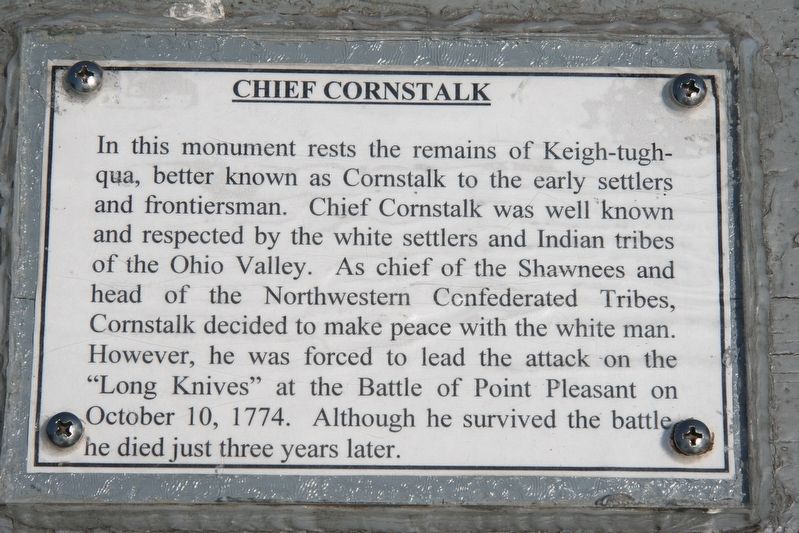
Chief Cornstalk
Topics. This historical marker is listed in these topic lists: Colonial Era • Native Americans • Settlements & Settlers • Wars, US Indian. A significant historical date for this entry is October 10, 1774.
Location. This marker has been replaced by another marker nearby. It was located near 38° 50.384′ N, 82° 8.458′ W. Marker was in Point Pleasant, West Virginia, in Mason County. Marker could be reached from 1st Street just west of Main Street, on the left when traveling west. Touch for map. Marker was at or near this postal address: 105e 1st St, Point Pleasant WV 25550, United States of America. Touch for directions.
Other nearby markers. At least 8 other markers are within walking distance of this location. A different marker also named Chief Cornstalk (here, next to this marker); Water Panther Stone (a few steps from this marker); Ann Bailey (within shouting distance of this marker); Colonel Andrew Lewis (within shouting distance of this marker); The Mansion House (within shouting distance of this marker); The Battle of Point Pleasant (within shouting distance of this marker); Point Pleasant Battle / War of 1812 (within shouting distance of this marker); a different marker also named The Mansion House (within shouting distance of this marker). Touch for a list and map of all markers in Point Pleasant.
Related marker. Click here for another marker that is related to this marker. This marker was replaced by the linked marker.
Credits. This page was last revised on January 5, 2022. It was originally submitted on January 5, 2022, by Dale K. Benington of Toledo, Ohio. This page has been viewed 163 times since then and 20 times this year. Photo 1. submitted on July 13, 2009, by Dale K. Benington of Toledo, Ohio. • Devry Becker Jones was the editor who published this page.
