Fairmount Park in Philadelphia in Philadelphia County, Pennsylvania — The American Northeast (Mid-Atlantic)
Getting to the Park
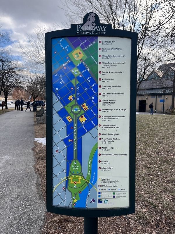
Parkway Museums District

Fairmount Park was established in 1855 to preserve land along the Schuylkill River. This protected Philadelphia's drinking water from pollution. It also provided city residents with a park for recreation and enjoyment.
The city's grid system of roads, and the concentration of industrial uses in the northwest quadrant of Center City, made it difficult for city dwellers to get to Fairmount Park. The idea of creating a diagonal boulevard from City Hall to the Water Works, at the edge of the park, first emerged in the 1870s. It took many mayors and civic leaders, and numerous changes in plans, before construction would begin on the Benjamin Franklin Parkway in 1907.
Topics. This historical marker is listed in these topic lists: Parks & Recreational Areas • Roads & Vehicles • Waterways & Vessels. A significant historical year for this entry is 1855.
Location. 39° 58.153′ N, 75° 11.098′ W. Marker is in Philadelphia, Pennsylvania, in Philadelphia County. It is in Fairmount Park. It is at the intersection of Kelly Drive and Waterworks Drive, on the left when traveling west on Kelly Drive. Touch for map. Marker is
this page online

Regionally, this marker is in Southeast Pennsylvania. It is also in the American Northeast and in the Mid-Atlantic. Globally, it is in North America, the Western Hemisphere, the Western World, and the Anglosphere. Historically, it finds itself in what was once the Haudenosaunee (Iroquois) Confederacy, New Netherland, and one of the original Thirteen Colonies.
Other nearby markers. At least 8 other markers are within walking distance of this marker: Lloyd Hall (within shouting distance of this marker); Fairmount Water Works (within shouting distance of this marker); Fairmount Park (within shouting distance of this marker); Henry Penn Burke (within shouting distance of this marker); Abraham Lincoln (within shouting distance of this marker); a different marker also named Abraham Lincoln (within shouting distance of this marker); Schuylkill Navy of Philadelphia (about 400 feet away, measured in a direct line); Silenus and the Infant Bacchus (about 600 feet away). Touch for a list and map of all markers in Philadelphia.

Credits. This page was last revised on February 2, 2023. It was originally submitted on February 7, 2022, by Devry Becker Jones of Washington, District of Columbia. This page has been viewed 241 times since then and 19 times this year. Photos: 1, 2, 3. submitted on February 7, 2022, by Devry Becker Jones of Washington, District of Columbia.
