Hayes in Gloucester County, Virginia — The American South (Mid-Atlantic)
Managing a Dynamic Landscape
Machicomoco State Park
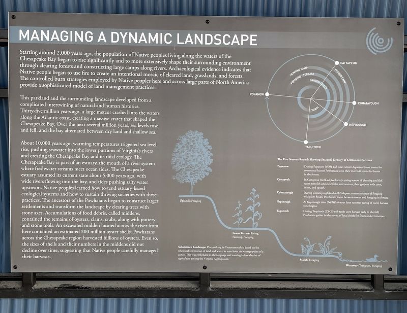
Starting around 2,000 years ago, the population of Native peoples living along the waters of the Chesapeake Bay began to rise significantly and to more extensively shape their surrounding environment through clearing forests and constructing large camps along rivers. Archeological evidence indicates that Native people began to use fire to create an intentional mosaic of cleared land, grasslands, and forests. The controlled burn strategies employed by Native peoples here and across large parts of North America provide a sophisticated model of land management practices.
This parkland and the surrounding landscape developed from a complicated intertwining of natural and human histories. Thirty-five million years ago, a large meteor crashed into the waters along the Atlantic coast, creating a massive crater that shaped the Chesapeake Bay. Over the next several million years, sea levels rose and fell, and the bay alternated between dry land and shallow sea.
About 10,000 years ago, warming temperatures triggered sea level rise, pushing seawater into the lower portions of Virginia’s rivers and creating the Chesapeake Bay and its tidal ecology. The Chesapeake Bay is part of an estuary, the mouth of a river system where freshwater streams meet ocean tides. The Chesapeake estuary assumed its current state about 5,000 years ago, with wide rivers flowing into the bay, and tides pushing salty water upstream. Native peoples learned how to tend estuary-based ecological systems and how to sustain thriving societies with these practices. The ancestors of the Powhatans began to construct larger settlements and transform the landscape by clearing trees with stone axes. Accumulations of food debris, called middens, contained the remains of oysters, clams, crabs, along with pottery and stone tools. An excavated midden located across the River from here contained an estimated 200 million oyster shells. Powhatans across the Chesapeake region harvested billions of oysters. Even so, the sizes of shells and their numbers in the maddens did not decline over time, suggesting that Native people carefully managed their harvests.
Subsistence Landscape: Placemaking in Tsenacomacoh is based on the relational orientation of land and water, as seen from the vantage point of a canoe. This was embedded in the language and naming before the rise of agriculture among the Virginia Algonquians.
The Five Seasons Round: Showing Seasonal Density of Settlement Patterns
Popanow During Popanow (POH-pub-now; winter departure from towns for communal hunts) Powhatans leave their riverside towns for hunts in the forests.
Cattapeuk In Cattapeuk ( KAT-uh-pook; early spring season of planting and fish runs) men fish and clear fields and women plant gardens with corn, beans, and squash.
Cohatayough During Cohatayough ( koh-HAT-uh-yaw; summer season of foraging wild plant foods) Powhatans move between towns and foraging in forests.
Nepinough At Nepinough time ( NEHP-in-naw; later summer caring of corn) harvest time begins.
Taquitock During Taquirock ( TACK-wih-tawk; corn harvest early in the fall) Powhatans gather in the towns of local chiefs for feasts and ceremonies.
Erected 2021 by State of Virginia.
Topics. This historical marker is listed in these topic lists: Anthropology & Archaeology • Native Americans • Parks & Recreational Areas • Settlements & Settlers.
Location. 37° 17.891′ N, 76° 32.199′ W. Marker is in Hayes, Virginia, in Gloucester County. Marker can be reached from Timberneck Farm Road, 0.3 miles south of Borden Road, on the right when traveling east. Located on the grounds of Machicomoco State Park. Touch for map. Marker is at or near this postal address: 3084 Timberneck Farm Rd, Hayes VA 23072, United States of America. Touch for directions.
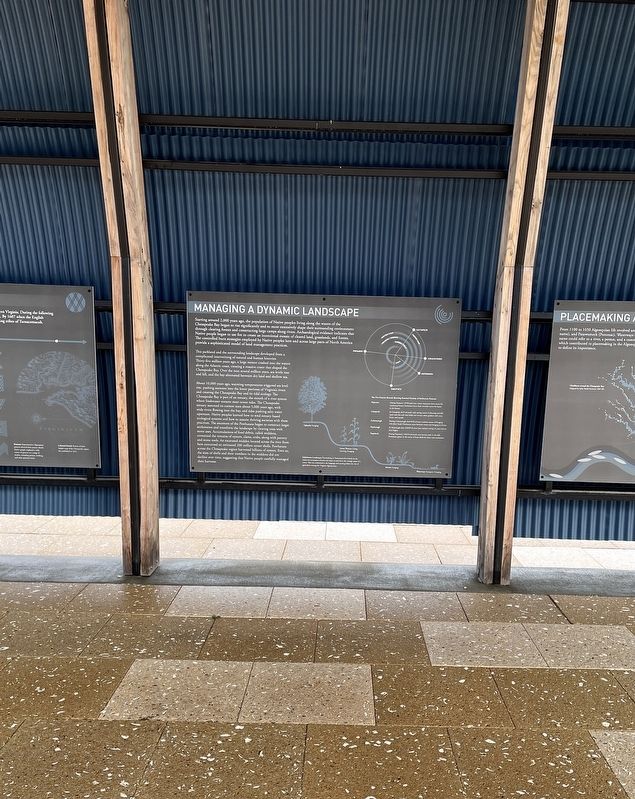
Other nearby markers. At least 8 other markers are within walking distance of this marker. Peacemaking and Mobility (here, next to this marker); History and Community (here, next to this marker); Authority and Ceremony (here, next to this marker); The Algonquian Landscape (here, next to this marker); Persistence (a few steps from this marker); Timberneck House Renovation at Machicomoco State Park (about 300 feet away, measured in a direct line); Early Timberneck Graveyard (about 300 feet away); Powhatan’s Chimney (approx. half a mile away). Touch for a list and map of all markers in Hayes.
Also see . . .
1. Virginia’s Machicomoco State Park—A “Special Meeting Place”. (Submitted on February 13, 2022, by Brandon D Cross of Flagler Beach, Florida.)
2. Machicomoco State Park. (Submitted on February 13, 2022, by Brandon D Cross of Flagler Beach, Florida.)
Credits. This page was last revised on February 14, 2022. It was originally submitted on February 13, 2022, by Brandon D Cross of Flagler Beach, Florida. This page has been viewed 95 times since then and 8 times this year. Photos: 1, 2. submitted on February 13, 2022, by Brandon D Cross of Flagler Beach, Florida. • Devry Becker Jones was the editor who published this page.

