Modoc in Randolph County, Illinois — The American Midwest (Great Lakes)
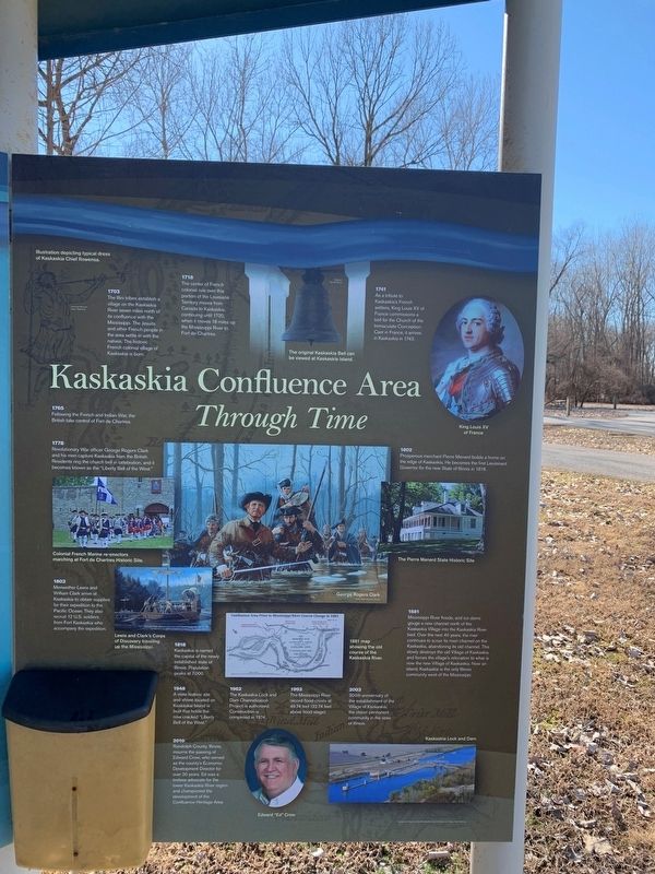
Kaskaskia Confluence Area
Through Time
1718 The center of French colonial rule over this portion of the Louisiana Territory moves from Canada to Kaskaskia, continuing until 1720, when it moves 18 miles up the Mississippi River to Fort de Chartres.
1765 Following the French and Indian War, the British take control of Fort de Chartres.
1778 Revolutionary War officer George Rogers Clark and his men capture Kaskaskia from the British. Residents ring the church bell in celebration, and it becomes known as the "Liberty Bell of the West.
1803 Meriwether Lewis and William Clark arrive at Kaskaskia to obtain supplies for their expedition to the Pacific Ocean. They also recruit 12 U. S. soldiers from Fort Kaskaskia who accompany the expedition.
1818 Kaskaskia is named the capital of the newly established state of Illinois. Population peaks at 7,000.
1948 A state historic site and shrine located on Kaskaskia Island is built that holds the now cracked "Liberty Bell of the West".
1962 The Kaskaskia Lock and Dam Channelization Project is authorized. Construction is completed in 1974.
1993 The Mississippi River record flood crests ay 49.74 feet [22.74 feet above flood stage].-
2003 3000 anniversary of the establishment of the Village of Kaskaskia, the oldest permanent community in the State of Illinois.
Randolph County, Illinois, mourns the passing of Edward Crow, who served as the county's Economic Development Director for over 20 years. Ed was a tireless advocate for the lower Kaskaskia River region and championed of the Confluence Heritage Area.
Second Sign
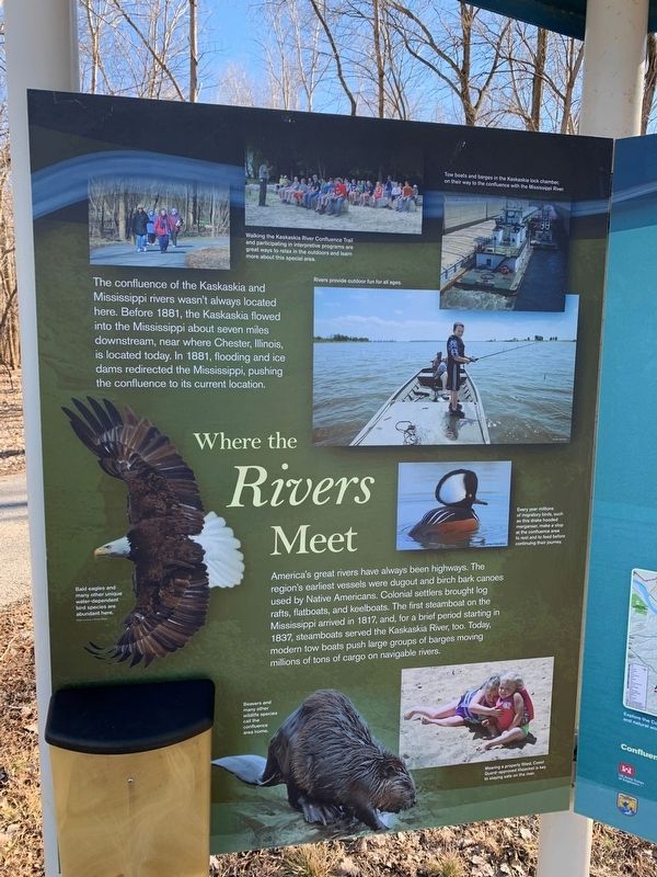
Where the Rivers Meet-
The confluence of the Kaskaskia and Mississippi rivers wasn't always located here. Before 1881, the Kaskaskia flowed into the Mississippi about seven miles downstream, near where Chester, Illinois is located today. In 1881, flooding and ice dams redirected the Mississippi, pushing the confluence to its current location.--- America's great rivers have always been highways. The region's earliest vessels were dugout and birch bark canoes, used by Native Americans. Colonial settlers brought log rafts, flatboats, and keelboats. The first steamboat on the Mississippi arrived in 1817,and, for a brief period starting in 1837, steamboats served the Kaskaskia River, too. Today, modern tow boats push large groups of barges moving millions of tons of cargo on navigable rivers.
Topics. This historical marker is listed in these topic lists: Colonial Era • Native Americans • Settlements & Settlers • Waterways & Vessels.
Location. 37° 58.857′ N, 89° 56.709′ W. Marker is in Modoc, Illinois, in Randolph County. Marker is on Levee Rd., one mile south of Roots Rd., in the median. Touch for map. Marker is at or near this postal address: Kaskaskia Camp Grounds, Modoc IL 62261, United States of America. Touch for directions.
Other nearby markers. At least 8 other markers are within 3 miles of this marker, measured as the crow flies. Lewis and Clark in Illinois (approx. 2.1 miles away); Kaskaskia Island (approx. 2.1 miles away); Dedicated in Memory of George Rogers Clark (approx. 2.1 miles away); Kaskaskia Village (approx. 2.1 miles away); Fort Kaskaskia Shelter (approx. 2.1 miles away); Garrison Hill Cemetery (approx. 2.2 miles away); Looking For a Few Good Men (approx. 2.4 miles away); Site of Fort Kaskaskia (approx. 2.4 miles away).
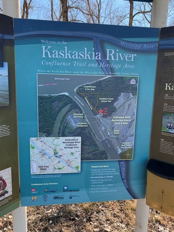
More about this marker. On the property of the Kaskaskia Lock and Dam
Credits. This page was last revised on March 14, 2022. It was originally submitted on February 24, 2022, by Thomas Smith of Waterloo, Ill. This page has been viewed 128 times since then and 22 times this year. Photos: 1, 2, 3. submitted on February 24, 2022, by Thomas Smith of Waterloo, Ill. • Bill Pfingsten was the editor who published this page.


