Hastings-on-Hudson in Westchester County, New York — The American Northeast (Mid-Atlantic)
The Ravine, Looking West / El Barranco, Mirado Hacia El Oeste
Hastings-on-Hudson, New York
— The Museum in the Streets® —

Photographed By Devry Becker Jones (CC0), March 6, 2022
1. The Ravine, Looking West / El Barranco, Mirado Hacia El Oeste Marker
The Ravine, Looking West
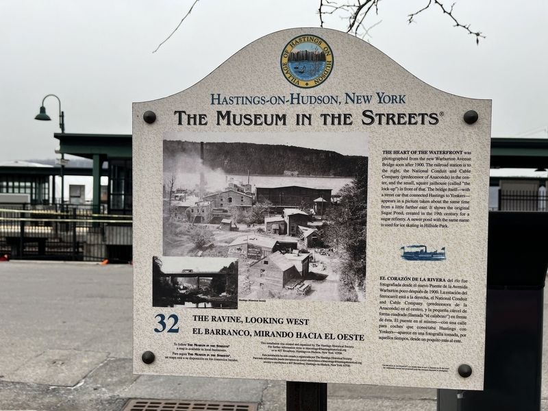
The heart of the waterfront was photographed from the new Warburton Avenue Bridge soon after 1900. The railroad station is to the right, the National Conduit and Cable Company (predecessor of Anaconda) in the center, and the small, square jailhouse (called "the lock-up") in front of that. The bridge itself—with a street car that connected Hastings to Yonkers—appears in a picture taken about the same time from a little farther east. It shows the original Sugar Pond, created in the 19th century for a sugar refinery. A newer pond with the same name is used for ice skating in Hillside Park.
El Corazón de la Rivera del río fue fotografiada desde el nuevo Puente de la Avenida Warburton poco después de 1900. La estación del ferrocarril está a la derecha, el National Conduit and Cable Company (predecesora de la Anaconda) en el centro, y la pequeña cárcel de forma cuadrada (llamada "el calabozo") en frente de ésta. El puente en sí mismo—con una calla para coches que conectaba Hastings con Yonkers—aparece en una fotografía tomada, por aquellos tiempos, desde un poquito más al este.
Erected 2006 by The Museum in the Streets®. (Marker Number 32.)
Topics and series. This historical marker is listed in these topic lists: Bridges & Viaducts • Industry & Commerce • Law Enforcement • Parks & Recreational Areas • Waterways & Vessels. In addition, it is included in the The Museum in the Streets®: Hastings-on-Hudson, New York series list. A significant historical year for this entry is 1900.
Location. 40° 59.648′ N, 73° 53.048′ W. Marker is in Hastings-on-Hudson, New York, in Westchester County. Marker is on Southside Avenue north of Cropsey Lane, on the right when traveling north. Touch for map. Marker is at or near this postal address: 134 Southside Ave, Hastings on Hudson NY 10706, United States of America. Touch for directions.
Other nearby markers. At least 8 other markers are within walking distance of this marker. The Ravine, Looking East / El Barranco, Mirando Hacia El Este (here, next to this marker); Hastings-on-Hudson, New York (within shouting distance of this marker); Industrial Hastings / El Hastings Industrial (about 300 feet away, measured in a direct line); The Local Soda Fountain / La Fuente de Soda Local (about 500 feet away); Honor Roll (about 500 feet away); Purple Heart Village (about 500

Photographed By Devry Becker Jones (CC0), March 6, 2022
2. The Ravine, Looking West / El Barranco, Mirado Hacia El Oeste Marker
Credits. This page was last revised on March 13, 2022. It was originally submitted on March 13, 2022, by Devry Becker Jones of Washington, District of Columbia. This page has been viewed 66 times since then and 9 times this year. Photos: 1, 2. submitted on March 13, 2022, by Devry Becker Jones of Washington, District of Columbia.