Allegheny West in Philadelphia in Philadelphia County, Pennsylvania — The American Northeast (Mid-Atlantic)
Laurel Hill Cemetery
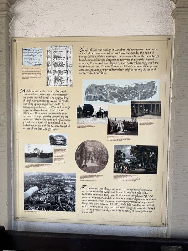
Laurel Hill soil was broken in October 1836 to receive the remains of its first permanent resident, a Quaker woman by the name of Mercy Carlisle. While catering to the average citizen, the cemetery's founders were likewise determined to invest the site with historical meaning. Remains of noted figures, such as Revolutionary War hero Hugh Mercer, and Charles Thompson of the Continental Congress, were subsequently removed from their original resting places and reinterred at Laurel Hill.
Both honored and ordinary, the dead continued to consecrate the cemetery in the years that followed. The original tract of land, now comprising Laurel Hill North, was filling up at a rapid pace. In 1848, managers purchased the 27-acre Harleigh estate and transformed it into Laurel Hill South. Nearly one quarter mile then separately the properties comprising the cemetery. The institution's two halves were joined, and Laurel Hill completed, in 1861, with the purchase of the 22-acre Fairy Hill estate of the late George Pepper.
The cemetery was always intended to be a place of recreation and retreat for the living, and its scenic location
this page online
[Captions:]
[above] One from among thousands of historic and contemporary interment records contained in Laurel Hill's Archives. This example dates back to 1857.
[right] Mercy Carlisle visited Laurel Hill shortly before her death and noted a small grouping of pines, under which she soon came to rest. Before long, Laurel Hill's first resident was joined by fellow souls in peaceful repose.
The office in Laurel Hill South is one of among many cemetery buildings no longer in existence (circa 1909).
An unidentified man stands outside the now-demolished Superintendent's office in Laurel Hill Central, circa 1899. Behind him runs the bridge over what was once Nicetown Lane (today's Hunting Park Avenue).
Notman's Roman Doric Gatehouse, situated in Laurel Hill North, remains the cemetery's main entrance (circa 1909).
The development of public transportation, including the establishment of the Ridge Avenue Rail Road and the introduction of steamboat travel along the Schuylkill, contributed to the ease with which Laurel Hill could be reached.
[above] Beginning in the 1850s, Schuylkill River steamboats embarked on an hourly circuit between Fairmount and the Falls of Schuylkill, depositing streams of visitors and lot-holders at Laurel Hill.
[left] The trolley became another mode of transport for the Laurel Hill visitors in the twentieth century (Ridge Avenue, 1928).
Aerial view of Laurel Hill Cemetery and her surroundings.
Laurel Hill's early managers promoted the concept of rural cemeteries as places of contemplative recreation. This view captures a man reclining with a book in the North section of Laurel Hill.
By the mid-1800's, Laurel Hill's major draws for tourists and curiosity-seekers were functioning all too well. An engraving designed for Godey's Lady's Book presents and idealized view of the grounds. However, the reverential atmosphere of the cemetery was now being threatened by growing crowds and foot traffic.
Erected by Laurel
Photographed by Devry Becker Jones (CC0), March 19, 2022
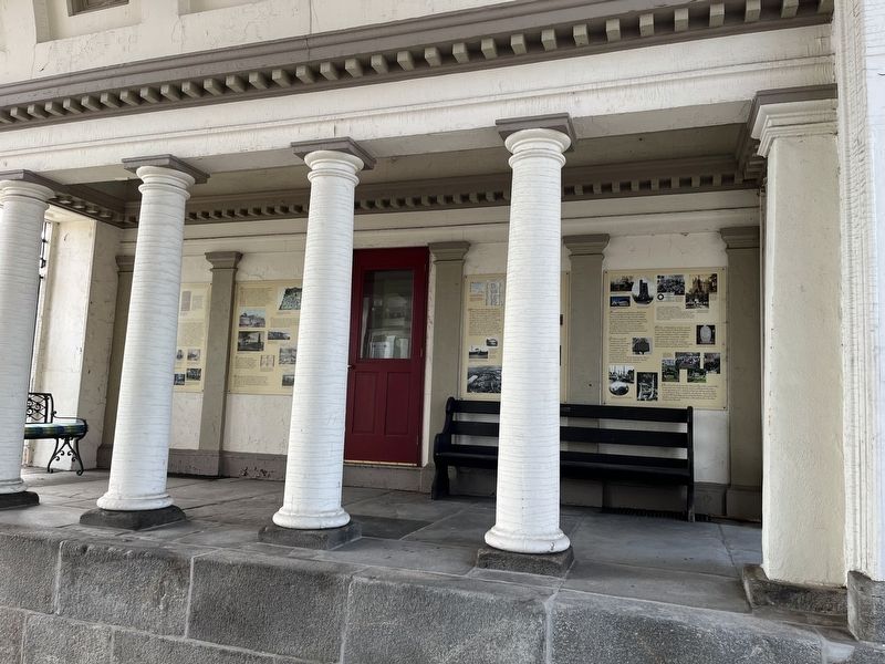
2. A set of markers interpreting Laurel Hill Cemetery's history
Topics and series. This historical marker is listed in these topic lists: Cemeteries & Burial Sites • Parks & Recreational Areas • War, US Revolutionary • Women. In addition, it is included in the Quakerism series list. A significant historical month for this entry is October 1836.
Location. 40° 0.247′ N, 75° 11.259′ W. Marker is in Philadelphia, Pennsylvania, in Philadelphia County. It is in Allegheny West. It is on Ridge Avenue (County Road 3009) south of West Clearfield Street, on the right when traveling south. Touch for map. Marker is at or near this postal address: 3822 Ridge Ave, Philadelphia PA 19132, United States of America. Touch for directions.

Regionally, this marker is in Southeast Pennsylvania. It is also in the American Northeast and in the Mid-Atlantic. Globally, it is in North America, the Western Hemisphere, the Western World, and the Anglosphere. Historically, it finds itself in what was once the Haudenosaunee (Iroquois) Confederacy, New Netherland, and one of the original Thirteen Colonies.
Other nearby markers. At least 8 other markers are within walking distance of this marker: A different marker also named Laurel Hill Cemetery (here, next to this marker); a different marker also named Laurel Hill Cemetery (here, next to this marker); a different marker also named Laurel Hill Cemetery (here, next to this marker); Gatehouse (a few steps from this marker); a different marker also named Laurel Hill Cemetery (a few steps from this marker); a different marker also named Laurel Hill Cemetery (a few steps from this marker); a different marker also named Laurel Hill Cemetery (a few steps from this marker); Lieutenant Joseph Bonnell (within shouting distance of this marker). Touch for a list and map of all markers in Philadelphia.
Credits. This page was last revised on February 2, 2023. It was originally submitted on March 21, 2022, by Devry Becker Jones of Washington, District of Columbia. This page has been viewed 294 times since then and 25 times this year. Photos: 1. submitted on March 21, 2022, by Devry Becker Jones of Washington, District of Columbia. 2. submitted on March 20, 2022, by Devry Becker Jones of Washington, District of Columbia.
