Fenton in St. Louis County, Missouri — The American Midwest (Upper Plains)
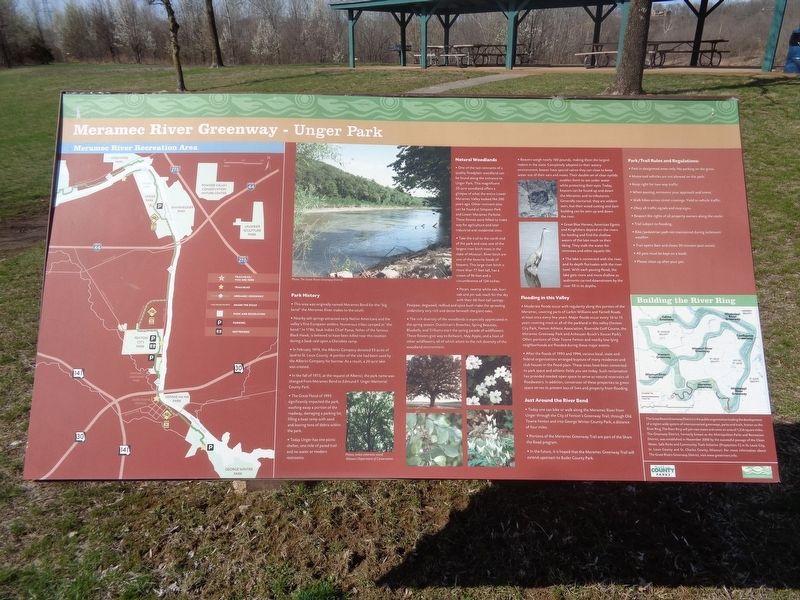
Meramec River Greenway - Unger Park
Park History
This area was originally named Meramec Bend for the "big bend" the Meramec River makes to the south.
Nearby salt springs attracted early Native Americans and the valley's first European settlers. Numerous tribes camped at "the bend." In 1786, Sauk Indian Chief Pyesa, father of the famous Black Hawk, is believed to have been killed near this location during a Sauk raid upon a Cherokee camp.
In February 1974, the Alberici Company donated 93 acres of land to St. Louis County. A portion of the site had been used by the Alberici Company for borrow. As a result, a 20-acre lake was created.
In the fall of 1975, at the request of Alberici, the park named was changed from Meramec Bend to Edmund F. Unger Memorial County Park.
The Great Flood of 1993 significantly impacted the park, washing away a portion of the roadway, damaging a parking lot, filling a boat ramp with sand and leaving tons of debris within the park.
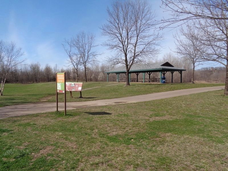
Today Unger has one picnic shelter, one mile of paved trail and no water or modern restrooms.
Natural Woodlands
One of the last remnants of a quality floodplain woodland can be found along the entrance to Unger Park. This magnificent 20-acre woodland offers a glimpse of what the entire Lower Meramec Valley looked like 200 years ago. Other remnant sites can be found at Simpson Park and Lower Meramec Parksite. These forests were felled to make way for agriculture and later industrial and residential sites.
Take the trail to the north end of the park and view one of the largest river birch trees in the state of Missouri. River birch are one of the favorite foods of beavers. This large river birch is more than 77 feet tall, has a crown of 96 feet and a circumference of 124 inches.
Pecan, swamp white oak, burr oak and pin oak reach for the sky with their 60-foot-tall canopy. Pawpaw, dogwood, redbud and spice bush make the sprawling understory very rich and dense beneath the giant oaks.
The rich diversity of the woodlands is especially appreciated in the spring season. Dutchman's Breeches, Spring Beauties, Bluebells, and Trilliums start the spring parade of wildflowers. These flowers give way to Bellwort, May Apple, and a host of other wildflowers, all of which attest to the rich diversity of the woodland environment.
Beavers weigh nearly 100 pounds, making them the largest rodent in the state. Completely adapted to their watery environment, beaver have special valves they can close to keep water out of their ears and noses. Their double set of clear eyelids enables them to see under water while protecting their eyes. Today, beavers
can be found up and down the Meramec and its tributaries. Generally nocturnal, they are seldom seen, but their wood cutting and dam building can be seen up and down the river.
Great Blue Herons, American Egrets and Kingfishers depend on the rivers for feeding and find the shallow waters of the lake much to their liking. They stalk the water for minnows and other aquatic life.
The lake is connected with the river, and its depth fluctuates with the river level. With each passing flood, the lake gets more and more shallow as sediments carried downstream by the river fill in its depths.
Flooding in this Valley
Moderate floods occur with regularity along this portion of the Meramec, covering parts of Larkin Williams and Yarnell Roads at least once every few years. Major floods occur every 10 to 15 years covering most or all of the parkland in this valley (Fenton City Park, Fenton Athletic Association, Riverside Golf Course, the Meramec Greenway Park and Anheuser-Busch's Soccer Park). Often portions of Olde Towne Fenton and nearby low-lying neighborhoods are flooded during these major events.
After the floods of 1993 and 1994, various local, state and federal organizations arranged buyouts of many residences and club houses in the flood plain. These areas have been converted to park space and athletic fields you see today. Such reclamation has provided need open space to serve as natural reservoirs of floodwaters. In addition, conversion of these properties to green space serves to prevent loss of lives and property from flooding.
Just Around the River Bend
Today one can bike or walk along the Meramec River from Unger through the City of Fenton's Greenway Trail, through Old Towne Fenton and into George Winter County Park, a distance of four miles.
(aside:)
The Great Rivers Greenway District is the public organization leading the development of a region-wide system of interconnected greenways, parks and trails, known as the River Ring. The River Ring will join two states and cover and area of 1,216 square miles. The Greenway District, formerly known as the Metropolitan Parks and Recreations District, was established in November 2000 by the successful passage of the Clean Water, Safe Parks and Community Trails Initiative (Proposition C) in St. Louis City, St. Louis County and St. Charles County, Missouri. For more information about The Great Rivers Greenway District, visit www.greatrivers.info.
Erected by Great Rivers Greenway and Saint Louis County Parks.
Topics. This historical marker is listed in these topic lists: Animals • Native Americans • Parks & Recreational Areas • Waterways & Vessels. A significant historical month for this entry is February 1974.
Location. 38° 33.082′ N, 90° 26.506′ W. Marker is in Fenton, Missouri, in St. Louis County. Marker is on 2nd Street west of Club Road, on the right when traveling east. Marker is located at Unger Park. Touch for map. Marker is at or near this postal address: 217 2nd St, Fenton MO 63026, United States of America. Touch for directions.
Other nearby markers. At least 8 other markers are within 2 miles of this marker, measured as the crow flies. Greentree Park and Meramec Greenway (approx. 0.6 miles away); Ernest Trova (American, 1927-2009) (approx. 1.2 miles away); Simpson Park and the Meramec River Greenway (approx. 1.3 miles away); Veteran's Memorial (approx. 1.3 miles away); Quinette Cemetery (approx. 1.3 miles away); Historic Quinette Cemetery (approx. 1.3 miles away); Ian Hamilton Finlay (British, 1925-2006) (approx. 1.3 miles away); Geoffrey Krawzyck (American, born 1978) (approx. 1.3 miles away).
Also see . . .
1. Unger Park. From St. Louis County Parks' website. This was open to the public on March 31, 1979. (Submitted on March 26, 2022, by Jason Voigt of Glen Carbon, Illinois.)
2. Meramec Greenway (George Winter Park to Unger Park). From Great Rivers Greenway's website (the web address on the marker is outdated) (Submitted on March 26, 2022, by Jason Voigt of Glen Carbon, Illinois.)
Credits. This page was last revised on March 26, 2022. It was originally submitted on March 26, 2022, by Jason Voigt of Glen Carbon, Illinois. This page has been viewed 320 times since then and 40 times this year. Photos: 1, 2. submitted on March 26, 2022, by Jason Voigt of Glen Carbon, Illinois.

