Leesburg in Loudoun County, Virginia — The American South (Mid-Atlantic)
The Smokehouse
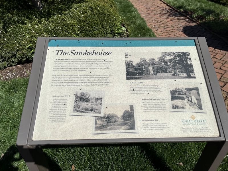
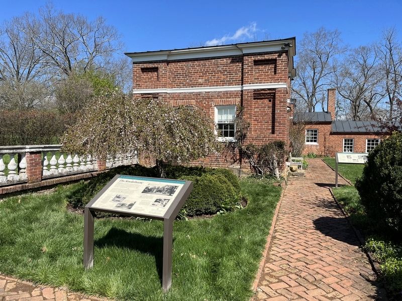
The Smokehouse, circa 1821, is located on the same axis as the Dairy/Bachelor's Cottage for symmetry of the plantation's layout. The windowless, one-story brick building with dirt floor was used by the enslaved people as a place to preserve and store meat products. Typically, fresh meat was dry-salted, marinated in wooden boxes or troughs for up to six weeks, smoked inside the building over a smoldering pit fire. It was then stored on shelves or hung on beams until needed.
In the early 1900s, Edith Eustis turned the building into a studio during renovations of the dilapidated garden. Changes included a new front door with sidelights and transom, construction of a floor and ceiling, and installation of four windows. She also added a chimney to the building and appropriated one of the mantelpieces from the mansion to use in her new space. Today, Oatlands' garden staff uses the building as office space.
[Captions:]
The Smokehouse, c. 1930.
In the 1930s, photographer Frances Benjamin Johnson captured several beautiful shots of the garden in full bloom, along with decorative fence rows and intriguing boxwood configurations, all part of Edith Eustis' restoration plan. Today, the smokehouse doorway looks the same except for the additions of an awning and a screen door. Image courtesy of the Library of Congress Prints and Photograph Division.
The Smokehouse, 1940.
The smokehouse has not changed much since Edith Eustis turned it into a studio and children's playhouse. It was a peaceful space in which to plan her extensive revitalization of the garden. Edith Eustis once wrote, "It is always quiet and sheltered under the lea of the walls, even when the most biting northwest wind is blowing."
Morton and Edith "Babs" Eustis, c. 1912.
Morton and his new baby sister, "Babs," are posed in front of the smokehouse's western façade. It is a rare image of the building before Edith Eustis began her renovations, which included installation of two western-facing windows and two southern-facing windows.
The Smokehouse, c. 1904
This image from the early 1900s documents initial improvements made to the garden by Edith Eustis. She kept several photographs in an album as mementos of her progress.
Erected by Oatlands Historic House & Gardens, a site of the National Trust for Historic Preservation.
Topics. This historical marker is listed in these topic lists: African Americans • Agriculture • Animals • Arts, Letters, Music • Notable Buildings • Women. A significant historical year for this entry is 1821.
Location.
Other nearby markers. At least 8 other markers are within walking distance of this marker. The Garden Dependency (here, next to this marker); The Walled Garden (here, next to this marker); Reclaim Your Story (a few steps from this marker); The Mansion (within shouting distance of this marker); The Enslaved Community (within shouting distance of this marker); The Bachelor's Cottage (about 300 feet away, measured in a direct line); The Greenhouse (about 300 feet away); The Carriage House (about 700 feet away). Touch for a list and map of all markers in Leesburg.
Credits. This page was last revised on April 9, 2022. It was originally submitted on April 9, 2022, by Devry Becker Jones of Washington, District of Columbia. This page has been viewed 80 times since then and 8 times this year. Photos: 1, 2. submitted on April 9, 2022, by Devry Becker Jones of Washington, District of Columbia.

