Old Town in Alexandria, Virginia — The American South (Mid-Atlantic)
Industrialization of the Strand
Alexandria Heritage Trail
— City of Alexandria, est. 1749 —
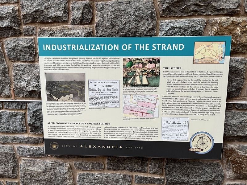
During the 19th century, numerous entrepreneurs gradually improved the lots and expanded the warehouses and wharves associated with the 200 block of the Strand. Josiah Davis owned many properties along Alexandria's waterfront and bought property at present-day 211 Strand Street specifically to open a plaster mill in 1822, which he operated until 1875, except during the Civil War. His warehouse contained a steam engine, a boiler, and machinery for grinding plaster. He was also involved in ship chandlery, the procurement of supplies for ships and their crews, and the lumber business.
Archaeological Evidence of a Working Seaport
By the latter decades of the 19th century Alexandria's waterfront was becoming increasingly industrialized. Archaeological excavations uncovered evidence of some of these burgeoning industries on the property. For example, the Sanborn Fire Insurance Map showed four warehouses on the property in 1885, but by 1896, Warehouse A had been demolished and was used by DeWilton Aitcheson for his coal yard. Annie Moore continued to operate her husband's business after he died in 1894. Warehouse D continued to be used for pattern storage, but Warehouse C was converted into a blacksmith shop. The warehouse foundations uncovered during archaeological excavations also defined the two alleys that historically ran between Warehouses A and B and between B and C. Historic alleyways would have given waterfront access to merchants occupying buildings across the entire property.
The 1897 Fire
In 1897, a fire destroyed most of the 200 block of the Strand. It began in the engine room of Herbert Bryant's bone mill, located on the east side of Strand Street, present-day Point Lumley Park. Only one building east of Union Street survived the blaze.
"It was first supposed that the fire could be confined to the mill, which is of brick…before it could hardly be realized, the devouring element had crossed the Strand via the via the tramway connecting the mill with the frame warehouse on the west…in a short time the entire square was a roaring furnace…Herbert Bryant says there is no doubt in his mind that the fire was of incendiary origin". — Alexandria Gazette 3 June 1897
After the fire, DeWilton Aitcheson bought some of the newly empty lots primarily on the north side of the block to add open space to his business, the D.W. Aitcheson Coal & Wood Yard (also known as Aitcheson Fuel Co.). He cleared much of the destroyed warehouses and built a new office, new warehouses, and a railroad switch. Further improvements to the property included the addition of a stable in 1902 and a tannery in 1907. After Aitheson's death, the property passed
[Captions:]
Born in Alexandria in 1821, William Moore, a councilman, operated an iron and brass foundry from 1852 to 1897 on Union Street across from this property, but his machine and pattern storage warehouses (C and D) were located here. The building consisted of four stories with patterns stored on the third and fourth floors, while his 25 employees operated lathes and other machinery on the first and second floors. He produced many kinds of iron and brass castings and had customers throughout the country. ("Alexandria from Pioneer Mill, looking north-west", March 1865 Photograph, Courtesy of the Library of Congress, Prints and Photographs Division).
Alexandria Gazette 6 August 1888
"Birds eye view of Alexandria, Va" by Charles Magnus (1863) showing the full 200 block of the Strand. The Watermark property, outlined in yellow, contained three buildings that fronted the Strand. (Courtesy of the Library of Congress, Prints and Photographs Division).
1869 Sanborn Fire Insurance Map of Alexandria (Wetland Studies and Solutions, Inc.).
Alexandria Gazette 20 February 1899
Erected by City of Alexandria, Virginia.
Topics and series. This historical marker is listed in these topic lists: Anthropology & Archaeology • Industry & Commerce • Waterways & Vessels • Women. In addition, it is included in the Virginia, The City of Alexandria series list. A significant historical date for this entry is February 20, 1899.
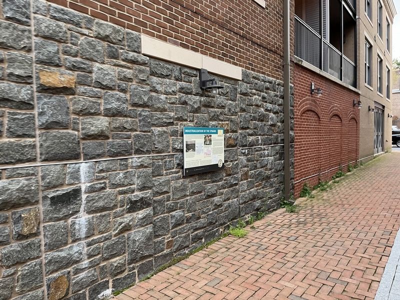
Location. 38° 48.155′ N, 77° 2.417′ W. Marker is in Alexandria, Virginia. It is in Old Town. Marker can be reached from Strand Street just south of Prince Street, on the right when traveling south. Touch for map. Marker is at or near this postal address: 211 Strand St, Alexandria VA 22314, United States of America. Touch for directions.
Other nearby markers. At least 8 other markers are within walking distance of this marker. Waterfront Archaeology (a few steps from this marker); ODBC (within shouting distance of this marker); A Rich History on the Alexandria Waterfront (within shouting distance of this marker); a different marker also named ODBC (within shouting distance of this marker); 115 Prince Street (about 400 feet away, measured in a direct line); The River Queen (about 400 feet away); Shipbuilding at Point Lumley (about 400 feet away); Pioneer Mill (about 400 feet away). Touch for a list and map of all markers in Alexandria.
Credits. This page was last revised on May 25, 2023. It was originally submitted on April 15, 2022, by Devry Becker Jones of Washington, District of Columbia. This page has been viewed 166 times since then and 32 times this year. Photos: 1, 2. submitted on April 15, 2022, by Devry Becker Jones of Washington, District of Columbia.

